National Register of Historic Places listings in Douglas County, Nevada
Contents: List of Registered Historic Places in Douglas County, Nevada, USA:
The locations of National Register properties and districts (at least for all showing latitude and longitude coordinates below), may be seen in an online map by clicking on "Map of all coordinates".[1]
- This National Park Service list is complete through NPS recent listings posted January 29, 2021.[2]
Current listings
| [3] | Name on the Register | Image | Date listed[4] | Location | City or town | Description |
|---|---|---|---|---|---|---|
| 1 | Carson Valley Hospital | 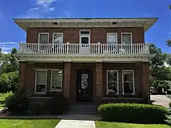 Carson Valley Hospital |
May 29, 1979 (#79001462) |
1466 U.S. Route 395 38°56′34″N 119°45′02″W |
Gardnerville | |
| 2 | Carson Valley Improvement Club Hall | 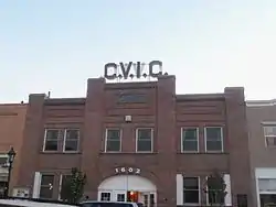 Carson Valley Improvement Club Hall |
August 4, 1983 (#83004184) |
1606 Esmeralda Ave. 38°57′12″N 119°45′49″W |
Minden | |
| 3 | de'ek wadapush (Cave Rock) Traditional Cultural Property | 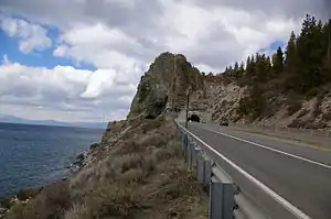 de'ek wadapush (Cave Rock) Traditional Cultural Property |
January 31, 2017 (#100000610) |
United States Route 50 north of Stateline 39°02′48″N 119°56′53″W |
Lincoln Park vicinity | |
| 4 | Douglas County Courthouse | 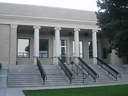 Douglas County Courthouse |
August 6, 1986 (#86002266) |
1616 8th St. 38°57′20″N 119°45′48″W |
Minden | |
| 5 | Douglas County High School | 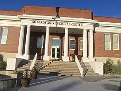 Douglas County High School |
March 9, 1992 (#92000117) |
1477 U.S. Route 395 38°56′37″N 119°45′02″W |
Gardnerville | |
| 6 | Farmers Bank of Carson Valley | 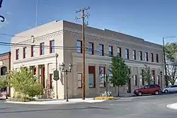 Farmers Bank of Carson Valley |
August 6, 1986 (#86002264) |
1597 Esmeralda Ave. 38°57′13″N 119°45′45″W |
Minden | |
| 7 | Farmer's Bank of Carson Valley | 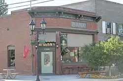 Farmer's Bank of Carson Valley |
April 6, 2000 (#00000338) |
1596 Esmeralda Ave. 38°57′10″N 119°45′47″W |
Minden | |
| 8 | Friday's Station | 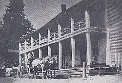 Friday's Station |
October 9, 1986 (#86003259) |
U.S. Route 50 between Kingsbury Grade and Loop Rd. 38°57′50″N 119°56′05″W |
Stateline | |
| 9 | Lena N. Gale Cabin | June 12, 2001 (#01000586) |
726 Cedar St. 39°00′12″N 119°56′56″W |
Zephyr Cove | ||
| 10 | Gardnerville Branch Jail | 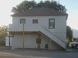 Gardnerville Branch Jail |
May 16, 2003 (#03000415) |
1440 Courthouse St. 38°56′29″N 119°44′30″W |
Gardnerville | |
| 11 | Gardnerville Elementary School | 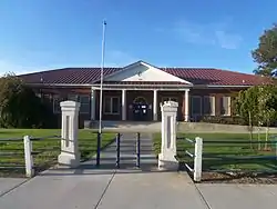 Gardnerville Elementary School |
February 19, 2008 (#08000033) |
1290 Toler Ave. 38°56′23″N 119°44′38″W |
Gardnerville | (School Buildings in Nevada MPS) |
| 12 | Genoa Historic District |  Genoa Historic District |
April 16, 1975 (#75001108) |
7 miles northwest of Minden on State Route 57 39°00′18″N 119°50′35″W |
Genoa | |
| 13 | Home Ranch | 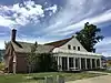 Home Ranch |
December 5, 1980 (#80002466) |
West of Minden 38°56′54″N 119°47′20″W |
Minden | |
| 14 | It-goom-mum teh-weh-weh ush-shah-ish | February 1, 2016 (#15001029) |
Address restricted[5] |
Dresslerville | ||
| 15 | Arendt Jensen House | 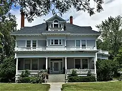 Arendt Jensen House |
March 8, 1989 (#89000126) |
1431 Ezell St. 38°56′31″N 119°44′29″W |
Gardnerville | |
| 16 | Arendt Jensen, Jr. House | 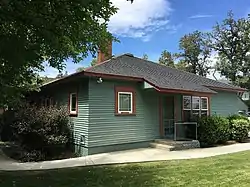 Arendt Jensen, Jr. House |
December 1, 1994 (#94001405) |
1243 A and 1243 B Eddie St. 38°56′32″N 119°44′46″W |
Gardnerville | |
| 17 | Jobs Peak Ranch | January 11, 2001 (#00001639) |
144 Summit Ridge Way 38°53′49″N 119°50′56″W |
Genoa | ||
| 18 | Lake Shore House | October 4, 1979 (#79001463) |
Glenbrook Rd 39°05′18″N 119°56′18″W |
Glenbrook | ||
| 19 | Wilhelm and William Lampe Ranch | 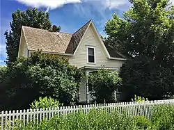 Wilhelm and William Lampe Ranch |
April 12, 2018 (#100001620) |
1335 Centerville Ln. 38°56′03″N 119°44′56″W |
Gardnerville | |
| 20 | Minden Butter Manufacturing Company |  Minden Butter Manufacturing Company |
August 6, 1986 (#86002263) |
1617 Water St. 38°57′20″N 119°45′48″W |
Minden | |
| 21 | Minden Elementary School | 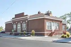 Minden Elementary School |
February 19, 2008 (#08000034) |
1638 Mono Ave. 38°57′14″N 119°46′01″W |
Minden | (School Buildings in Nevada MPS) |
| 22 | Minden Flour Milling Company | 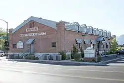 Minden Flour Milling Company |
November 14, 1978 (#78001721) |
6th St. and U.S. Route 395 38°57′18″N 119°45′46″W |
Minden | |
| 23 | Minden Inn | 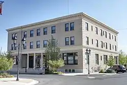 Minden Inn |
August 6, 1986 (#86002262) |
1594 Esmeralda Ave. 38°57′11″N 119°45′44″W |
Minden | |
| 24 | Minden Wool Warehouse | 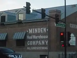 Minden Wool Warehouse |
August 6, 1986 (#86002261) |
1615 Railroad Ave. 38°57′19″N 119°45′51″W |
Minden | |
| 25 | Reese-Johnson-Virgin House | 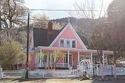 Reese-Johnson-Virgin House |
July 21, 2004 (#04000728) |
193 Genoa Ln. 39°00′12″N 119°50′40″W |
Genoa | |
| 26 | TAHOE (Shipwreck) | 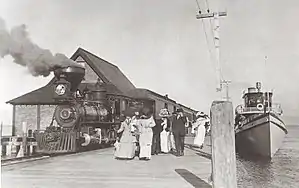 TAHOE (Shipwreck) |
February 11, 2004 (#04000026) |
Lake Tahoe 39°05′29″N 119°57′08″W |
Glenbrook |
See also
| Wikimedia Commons has media related to National Register of Historic Places in Douglas County, Nevada. |
References
- The latitude and longitude information provided in this table was derived originally from the National Register Information System, which has been found to be fairly accurate for about 99% of listings. Some locations in this table may have been corrected to current GPS standards.
- "National Register of Historic Places: Weekly List Actions". National Park Service, United States Department of the Interior. Retrieved on January 29, 2021.
- Numbers represent an alphabetical ordering by significant words. Various colorings, defined here, differentiate National Historic Landmarks and historic districts from other NRHP buildings, structures, sites or objects.
- The eight-digit number below each date is the number assigned to each location in the National Register Information System database, which can be viewed by clicking the number.
- Federal and state laws and practices restrict general public access to information regarding the specific location of this resource. In some cases, this is to protect archeological sites from vandalism, while in other cases it is restricted at the request of the owner. See: Knoerl, John; Miller, Diane; Shrimpton, Rebecca H. (1990), Guidelines for Restricting Information about Historic and Prehistoric Resources, National Register Bulletin, National Park Service, U.S. Department of the Interior, OCLC 20706997.
| Topics | |
|---|---|
| Lists by state |
|
| Lists by insular areas | |
| Lists by associated state | |
| Other areas | |
| Related | |
| |
This article is issued from Wikipedia. The text is licensed under Creative Commons - Attribution - Sharealike. Additional terms may apply for the media files.