National Register of Historic Places listings in Downtown Louisville, Kentucky
This is a list of properties and historic districts on the National Register of Historic Places in downtown Louisville, Kentucky. Latitude and longitude coordinates of the 85 sites listed on this page may be displayed in a map or exported in several formats by clicking on one of the links in the adjacent box.[1]
National Register sites elsewhere in Jefferson County are listed separately.
- This National Park Service list is complete through NPS recent listings posted February 5, 2021.[2]
Current listings
| [3] | Name on the Register | Image | Date listed[4] | Location | Description |
|---|---|---|---|---|---|
| 1 | Adath Jeshurun Temple and School | 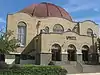 Adath Jeshurun Temple and School |
January 28, 1982 (#82002703) |
757 S. Brook St. 38°14′35″N 85°45′07″W |
|
| 2 | Almsted Brothers Building | 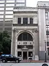 Almsted Brothers Building |
March 1, 1982 (#82002704) |
425 W. Market St. 38°15′20″N 85°45′29″W |
|
| 3 | Ancient and Accepted Scottish Rite Temple | 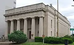 Ancient and Accepted Scottish Rite Temple |
April 29, 1982 (#82002705) |
200 E. Gray St. 38°14′48″N 85°45′04″W |
|
| 4 | Belle of Louisville (steamer) | 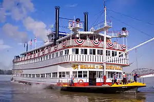 Belle of Louisville (steamer) |
April 10, 1972 (#72000535) |
401 W. River Rd. 38°15′34″N 85°45′20″W |
|
| 5 | Bosler Fireproof Garage | 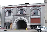 Bosler Fireproof Garage |
August 18, 1983 (#83002639) |
423 S. 3rd St. 38°15′08″N 85°45′19″W |
Later called the Morrissey Garage, the city of Louisville began demolition of the building April 11–12, 2015[5] |
| 6 | Brandeis House | 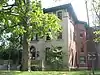 Brandeis House |
March 1, 1984 (#84001553) |
310 E. Broadway 38°14′42″N 85°44′57″W |
|
| 7 | Breslin Building | 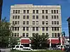 Breslin Building |
June 20, 2013 (#83004589) |
305 W. Broadway 38°14′47″N 85°45′25″W |
Originally nominated in 1983, but was initially denied due to owner objection. Objections were lifted in 2013. |
| 8 | Brown Hotel Building and Theater | 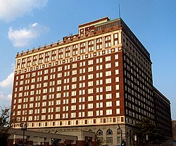 Brown Hotel Building and Theater |
February 17, 1978 (#78001346) |
335 W. Broadway 38°14′47″N 85°45′29″W |
|
| 9 | J.T.S. Brown and Son's Complex |  J.T.S. Brown and Son's Complex |
December 10, 1998 (#98001489) |
105, 107-109 W. Main St. 38°15′23″N 85°45′07″W |
|
| 10 | The Business Women's Club |  The Business Women's Club |
February 7, 2008 (#08000006) |
425 Muhammad Ali Boulevard 38°15′05″N 85°45′31″W |
|
| 11 | Caperton Block |  Caperton Block |
July 12, 1984 (#84001554) |
564-574 4th St. 38°14′57″N 85°45′29″W |
|
| 12 | Cathedral of the Assumption |  Cathedral of the Assumption |
September 21, 1977 (#77000623) |
443 S. 5th St. 38°15′07″N 85°45′31″W |
|
| 13 | Chestnut Street Methodist Church |  Chestnut Street Methodist Church |
July 16, 1979 (#79001000) |
809 W. Chestnut St. 38°15′00″N 85°45′55″W |
|
| 14 | Christ Church Cathedral | 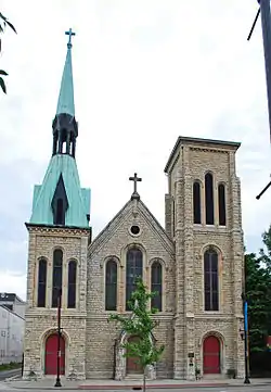 Christ Church Cathedral |
August 14, 1973 (#73000807) |
421 S. 2nd St. 38°15′07″N 85°45′13″W |
|
| 15 | The Cumberland | 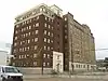 The Cumberland |
March 14, 1996 (#96000278) |
201 York St. 38°14′38″N 85°45′20″W |
|
| 16 | J. Dolfinger and Company Building |  J. Dolfinger and Company Building |
December 21, 1990 (#90001836) |
642 S. 4th St. 38°14′50″N 85°45′30″W |
|
| 17 | Electric Building | 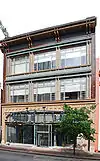 Electric Building |
March 14, 1985 (#85000558) |
619 S. 4th St. 38°14′54″N 85°45′28″W |
|
| 18 | Elks Athletic Club | 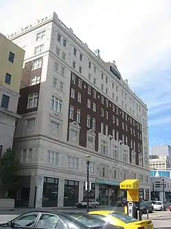 Elks Athletic Club |
July 16, 1979 (#79001003) |
604 S. 3rd St. 38°14′55″N 85°45′23″W |
|
| 19 | Fifth Ward School | 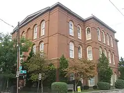 Fifth Ward School |
March 31, 1978 (#78001353) |
743 S. 5th St. 38°14′40″N 85°45′36″W |
|
| 20 | First Lutheran Church | 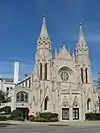 First Lutheran Church |
October 29, 1982 (#82001558) |
417 E. Broadway 38°14′44″N 85°44′48″W |
|
| 21 | First National Bank-Kentucky Title Company Building | 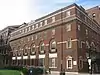 First National Bank-Kentucky Title Company Building |
May 19, 1983 (#83002664) |
214 S. 5th St. 38°15′18″N 85°45′32″W |
|
| 22 | German Bank Building | 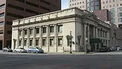 German Bank Building |
October 11, 1984 (#84000029) |
150 S. 5th St. 38°15′20″N 85°45′31″W |
|
| 23 | German Insurance Bank | 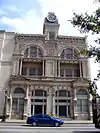 German Insurance Bank |
March 14, 1985 (#85000559) |
207 W. Market St. 38°15′19″N 85°45′14″W |
|
| 24 | Hamilton Brothers Warehouse | 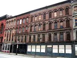 Hamilton Brothers Warehouse |
February 7, 2008 (#08000007) |
125-127 W. Main St. 38°15′23″N 85°45′09″W |
|
| 25 | Heyburn Building | 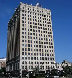 Heyburn Building |
July 16, 1979 (#79001007) |
332 W. Broadway 38°14′45″N 85°45′29″W |
|
| 26 | House of Weller | 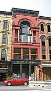 House of Weller |
September 26, 1979 (#79001008) |
121 W. Main St. 38°15′23″N 85°45′09″W |
|
| 27 | Howard-Hardy House | 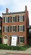 Howard-Hardy House |
November 9, 2004 (#03000709) |
429 S. 2nd St. 38°15′06″N 85°45′14″W |
|
| 28 | E.L. Hughes Company Building | August 4, 2016 (#16000498) |
209 E. Main St. 38°15′21″N 85°44′58″W |
||
| 29 | Inter-Southern Insurance Building | 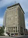 Inter-Southern Insurance Building |
March 19, 1980 (#80001605) |
239-247 S. 5th St. 38°15′15″N 85°45′30″W |
|
| 30 | Jefferson County Armory | 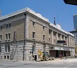 Jefferson County Armory |
March 24, 1980 (#80001606) |
525 W. Muhammad Ali Boulevard 38°15′06″N 85°45′37″W |
|
| 31 | Jefferson County Courthouse | 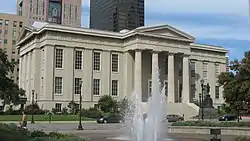 Jefferson County Courthouse |
April 10, 1972 (#72000537) |
527 W. Jefferson St. 38°15′16″N 85°45′34″W |
Now the Louisville Metro Hall, seat of government for all of Louisville and Jefferson County, Kentucky. |
| 32 | Jefferson County Courthouse Annex | 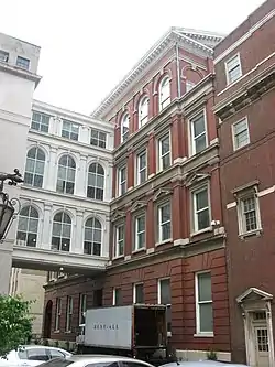 Jefferson County Courthouse Annex |
April 21, 1980 (#80001607) |
517 Court Pl. 38°15′18″N 85°45′34″W |
|
| 33 | Jefferson County Jail | 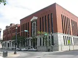 Jefferson County Jail |
July 16, 1973 (#73000808) |
514 W. Liberty St. 38°15′11″N 85°45′36″W |
|
| 34 | Haury Motor Company Showroom and Garage | March 13, 2017 (#100000739) |
741 S. 3rd St. 38°14′40″N 85°45′25″W |
||
| 35 | Kaufman-Straus Building | 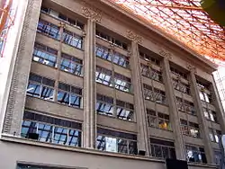 Kaufman-Straus Building |
February 14, 1978 (#78001357) |
427-437 S. 4th St. 38°15′07″N 85°45′25″W |
|
| 36 | Keneseth Israel Synagogue | 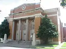 Keneseth Israel Synagogue |
October 29, 1982 (#82001559) |
232-236 E. Jacob St. 38°14′38″N 85°45′01″W |
|
| 37 | Kentucky National Bank | 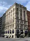 Kentucky National Bank |
July 16, 1979 (#79001010) |
300 W. Main St. 38°15′22″N 85°45′18″W |
|
| 38 | Kurfees Paint Company | 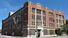 Kurfees Paint Company |
July 30, 2013 (#13000560) |
201 E. Market St. 38°15′17″N 85°44′59″W |
|
| 39 | Levy Brothers Building | 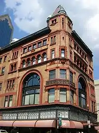 Levy Brothers Building |
March 24, 1978 (#78001359) |
235 W. Market St. 38°15′19″N 85°45′18″W |
|
| 40 | Loew's and United Artists State Theatre | 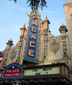 Loew's and United Artists State Theatre |
March 28, 1978 (#78001361) |
625 S. 4th St. 38°14′53″N 85°45′28″W |
|
| 41 | Louisville City Hall Complex | 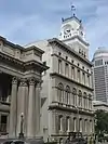 Louisville City Hall Complex |
September 1, 1976 (#76000905) |
601, 603, 617 W. Jefferson St. 38°15′16″N 85°45′38″W |
|
| 42 | Louisville Free Public Library |  Louisville Free Public Library |
March 27, 1980 (#80001608) |
301 W. York St. 38°14′40″N 85°45′28″W |
|
| 43 | Louisville Grocery Company Building |  Louisville Grocery Company Building |
April 18, 2003 (#03000258) |
231 E. Main St. 38°15′22″N 85°44′54″W |
|
| 44 | Louisville Municipal Bridge, Pylons and Administration Building | 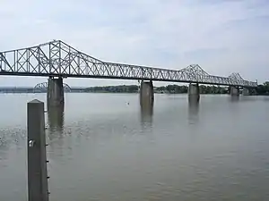 Louisville Municipal Bridge, Pylons and Administration Building |
March 8, 1984 (#84001578) |
Spans the Ohio River between Louisville and Jeffersonville, IN 38°15′36″N 85°45′09″W |
Extends into Clark County, Indiana |
| 45 | Louisville Trust Building |  Louisville Trust Building |
April 18, 1977 (#77000624) |
208 S. 5th St. 38°15′19″N 85°45′31″W |
|
| 46 | Madrid Building |  Madrid Building |
July 11, 1985 (#85001509) |
545 S. 3rd St. 38°14′58″N 85°45′21″W |
|
| 47 | Main Street District, Expanded |  Main Street District, Expanded |
April 1, 1980 (#80001609) |
316, 320, 324 and 328 W. Main St. 38°15′23″N 85°45′22″W |
|
| 48 | Marmaduke Building |  Marmaduke Building |
July 26, 1991 (#91000921) |
520 S. 4th St. 38°15′02″N 85°45′28″W |
|
| 49 | Mayor Andrew Broaddus | 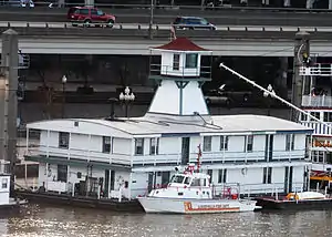 Mayor Andrew Broaddus |
June 30, 1989 (#89001446) |
401 W. River Rd. 38°15′34″N 85°45′18″W |
|
| 50 | Miller Paper Company Buildings | 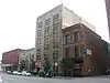 Miller Paper Company Buildings |
February 11, 2011 (#11000007) |
118-122 E. Main St. 38°15′21″N 85°45′02″W |
|
| 51 | New Enterprise Tobacco Warehouse | 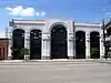 New Enterprise Tobacco Warehouse |
December 4, 1980 (#80001611) |
925 W. Main St. 38°15′23″N 85°45′40″W |
|
| 52 | Old Presbyterian Theological Seminary | 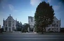 Old Presbyterian Theological Seminary |
March 24, 1978 (#78001362) |
109 E. Broadway 38°14′46″N 85°45′10″W |
|
| 53 | Old U.S. Customshouse and Post Office and Fireproof Storage Company Warehouse | .jpg.webp) Old U.S. Customshouse and Post Office and Fireproof Storage Company Warehouse |
November 23, 1977 (#77000626) |
300-314 W. Liberty St. 38°15′10″N 85°45′21″W |
Originally listed as the "Old U.S. Customshouse and Post Office"; warehouse added in a boundary increase of May 31, 1980 |
| 54 | Pendennis Club | 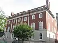 Pendennis Club |
December 4, 2003 (#03001225) |
218 W. Muhammad Ali Boulevard 38°15′02″N 85°45′18″W |
|
| 55 | Republic Building | 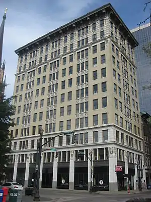 Republic Building |
August 12, 1982 (#82002718) |
429 W. Muhammad Ali Boulevard 38°15′05″N 85°45′32″W |
|
| 56 | Ronald-Brennan House | 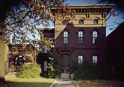 Ronald-Brennan House |
August 11, 1975 (#75000774) |
631 S. 5th St. 38°14′53″N 85°45′34″W |
|
| 57 | Rossmore Apartment House | 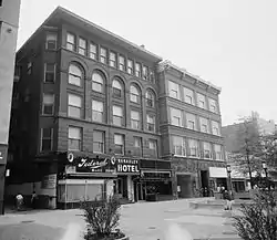 Rossmore Apartment House |
November 14, 1978 (#78001365) |
22 Theater Sq. 38°14′50″N 85°45′31″W |
|
| 58 | St. Paul's German Evangelical Church and Parish House | 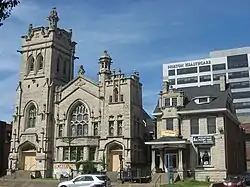 St. Paul's German Evangelical Church and Parish House |
February 25, 1982 (#82002724) |
213 E. Broadway 38°14′45″N 85°45′03″W |
|
| 59 | Savoy Historic District |  Savoy Historic District |
June 1, 1988 (#88000188) |
209-221 W. Jefferson St. 38°15′14″N 85°45′16″W |
|
| 60 | Sears, Roebuck and Company Store |  Sears, Roebuck and Company Store |
February 18, 1983 (#83002729) |
800 W. Broadway 38°14′47″N 85°45′56″W |
|
| 61 | Second and Market Streets Historic District |  Second and Market Streets Historic District |
March 17, 1988 (#88000186) |
Second and Market Sts.[6] 38°15′19″N 85°45′15″W |
|
| 62 | Seelbach Hotel |  Seelbach Hotel |
August 12, 1975 (#75000775) |
500 S. 4th St. 38°15′03″N 85°45′28″W |
|
| 63 | Snead Manufacturing Building |  Snead Manufacturing Building |
August 1, 1978 (#78001367) |
817 W. Market St. 38°15′23″N 85°45′52″W |
|
| 64 | South Central Bell Company Office Building |  South Central Bell Company Office Building |
December 3, 1980 (#80001620) |
521 W. Chestnut St. 38°14′58″N 85°45′38″W |
|
| 65 | Southern National Bank |  Southern National Bank |
August 12, 1971 (#71000349) |
320 W. Main St. 38°15′23″N 85°45′21″W |
Also known as the Old Bank of Louisville; designated a National Historic Landmark on November 11, 1971 |
| 66 | Speed Building |  Speed Building |
May 18, 1983 (#83002737) |
319 Guthrie St. 38°15′00″N 85°45′24″W |
|
| 67 | Starks Building | 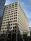 Starks Building |
July 11, 1985 (#85001508) |
455 S. 4th St. 38°15′05″N 85°45′26″W |
|
| 68 | Steam Engine Company No. 2 |  Steam Engine Company No. 2 |
November 7, 1980 (#80001625) |
617-621 W. Jefferson St. 38°15′16″N 85°45′41″W |
|
| 69 | Stewart's Dry Goods Company Building | 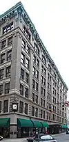 Stewart's Dry Goods Company Building |
August 12, 1982 (#82002725) |
501 S. 4th St. 38°15′03″N 85°45′26″W |
|
| 70 | W.K. Stewart Bookstore | 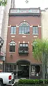 W.K. Stewart Bookstore |
March 24, 2003 (#02001469) |
550 S. 4th St. 38°14′59″N 85°45′29″W |
|
| 71 | Theater Building | 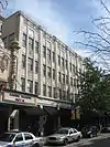 Theater Building |
August 12, 1982 (#82002726) |
625-633 S. 4th St. 38°14′52″N 85°45′28″W |
|
| 72 | Third and Jefferson Streets Historic District | 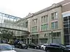 Third and Jefferson Streets Historic District |
March 17, 1988 (#88000190) |
301-317 S. 3rd St. and 232-244 Jefferson St. 38°15′12″N 85°45′18″W |
|
| 73 | Third and Market Streets Historic District | 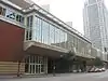 Third and Market Streets Historic District |
March 17, 1988 (#88000187) |
201-219 S. 3rd St. and 224-240 W. Market St. 38°15′17″N 85°45′18″W |
|
| 74 | Trade Mart Building | 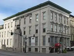 Trade Mart Building |
May 25, 1973 (#73000811) |
131 W. Main St. 38°15′23″N 85°45′11″W |
|
| 75 | Tyler Block | 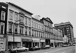 Tyler Block |
October 15, 1973 (#73002253) |
319 W. Jefferson St. 38°15′14″N 85°45′22″W |
|
| 76 | Tyler Hotel | 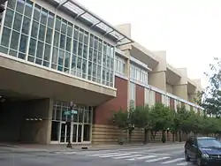 Tyler Hotel |
March 17, 1988 (#88000189) |
229-245 W. Jefferson St. 38°15′14″N 85°45′18″W |
|
| 77 | Tyler-Muldoon House | 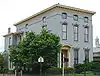 Tyler-Muldoon House |
July 20, 1977 (#77000629) |
132 E. Gray St. 38°14′48″N 85°45′06″W |
|
| 78 | United States Post Office, Court House and Custom House | 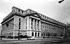 United States Post Office, Court House and Custom House |
March 18, 1999 (#99000334) |
601 W. Broadway 38°14′48″N 85°45′45″W |
|
| 79 | University of Louisville School of Medicine | 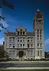 University of Louisville School of Medicine |
July 30, 1975 (#75000778) |
101 W. Chestnut St. 38°14′55″N 85°45′12″W |
|
| 80 | Walnut Street Theater |  Walnut Street Theater |
September 1, 1978 (#78001370) |
416 W. Muhammad Ali Boulevard 38°15′04″N 85°45′31″W |
|
| 81 | Weissinger-Gaulbert Apartments |  Weissinger-Gaulbert Apartments |
December 12, 1977 (#77000630) |
709 S. 3rd St. 38°14′44″N 85°45′24″W |
|
| 82 | West Main Street Historic District |  West Main Street Historic District |
March 22, 1974 (#74000884) |
W. Main St.; specifically the 600-800 blocks of W. Main St. and the south side of the 500 block 38°15′26″N 85°45′44″W |
Specific addresses represent a boundary increase of March 27, 1980 |
| 83 | Whiskey Row Historic District |  Whiskey Row Historic District |
June 4, 2010 (#89000385) |
101-133 W. Main St. 38°15′23″N 85°45′09″W |
|
| 84 | Wright and Taylor Building | 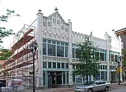 Wright and Taylor Building |
November 15, 1984 (#84000383) |
611-617 S. 4th St. 38°14′54″N 85°45′28″W |
|
| 85 | Y.M.C.A. Building | 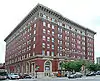 Y.M.C.A. Building |
December 16, 1977 (#77000631) |
227-229 W. Broadway 38°14′46″N 85°45′23″W |
Former listing
| [3] | Name on the Register | Image | Date listed | Date removed | Location | Summary |
|---|---|---|---|---|---|---|
| 1 | Louisville Board of Trade Building | 1973 (#73002254) | 1975 | 301 W. Main St. |
Demolished in 1975 for widening of Third Street[7] | |
| 2 | Norton Company Building | May 6, 1982 (#82002714) | February 5, 1991 | 400 W. Market St. |
See also
References
- The latitude and longitude information provided in this table was derived originally from the National Register Information System, which has been found to be fairly accurate for about 99% of listings. Some locations in this table may have been corrected to current GPS standards.
- "National Register of Historic Places: Weekly List Actions". National Park Service, United States Department of the Interior. Retrieved on February 5, 2021.
- Numbers represent an alphabetical ordering by significant words. Various colorings, defined here, differentiate National Historic Landmarks and historic districts from other NRHP buildings, structures, sites or objects.
- The eight-digit number below each date is the number assigned to each location in the National Register Information System database, which can be viewed by clicking the number.
- Shafer, Sheldon S. (April 13, 2015). "Preservationists bemoan loss of structures for Omni". The Courier-Journal. Retrieved April 23, 2015.
- Location derived from the name of the district; the NRIS lists it as "Address Restricted".
- Kleber, John (2001). The Encyclopedia of Louisville. The University Press of Kentucky. p. 537. ISBN 0813121000.
| Topics | |
|---|---|
| Lists by state |
|
| Lists by insular areas | |
| Lists by associated state | |
| Other areas | |
| Related | |
| |

This article is issued from Wikipedia. The text is licensed under Creative Commons - Attribution - Sharealike. Additional terms may apply for the media files.