National Register of Historic Places listings in Jersey County, Illinois
This is a list of the National Register of Historic Places listings in Jersey County, Illinois.
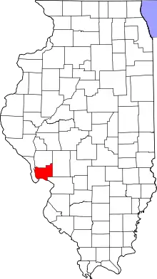
Location of Jersey County in Illinois
This is intended to be a complete list of the properties and districts on the National Register of Historic Places in Jersey County, Illinois, United States. Latitude and longitude coordinates are provided for many National Register properties and districts; these locations may be seen together in a map.[1]
There are 19 properties and districts listed on the National Register in the county.
- This National Park Service list is complete through NPS recent listings posted January 29, 2021.[2]
Current listings
| [3] | Name on the Register | Image | Date listed[4] | Location | City or town | Description |
|---|---|---|---|---|---|---|
| 1 | Charles Brainerd House | 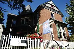 Charles Brainerd House |
February 5, 1998 (#98000065) |
420 E. Main St. (Illinois Route 100) 38°58′19″N 90°25′45″W |
Grafton | |
| 2 | Duncan Farm | 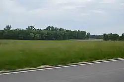 Duncan Farm |
August 24, 1982 (#82002542) |
Southern side of Illinois Route 100, ½ mile west of Brussels Ferry[5] 38°58′05″N 90°30′49″W |
Grafton | |
| 3 | Elsah Historic District | 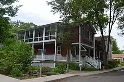 Elsah Historic District |
July 27, 1973 (#73000706) |
North of the McAdams Highway 38°57′15″N 90°21′37″W |
Elsah | |
| 4 | Fisher-Chapman Farmstead | 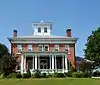 Fisher-Chapman Farmstead |
February 15, 2012 (#12000028) |
24818 Homeridge Dr. 39°08′29″N 90°20′42″W |
Jerseyville | |
| 5 | Col. William H. Fulkerson Farmstead | 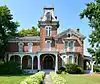 Col. William H. Fulkerson Farmstead |
August 6, 1998 (#98000977) |
1510 N. State St. (US Highway 67) 39°08′52″N 90°20′54″W |
Jerseyville | |
| 6 | Grafton Bank | 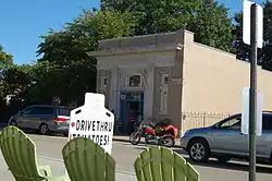 Grafton Bank |
February 16, 1994 (#94000016) |
225 E. Main St. (Illinois Route 100) 38°58′10″N 90°25′55″W |
Grafton | |
| 7 | Grafton Historic District | 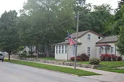 Grafton Historic District |
February 16, 1994 (#94000020) |
105-225 and 24-214 W. Main St. (Illinois Route 100), and stone wharf at Maple St. 38°58′09″N 90°26′16″W |
Grafton | |
| 8 | Hamilton Primary School | 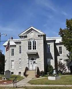 Hamilton Primary School |
August 6, 1998 (#98000975) |
200 ft. west of the intersection of Otterville and McClusky Rds. 39°03′04″N 90°23′50″W |
Otterville | |
| 9 | Jersey County Courthouse | 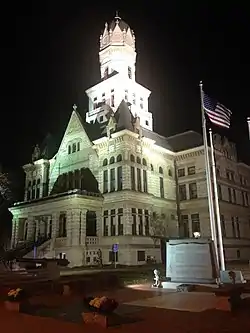 Jersey County Courthouse |
May 8, 1986 (#86001008) |
Courthouse Square (bordered by W. Pearl, N. Lafayette, W. Exchange, and N. Washington Streets) 39°07′08″N 90°19′44″W |
Jerseyville | |
| 10 | Jerseyville Downtown Historic District | 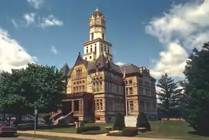 Jerseyville Downtown Historic District |
December 29, 1986 (#86003528) |
Roughly bounded by Spruce, N. Lafayette, Prairie, and N. Jefferson Streets 39°07′07″N 90°19′41″W |
Jerseyville | |
| 11 | Paris Mason Building | 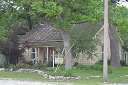 Paris Mason Building |
February 16, 1994 (#94000017) |
100 N. Springfield St. 38°58′17″N 90°27′01″W |
Grafton | |
| 12 | John and Amelia McClintock House | 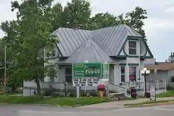 John and Amelia McClintock House |
February 16, 1994 (#94000019) |
321 E. Main St. (Illinois Route 100) 38°58′10″N 90°25′50″W |
Grafton | |
| 13 | New Piasa Chautauqua Historic District | 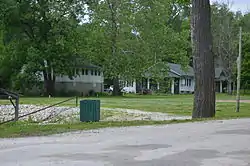 New Piasa Chautauqua Historic District |
June 15, 1982 (#82002541) |
Off McAdams Parkway 38°57′57″N 90°23′05″W |
Chautauqua | |
| 14 | Nutwood Site | February 9, 1979 (#79003784) |
Western side of Illinois Route 100, 500 feet south of the Narrows Creek bridge[6] 39°04′54″N 90°33′23″W |
Nutwood | ||
| 15 | Pere Marquette State Park Lodge and Cabins | .jpg.webp) Pere Marquette State Park Lodge and Cabins |
March 4, 1985 (#85002405) |
Box 158 38°58′18″N 90°32′28″W |
Grafton | |
| 16 | Principia College Historic District | .jpg.webp) Principia College Historic District |
April 19, 1993 (#93001605) |
River Rd. 38°57′01″N 90°21′01″W |
Elsah | |
| 17 | Ruebel Hotel | 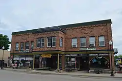 Ruebel Hotel |
February 16, 1994 (#94000015) |
207-215 E. Main St. (Illinois Route 100) 38°58′11″N 90°25′56″W |
Grafton | |
| 18 | Slaten-LaMarsh House | 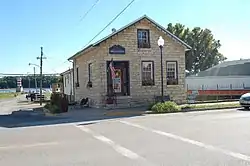 Slaten-LaMarsh House |
February 16, 1994 (#94000018) |
25 E. Main St. (Illinois Route 100) 38°58′10″N 90°26′03″W |
Grafton | |
| 19 | Smith-Duncan House and Eastman Barn |  Smith-Duncan House and Eastman Barn |
November 22, 1999 (#99001379) |
Illinois Route 100 at Pere Marquette State Park, 2,000 feet (610 m) west of Deer Lick Hollow 38°58′09″N 90°30′43″W |
Grafton |
See also
| Wikimedia Commons has media related to National Register of Historic Places in Jersey County, Illinois. |
References
- The latitude and longitude information provided in this table was derived originally from the National Register Information System, which has been found to be fairly accurate for about 99% of listings. Some locations in this table may have been corrected to current GPS standards.
- "National Register of Historic Places: Weekly List Actions". National Park Service, United States Department of the Interior. Retrieved on January 29, 2021.
- Numbers represent an alphabetical ordering by significant words. Various colorings, defined here, differentiate National Historic Landmarks and historic districts from other NRHP buildings, structures, sites or objects.
- The eight-digit number below each date is the number assigned to each location in the National Register Information System database, which can be viewed by clicking the number.
- Wagner, Suzanne. National Register of Historic Places Inventory/Nomination: Duncan Farm. National Park Service, 1981-07-30, 5.
- Maruszak, Kathleen. National Register of Historic Places Inventory/Nomination: Nutwood Site. National Park Service, 1977-02, 5.
| Topics | |
|---|---|
| Lists by state |
|
| Lists by insular areas | |
| Lists by associated state | |
| Other areas | |
| Related | |
| |
This article is issued from Wikipedia. The text is licensed under Creative Commons - Attribution - Sharealike. Additional terms may apply for the media files.