National Register of Historic Places listings in Lee County, Illinois
This is a list of the National Register of Historic Places listings in Lee County, Illinois.
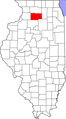
Location of Lee County in Illinois
This is intended to be a complete list of the properties and districts on the National Register of Historic Places in Lee County, Illinois, United States. Latitude and longitude coordinates are provided for many National Register properties and districts; these locations may be seen together in a map.[1]
There are 10 properties and districts listed on the National Register in the county.
- This National Park Service list is complete through NPS recent listings posted February 5, 2021.[2]
Current listings
| [3] | Name on the Register | Image | Date listed[4] | Location | City or town | Description |
|---|---|---|---|---|---|---|
| 1 | Amboy Illinois Central Depot | 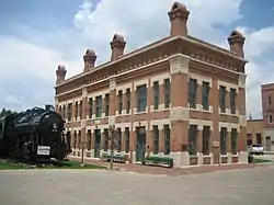 Amboy Illinois Central Depot |
August 18, 1992 (#92001015) |
50 S. East Ave. 41°42′50″N 89°19′55″W |
Amboy | |
| 2 | Christopher Brookner House | 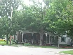 Christopher Brookner House |
November 13, 1984 (#84000319) |
222 N. Dixon Ave. 41°50′58″N 89°28′50″W |
Dixon | |
| 3 | Dixon Downtown Historic District |  Dixon Downtown Historic District |
March 7, 2012 (#12000059) |
Roughly bounded by River St., Dixon Ave., 3rd St., & Monroe Ave. 41°50′34″N 89°29′02″W |
Dixon | |
| 4 | Illinois Central Stone Arch Railroad Bridges | 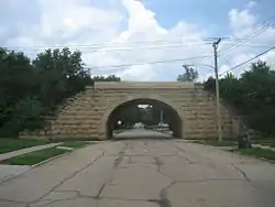 Illinois Central Stone Arch Railroad Bridges |
December 2, 1987 (#87002048) |
W. First, W. Second, & W. Third Sts. between Monroe & College Aves. 41°50′26″N 89°29′28″W |
Dixon | |
| 5 | Lowell Park | 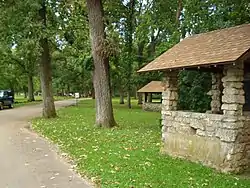 Lowell Park |
August 8, 2006 (#06000680) |
2114 Lowell Park Rd. 41°53′23″N 89°29′43″W |
Dixon | |
| 6 | Nachusa House | 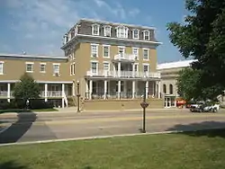 Nachusa House |
February 10, 1983 (#83000323) |
215 S. Galena Ave. 41°50′32″N 89°28′55″W |
Dixon | |
| 7 | Ronald Reagan Boyhood Home | 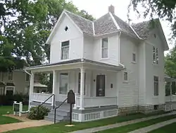 Ronald Reagan Boyhood Home |
March 26, 1982 (#82002580) |
816 S. Hennepin Ave. 41°50′10″N 89°28′51″W |
Dixon | |
| 8 | William H. Van Epps House | 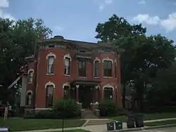 William H. Van Epps House |
February 11, 1982 (#82002581) |
212 S. Ottawa Ave. 41°50′33″N 89°28′50″W |
Dixon | |
| 9 | Col. Nathan Whitney House | 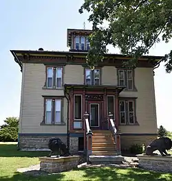 Col. Nathan Whitney House |
November 2, 1990 (#90001726) |
1620 Whitney Rd. 41°49′06″N 89°17′37″W |
Franklin Grove | |
| 10 | Stephen Wright House | 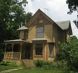 Stephen Wright House |
May 22, 2005 (#05000433) |
612 Chicago Rd. 41°41′33″N 88°59′17″W |
Paw Paw |
See also
| Wikimedia Commons has media related to National Register of Historic Places in Lee County, Illinois. |
References
- The latitude and longitude information provided in this table was derived originally from the National Register Information System, which has been found to be fairly accurate for about 99% of listings. Some locations in this table may have been corrected to current GPS standards.
- "National Register of Historic Places: Weekly List Actions". National Park Service, United States Department of the Interior. Retrieved on February 5, 2021.
- Numbers represent an alphabetical ordering by significant words. Various colorings, defined here, differentiate National Historic Landmarks and historic districts from other NRHP buildings, structures, sites or objects.
- The eight-digit number below each date is the number assigned to each location in the National Register Information System database, which can be viewed by clicking the number.
| Topics | |
|---|---|
| Lists by state |
|
| Lists by insular areas | |
| Lists by associated state | |
| Other areas | |
| Related | |
| |
This article is issued from Wikipedia. The text is licensed under Creative Commons - Attribution - Sharealike. Additional terms may apply for the media files.