National Register of Historic Places listings in Litchfield County, Connecticut
This is a list of the National Register of Historic Places listings in Litchfield County, Connecticut.
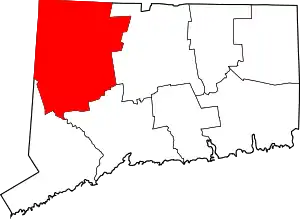
Location of Litchfield County in Connecticut
This is intended to be a complete list of the properties and districts on the National Register of Historic Places in Litchfield County, Connecticut, United States. The locations of National Register properties and districts for which the latitude and longitude coordinates are included below, may be seen in an online map.[1]
There are 171 properties and districts listed on the National Register in the county, including 4 National Historic Landmarks.
- This National Park Service list is complete through NPS recent listings posted January 29, 2021.[2]
Current listings
| [3] | Name on the Register[4] | Image | Date listed[5] | Location | City or town | Description |
|---|---|---|---|---|---|---|
| 1 | James Alldis House |  James Alldis House |
April 29, 1982 (#82004480) |
355 Prospect St. 41°48′16″N 73°07′24″W |
Torrington | Fine Queen Anne style house from 1895, built for supervisory of the largest industry in Torrington, the needle manufacturing plant which became the Torrington Company.[6] |
| 2 | American Legion Forest CCC Shelter |  American Legion Forest CCC Shelter |
September 4, 1986 (#86001725) |
Loop 3 of group camping area, American Legion State Forest 41°56′25″N 73°00′53″W |
Barkhamsted | |
| 3 | Leroy Anderson House |  Leroy Anderson House |
December 31, 2012 (#12000361) |
33 Grassy Hill Rd. 41°32′22″N 73°14′08″W |
Woodbury | |
| 4 | Jabez Bacon House |  Jabez Bacon House |
April 16, 1971 (#71000904) |
Hollow Rd. near its junction with U.S. Route 6 41°32′17″N 73°12′32″W |
Woodbury | |
| 5 | Amos Baldwin House | 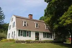 Amos Baldwin House |
July 19, 2016 (#16000450) |
92 Goshen St., E. 41°55′20″N 73°12′38″W |
Norfolk | |
| 6 | Barkhamsted Center Historic District | 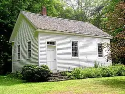 Barkhamsted Center Historic District |
December 22, 1999 (#99001594) |
119, 131 Center Hill Rd. and 2, 5, 6, and 8 Old Town Hall Rd. 41°55′47″N 72°57′59″W |
Barkhamsted | |
| 7 | Merritt Beach & Son Building |  Merritt Beach & Son Building |
April 28, 1992 (#92000403) |
30 Bridge St. 41°34′35″N 73°24′43″W |
New Milford | |
| 8 | Capt. Philo Beardsley House |  Capt. Philo Beardsley House |
July 3, 1979 (#79002616) |
Southeast of Kent on Beardsley Rd. 41°42′04″N 73°23′31″W |
Kent | |
| 9 | Beaver Meadow Complex Prehistoric Archeological District |  Beaver Meadow Complex Prehistoric Archeological District |
September 21, 1988 (#88000858) |
Peoples State Forest |
Barkhamsted | |
| 10 | Beckley Furnace | 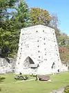 Beckley Furnace |
February 14, 1978 (#78002847) |
Southeast of Canaan on Lower Rd. 42°00′39″N 73°17′34″W |
North Canaan | |
| 11 | Joseph Bellamy House |  Joseph Bellamy House |
April 12, 1982 (#82004444) |
N. Main and West Sts. 41°38′42″N 73°12′32″W |
Bethlehem | |
| 12 | Francis Benedict Jr. House | 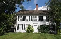 Francis Benedict Jr. House |
April 11, 2002 (#02000333) |
85 N. Colebrook Rd. 42°01′45″N 73°09′13″W |
Norfolk | |
| 13 | Bethlehem Green Historic District | 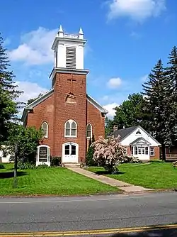 Bethlehem Green Historic District |
December 16, 1982 (#82001001) |
Parts of N. Main St., S. Main St., East St., West Rd., and Munger Lane 41°38′16″N 73°12′32″W |
Bethlehem | |
| 14 | Henry B. Bissell House | 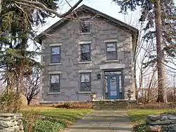 Henry B. Bissell House |
September 7, 1990 (#90001288) |
202 Maple St. 41°44′14″N 73°14′09″W |
Litchfield | |
| 15 | Boardman's Bridge | .jpg.webp) Boardman's Bridge |
May 13, 1976 (#76001983) |
Boardman Rd. at the Housatonic River, northwest of New Milford 41°35′36″N 73°27′02″W |
New Milford | |
| 16 | Braman Camp | August 2, 1982 (#82004451) |
Doolittle Lake 42°00′53″N 73°09′18″W |
Norfolk | ||
| 17 | Bridge No. 2305 | 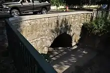 Bridge No. 2305 |
March 9, 2007 (#07000109) |
Main St. over Burton Brook 41°58′04″N 73°26′22″W |
Salisbury | |
| 18 | Bridge No. 560 | 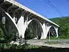 Bridge No. 560 |
September 29, 2004 (#04001090) |
US 7 and CT 4 over the Housatonic River 41°49′11″N 73°22′25″W |
Cornwall and Sharon | Also known as Cornwall Bridge, crosses the Housatonic River and the Housatonic Railroad. Built in 1930 by C.W. Blakeslee and Sons for the Connecticut Highway Department, it is a fairly large example of concrete open-spandrel construction.[7] |
| 19 | Bridgewater Center Historic District |  Bridgewater Center Historic District |
July 19, 2000 (#00000816) |
Roughly along Main St., Warner Rd., Clapboard Rd. and Hat Shop Hill 41°32′09″N 73°22′07″W |
Bridgewater | |
| 20 | Hervey Brooks Pottery Shop and Kiln Site | 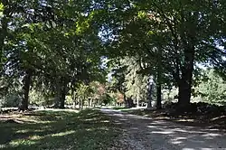 Hervey Brooks Pottery Shop and Kiln Site |
December 10, 1993 (#93001362) |
Address Restricted |
Goshen | |
| 21 | Roderick Bryan House | 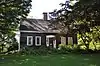 Roderick Bryan House |
December 28, 2000 (#00001563) |
867 Linkfield Rd. 41°38′45″N 73°07′58″W |
Watertown | |
| 22 | Bull's Bridge | 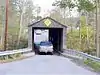 Bull's Bridge |
April 26, 1972 (#72001314) |
About 3 miles (4.8 km) southwest of Kent on Bull's Bridge Rd, over the Housatonic River 41°40′32″N 73°30′35″W |
Kent | |
| 23 | Capt. William Bull Tavern | 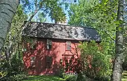 Capt. William Bull Tavern |
June 30, 1983 (#83001269) |
US 202 41°46′52″N 73°09′43″W |
Litchfield | |
| 24 | Burlington–Harmony Hill Roads Historic District | 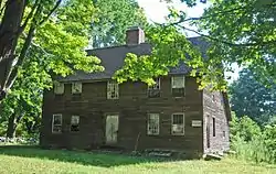 Burlington–Harmony Hill Roads Historic District |
December 6, 1996 (#96001364) |
Harmony Hill, Locust Grove, and Burlington Rds. 41°46′33″N 73°02′56″W |
Harwinton | |
| 25 | Burrall-Belden House |  Burrall-Belden House |
November 27, 2018 (#100003146) |
6 Barnes Rd. 41°57′42″N 73°20′03″W |
Canaan | |
| 26 | Calhoun–Ives Historic District |  Calhoun–Ives Historic District |
November 22, 1995 (#95001344) |
79-262 Calhoun St. and 11 and 12 Ives Rd. 41°39′34″N 73°19′58″W |
Washington | |
| 27 | Moses Camp House |  Moses Camp House |
May 10, 1984 (#84001060) |
682 Main St. 41°55′27″N 73°04′33″W |
Winchester* | |
| 28 | Canaan Village Historic District | 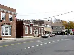 Canaan Village Historic District |
December 13, 1990 (#90001800) |
Roughly bounded by W. Main, Bragg, and Orchard Sts. and Granite Ave. 42°01′44″N 73°19′52″W |
North Canaan | |
| 29 | J. Howard Catlin House | August 6, 1993 (#93000672) |
14 Knife Shop Rd. 41°41′50″N 73°06′22″W |
Litchfield | Demolished.[8] | |
| 30 | Philip Chapin House | 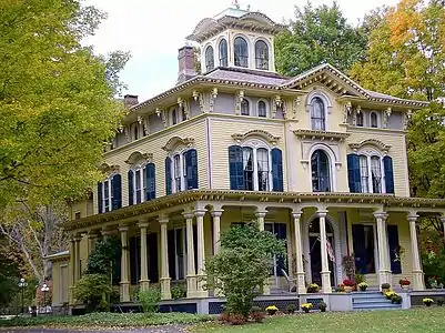 Philip Chapin House |
August 29, 1977 (#77001399) |
1 Church St. 41°52′30″N 72°58′08″W |
New Hartford | |
| 31 | Starling Childs Camp | August 2, 1982 (#82004463) |
Doolittle Lake 42°00′40″N 73°09′23″W |
Norfolk | ||
| 32 | John C. Coffing House |  John C. Coffing House |
December 18, 1990 (#90001922) |
U.S. Route 44 west of Lime Rock Rd. 41°58′38″N 73°25′34″W |
Salisbury | |
| 33 | Colebrook Center Historic District |  Colebrook Center Historic District |
July 26, 1991 (#91000953) |
Roughly the junction of Rockwell, Colebrook, Schoolhouse and Smith Hill Rds. and CT 183 41°59′30″N 73°05′52″W |
Colebrook | |
| 34 | Colebrook Store |  Colebrook Store |
April 26, 1976 (#76001980) |
CT 183 41°59′22″N 73°05′48″W |
Colebrook | |
| 35 | Cornwall Bridge Railroad Station | 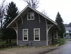 Cornwall Bridge Railroad Station |
April 26, 1972 (#72001313) |
Junction of Poppleswamp Brook Rd. and Kent Rd. 41°49′11″N 73°22′20″W |
Cornwall | |
| 36 | Cream Hill Agricultural School |  Cream Hill Agricultural School |
March 26, 1976 (#76001986) |
Northeast of West Cornwall off CT 128 on Cream Hill Rd. 41°53′33″N 73°19′22″W |
Cornwall | |
| 37 | Cream Hill Shelter | 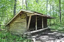 Cream Hill Shelter |
September 4, 1986 (#86001727) |
Wickwire Rd., Housatonic State Forest 41°54′43″N 73°19′39″W |
Cornwall | Incorrectly listed in Sharon; replaced in 1988. |
| 38 | Downtown Torrington Historic District |  Downtown Torrington Historic District |
December 22, 1988 (#88002978) |
Roughly bounded by Church and Alvord Sts., Center Cemetery, Willow St., E. Main St., Litchfield St., and Prospect St. 41°48′07″N 73°07′17″W |
Torrington | A historic district covering historic portion of commercial downtown area |
| 39 | East Plymouth Historic District |  East Plymouth Historic District |
February 21, 1985 (#85000312) |
E. Plymouth and Marsh Rd. 41°41′59″N 72°59′57″W |
Plymouth | |
| 40 | Esperanza | 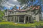 Esperanza |
April 11, 2002 (#02000334) |
511 Town Hill Rd. 41°51′25″N 73°00′14″W |
New Hartford | |
| 41 | Falls Village District | 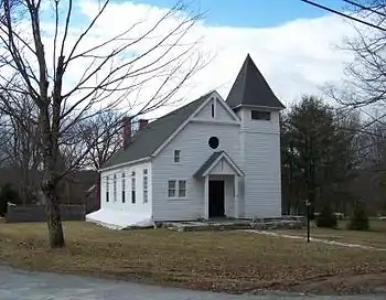 Falls Village District |
June 14, 1979 (#79002622) |
CT 126 41°57′23″N 73°21′49″W |
Canaan | Historic district including Greek Revival houses, churches, and the D.M. Hunt Library from 1891. |
| 42 | Farnum House |  Farnum House |
August 2, 1982 (#82004449) |
Litchfield Rd. 41°58′44″N 73°12′04″W |
Norfolk | |
| 43 | Flanders Historic District |  Flanders Historic District |
April 13, 1979 (#79002618) |
U.S. Route 7, Cobble Rd., Cobble Lane, and Studio Hill Rd. 41°44′22″N 73°27′25″W |
Kent | |
| 44 | Samuel Forbes Homestead | November 25, 1992 (#92001578) |
89 Lower Rd. 42°00′41″N 73°18′23″W |
North Canaan | ||
| 45 | Stephen and Helen Foster House |  Stephen and Helen Foster House |
May 8, 2017 (#100000955) |
417 Sharon Goshen Tpk. 41°52′18″N 73°21′44″W |
Cornwall | |
| 46 | Fyler–Hotchkiss Estate |  Fyler–Hotchkiss Estate |
February 12, 1987 (#87000129) |
192 Main St. 41°48′15″N 73°07′19″W |
Torrington | |
| 47 | Ebenezer Gay House |  Ebenezer Gay House |
July 9, 1979 (#79002619) |
Main St. 41°52′37″N 73°28′37″W |
Sharon | |
| 48 | Gilbert Clock Factory |  Gilbert Clock Factory |
December 13, 1984 (#84000494) |
Wallens St. 41°55′49″N 73°03′29″W |
Winchester* | |
| 49 | Gillette's Grist Mill |  Gillette's Grist Mill |
August 29, 1977 (#77001403) |
East of Torrington on Maple Hollow Rd. 41°50′18″N 73°01′29″W |
New Hartford | |
| 50 | Glebe House | 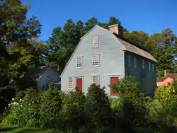 Glebe House |
March 11, 1971 (#71000902) |
Hollow Rd. 41°32′18″N 73°12′38″W |
Woodbury | |
| 51 | Goshen Historic District | 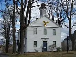 Goshen Historic District |
December 27, 1982 (#82000996) |
CT 63 and 4 and Gifford Rd. 41°49′50″N 73°13′25″W |
Goshen | |
| 52 | Gould House |  Gould House |
August 2, 1982 (#82004452) |
Golf Dr. 41°59′08″N 73°12′57″W |
Norfolk | |
| 53 | Gov. Smith Homestead | 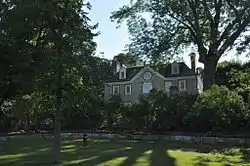 Gov. Smith Homestead |
March 25, 1982 (#82004475) |
South Main St. 41°52′09″N 73°28′32″W |
Sharon | |
| 54 | J. S. Halpine Tobacco Warehouse | 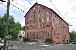 J. S. Halpine Tobacco Warehouse |
December 16, 1982 (#82001002) |
West and Mill Sts. 41°34′21″N 73°24′40″W |
New Milford | |
| 55 | Haystack Mountain Tower | .JPG.webp) Haystack Mountain Tower |
December 2, 1993 (#93001244) |
43 North St. 42°00′17″N 73°12′31″W |
Norfolk | |
| 56 | Hillside |  Hillside |
August 2, 1982 (#82004454) |
310 Litchfield Rd. 41°58′33″N 73°11′46″W |
Norfolk | |
| 57 | Hine–Buckingham Farms |  Hine–Buckingham Farms |
May 7, 2004 (#04000413) |
44, 46, and 48 Upland Rd. and 78, 81 Crossman Rd. 41°38′18″N 73°22′57″W |
New Milford | Now the Hunt Hill Farm. |
| 58 | Holabird House |  Holabird House |
June 28, 1982 (#82004445) |
Kellog Rd., corner of CT 126 41°57′14″N 73°20′48″W |
Canaan | |
| 59 | The Hollister Homestead |  The Hollister Homestead |
June 15, 2010 (#10000350) |
294-300 Nettleton Hollow Rd. 41°37′05″N 73°16′14″W |
Washington | |
| 60 | Hose and Hook and Ladder Truck Building | 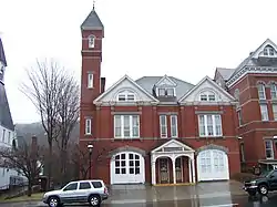 Hose and Hook and Ladder Truck Building |
January 4, 1982 (#82004479) |
Main St. 41°40′22″N 73°04′33″W |
Thomaston | |
| 61 | Hotchkissville Historic District |  Hotchkissville Historic District |
December 6, 1996 (#96001460) |
Roughly bounded by W. Wood, Paper Mill, Weekeepeemee, Washington, and Jack's Bridge Rds. 41°33′46″N 73°13′08″W |
Woodbury | |
| 62 | Housatonic Railroad Station | 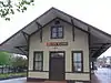 Housatonic Railroad Station |
March 1, 1984 (#84001062) |
Railroad St. 41°34′35″N 73°24′46″W |
New Milford | |
| 63 | Kent Iron Furnace | 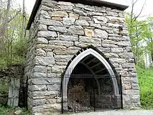 Kent Iron Furnace |
October 5, 1977 (#77001401) |
North of Kent off U.S. Route 7 41°44′19″N 73°28′12″W |
Kent | |
| 64 | George King House |  George King House |
November 6, 2006 (#06000592) |
12 N. Main St. 41°52′54″N 73°28′34″W |
Sharon | |
| 65 | Lakeville Historic District | 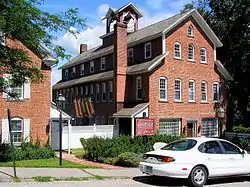 Lakeville Historic District |
August 1, 1996 (#96000845) |
Bounded by Millerton Rd., Sharon Rd., Allen St., and Holley St. 41°57′51″N 73°26′31″W |
Salisbury | |
| 66 | Lakeville Manor |  Lakeville Manor |
April 8, 2014 (#13000159) |
12 Elm St.;33 Sharon Rd. 41°57′44″N 73°26′27″W |
Lakeville | |
| 67 | Isaac Lawrence House |  Isaac Lawrence House |
March 10, 1983 (#83001270) |
Elm St. 42°01′23″N 73°19′33″W |
North Canaan | |
| 68 | Lighthouse Archeological Site (5-37) |  Lighthouse Archeological Site (5-37) |
April 25, 1991 (#91000445) |
Peoples State Forest 41°55′33″N 73°00′24″W |
Barkhamsted | The "Barkhamsted Lighthouse", site of an 18th-19th century mixed-race community. |
| 69 | Lime Rock Historic District |  Lime Rock Historic District |
July 5, 1984 (#84001064) |
Roughly White Hollow, Elm, Lime Rock, Norton Hill and Furnace Rds. 41°56′04″N 73°23′27″W |
Salisbury | |
| 70 | Lime Rock Park Race Track |  Lime Rock Park Race Track |
October 16, 2009 (#08001380) |
497 Lime Rock Rd. 41°55′40″N 73°23′01″W |
Salisbury | Unique race track, opened in 1959, has no stands, instead providing open fields for spectators. |
| 71 | Litchfield Historic District | 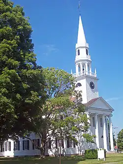 Litchfield Historic District |
November 24, 1968 (#68000050) |
Roughly both sides of North and South Sts. between Gallows Lane and Prospect St.; also U.S. Route 202 and Route 63 41°44′40″N 73°11′24″W |
Litchfield | Intact village of late 18th- and early 19th-century buildings was state's first historic district. 1978 expansion includes entire borough |
| 72 | Litchfield–South Roads Historic District | 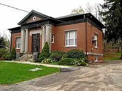 Litchfield–South Roads Historic District |
December 6, 1996 (#96001365) |
Roughly Litchfield Rd. from Bridge Park to Harwinton Heights Rds. and South Rd. from Litchfield Rd. to South Cemetery 41°46′15″N 73°03′38″W |
Harwinton | |
| 73 | Lover's Leap Bridge | .jpg.webp) Lover's Leap Bridge |
May 13, 1976 (#76001982) |
South of New Milford in Lovers Leap State Park 41°32′39″N 73°24′26″W |
New Milford | |
| 74 | Low House | 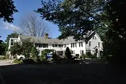 Low House |
February 17, 1984 (#84001067) |
Highfield Rd. 41°59′06″N 73°11′08″W |
Norfolk | |
| 75 | Caleb Martin House |  Caleb Martin House |
April 18, 1996 (#96000427) |
42 Mill Pond Rd. 41°37′44″N 73°13′19″W |
Bethlehem | |
| 76 | Mead Camp | August 2, 1982 (#82004455) |
Doolittle Lake 42°00′44″N 73°09′46″W |
Norfolk | ||
| 77 | Merryall Union Evangelical Society Chapel |  Merryall Union Evangelical Society Chapel |
June 5, 1986 (#86001240) |
Chapel Hill Rd. 41°38′50″N 73°25′11″W |
New Milford | |
| 78 | Merwinsville Hotel |  Merwinsville Hotel |
August 29, 1977 (#77001398) |
East of Gaylordsville on Brown's Forge Rd. 41°38′49″N 73°28′44″W |
New Milford | |
| 79 | Migeon Avenue Historic District |  Migeon Avenue Historic District |
September 6, 2002 (#02000913) |
Roughly along Migeon Ave. and parts of Forest St. 41°48′31″N 73°07′47″W |
Torrington | District of 9 contributing buildings, the most salient being Laurelhurst, a Shingle Style architecture work[9] |
| 80 | Milton Center Historic District |  Milton Center Historic District |
December 23, 1986 (#86003754) |
Roughly bounded by Milton, Shearshop, Headquarters, Sawmill, and Blue Swamp Rds. 41°46′03″N 73°16′22″W |
Litchfield | |
| 81 | Minortown Road Bridge |  Minortown Road Bridge |
August 17, 2001 (#01000883) |
Minortown Rd. over the Nonewaug River 41°34′36″N 73°10′34″W |
Woodbury | |
| 82 | William Moore Jr. House |  William Moore Jr. House |
April 14, 1999 (#99000406) |
5 Mountain Rd. 41°57′47″N 73°00′59″W |
Barkhamsted | |
| 83 | Moseley House-Farm |  Moseley House-Farm |
February 17, 1984 (#84001077) |
Greenwoods Rd. 42°00′23″N 73°14′29″W |
Norfolk | Known as Blackberry River Inn; original part built in 1763; Colonial Revival expansion in 1920; now a bed-and-breakfast.[10] |
| 84 | Moss Hill | 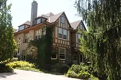 Moss Hill |
August 2, 1982 (#82004457) |
Litchfield Rd. 41°58′40″N 73°11′57″W |
Norfolk | |
| 85 | Mount Riga Ironworks Site | 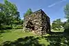 Mount Riga Ironworks Site |
December 1, 1994 (#94001417) |
South Pond 42°00′17″N 73°28′06″W |
Salisbury | |
| 86 | Mount Tom Tower | .JPG.webp) Mount Tom Tower |
December 2, 1993 (#93001247) |
Off U.S. Route 202 southeast of Woodville, Mount Tom State Park 41°41′39″N 73°16′30″W |
Litchfield, Morris, and Washington | |
| 87 | Mulville House | 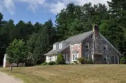 Mulville House |
February 17, 1984 (#84001079) |
Mountain Rd. 41°59′15″N 73°12′32″W |
Norfolk | |
| 88 | Music Mountain | 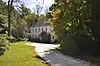 Music Mountain |
December 18, 1987 (#87001909) |
Music Mountain Rd. 41°55′12″N 73°19′16″W |
Canaan | |
| 89 | New Milford Center Historic District | 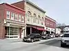 New Milford Center Historic District |
June 13, 1986 (#86001255) |
Bennett and Elm Sts., Center Cemetery, East, S. Main, Mill, and Railroad Sts. 41°34′40″N 73°24′35″W |
New Milford | |
| 90 | New Preston Hill Historic District | 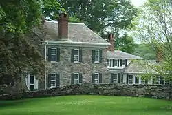 New Preston Hill Historic District |
August 26, 1985 (#85001931) |
New Preston Hill, Findley, and Gunn Hill Rds. 41°40′28″N 73°22′17″W |
Washington | |
| 91 | Noble House | 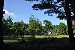 Noble House |
February 17, 1984 (#84001083) |
Highfield Rd. 41°59′09″N 73°11′07″W |
Norfolk | |
| 92 | John Glover Noble House | 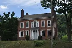 John Glover Noble House |
August 29, 1977 (#77001402) |
US 202 41°30′17″N 73°25′09″W |
New Milford | |
| 93 | Norfolk Country Club House | 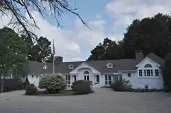 Norfolk Country Club House |
August 2, 1982 (#82004458) |
50 Golf Dr. 41°59′00″N 73°12′57″W |
Norfolk | |
| 94 | Norfolk Downs Shelter | 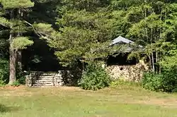 Norfolk Downs Shelter |
February 22, 1984 (#84001085) |
Golf Dr. 41°58′52″N 73°12′58″W |
Norfolk | |
| 95 | Norfolk Historic District |  Norfolk Historic District |
October 15, 1979 (#79003749) |
U.S. Route 44 and CT 272 41°59′20″N 73°12′16″W |
Norfolk | |
| 96 | Northfield Knife Company Site | 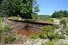 Northfield Knife Company Site |
April 8, 1997 (#97000275) |
Knife Shop Road, Humaston Brook State Park 41°41′56″N 73°06′12″W |
Litchfield | |
| 97 | Old Riverton Inn | 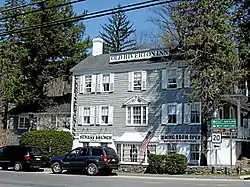 Old Riverton Inn |
July 24, 1992 (#92000906) |
436 E. River Rd. 41°57′46″N 73°01′01″W |
Barkhamsted | |
| 98 | James Pardee House | 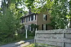 James Pardee House |
August 28, 2003 (#03000813) |
129 N. Main St. 41°53′00″N 73°28′20″W |
Sharon | |
| 99 | Paugnut Forest Administration Building | 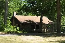 Paugnut Forest Administration Building |
September 5, 1986 (#86001736) |
385 Burr Mountain Rd., Burr Pond State Park 41°52′13″N 73°05′34″W |
Torrington | |
| 100 | Peoples Forest Museum | 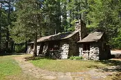 Peoples Forest Museum |
September 4, 1986 (#86001737) |
Greenwood Rd., Peoples State Forest 41°55′31″N 72°59′50″W |
Barkhamsted | |
| 101 | Phelps Farms Historic District | 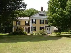 Phelps Farms Historic District |
August 18, 1983 (#83001249) |
CT 183 42°01′03″N 73°06′39″W |
Colebrook | |
| 102 | Arah Phelps Inn | 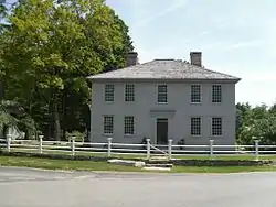 Arah Phelps Inn |
August 5, 1971 (#71000905) |
Junction of Prock Hill Rd. and CT 183 42°01′03″N 73°06′54″W |
Colebrook | |
| 103 | Pine Meadow Historic District |  Pine Meadow Historic District |
December 6, 1996 (#96001463) |
Roughly bounded by the Farmington River, Wicket, N. Ten, Church and Main Sts., in Pine Meadow 41°52′37″N 72°58′00″W |
New Hartford | |
| 104 | Plymouth Center Historic District |  Plymouth Center Historic District |
July 22, 1999 (#99000858) |
Roughly along Main, North, and South Sts., Cater, Hillside Ave., Ives Crossing, and Maple St. 41°40′18″N 73°03′15″W |
Plymouth | |
| 105 | Rectory and Church of the Immaculate Conception |  Rectory and Church of the Immaculate Conception |
August 2, 1982 (#82004459) |
North St. 41°59′40″N 73°12′07″W |
Norfolk | |
| 106 | Red Mountain Shelter | 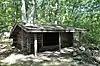 Red Mountain Shelter |
September 4, 1986 (#86001740) |
Northern side of CT 4 in Mohawk State Forest 41°50′50″N 73°17′15″W |
Cornwall | |
| 107 | Tapping Reeve House and Law School | 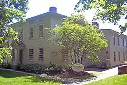 Tapping Reeve House and Law School |
October 15, 1966 (#66000879) |
South St. 41°44′38″N 73°11′20″W |
Litchfield | First law school in the United States separate from a college or university, its influential graduates included Aaron Burr Jr. and John C. Calhoun. |
| 108 | Reynolds Bridge |  Reynolds Bridge |
September 29, 2004 (#04001095) |
Waterbury Rd. at the Naugatuck River 41°39′11″N 73°04′39″W |
Thomaston | An open-spandrel concrete arch bridge from 1928 |
| 109 | Riverton Historic District | 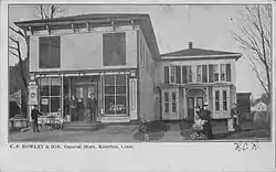 Riverton Historic District |
May 15, 2007 (#07000419) |
Roughly bounded by the Still River and the Farmington River and E. River Rd. 41°57′46″N 73°01′00″W |
Barkhamsted | |
| 110 | Rock Hall | 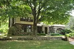 Rock Hall |
July 22, 2010 (#10000495) |
19 Rock Hall Rd. 41°59′02″N 73°08′11″W |
Colebrook | |
| 111 | Rockwell House | .jpg.webp) Rockwell House |
August 2, 1982 (#82004460) |
Laurel Way, W. 41°59′36″N 73°11′33″W |
Norfolk | |
| 112 | Solomon Rockwell House |  Solomon Rockwell House |
July 15, 1977 (#77001500) |
226 Prospect St. 41°55′26″N 73°04′44″W |
Winchester* | |
| 113 | Roxbury Center |  Roxbury Center |
July 28, 1983 (#83001271) |
CT 67, Weller's Bridge Rd., South and Church Sts. 41°33′20″N 73°18′28″W |
Roxbury | |
| 114 | Roxbury Iron Mine and Furnace Complex |  Roxbury Iron Mine and Furnace Complex |
June 24, 1979 (#79002621) |
Mine Hills Preserve 41°33′25″N 73°20′17″W |
Roxbury | |
| 115 | Rumsey Hall |  Rumsey Hall |
May 10, 1990 (#90000762) |
12 Bolton Hill Rd. 41°50′40″N 73°19′55″W |
Cornwall | Demolished in 2010. |
| 116 | Rye House | 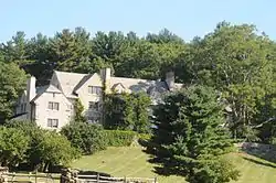 Rye House |
August 10, 2000 (#00000940) |
122-132 Old Mount Tom Rd. 41°43′10″N 73°16′39″W |
Litchfield | |
| 117 | St. Andrew's Episcopal Church | 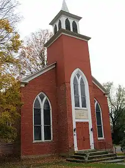 St. Andrew's Episcopal Church |
December 9, 1994 (#94001443) |
247 New Milford Turnpike, Marble Dale 41°39′46″N 73°22′10″W |
Washington | |
| 118 | Salisbury Center Historic District | 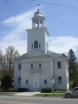 Salisbury Center Historic District |
September 11, 1997 (#97001115) |
Roughly along Academy, E. Main, Factory, and Main Sts., and 15 Underwood Rd. 41°58′58″N 73°25′25″W |
Salisbury | |
| 119 | Frederick S. Sanford House | 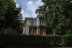 Frederick S. Sanford House |
January 19, 1989 (#88003230) |
Hat Shop Hill 41°32′07″N 73°22′24″W |
Bridgewater | |
| 120 | Carl F. Schoverling Tobacco Warehouse | 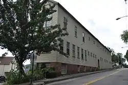 Carl F. Schoverling Tobacco Warehouse |
April 12, 1982 (#82004446) |
1 Wellsville Ave. 41°34′50″N 73°25′00″W |
New Milford | |
| 121 | Scoville Memorial Library | 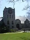 Scoville Memorial Library |
April 29, 1982 (#82004473) |
Main St. 41°58′51″N 73°25′23″W |
Salisbury | |
| 122 | Scoville Powerhouse | 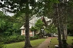 Scoville Powerhouse |
February 16, 1984 (#84001087) |
Twin Lakes and Beaver Dam Rds. 42°01′52″N 73°24′39″W |
Salisbury | |
| 123 | Maj. Gen. John Sedgwick House | 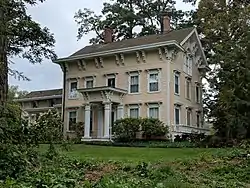 Maj. Gen. John Sedgwick House |
April 8, 1992 (#92000262) |
52 Hautboy Hill Rd. 41°53′55″N 73°16′27″W |
Cornwall | |
| 124 | Sharon Historic District | 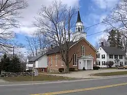 Sharon Historic District |
April 15, 1993 (#93000257) |
Roughly Main St. from Low Rd. to its junction with Mitchelltown, Amenia Union, and W. Woods Rds. 41°52′13″N 73°28′45″W |
Sharon | |
| 125 | Sharon Valley Historic District |  Sharon Valley Historic District |
September 9, 1982 (#82004478) |
Junction of Sharon Valley and Sharon Station Rds. 41°52′58″N 73°29′43″W |
Sharon | Hamlet that grew up around 19th-century iron mining and refining operation; first industrial community in Sharon |
| 126 | John Shepard House |  John Shepard House |
August 2, 1982 (#82004462) |
Shepard Park Rd. 41°59′41″N 73°11′47″W |
Norfolk | |
| 127 | David Sherman House |  David Sherman House |
August 23, 2002 (#02000868) |
Middle Quarter Rd. 41°31′41″N 73°12′02″W |
Woodbury | |
| 128 | Skee's Diner | 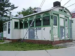 Skee's Diner |
September 6, 2002 (#02000912) |
Moved from 589 Main St. and currently in undisclosed location to begin restoration. 41°48′45″N 73°07′21″W |
Torrington | Barrel-roofed diner, prominently located at Main and Elm. Moved into place in 1944, escaping a war-time moratorium on new construction.[11] |
| 129 | Skilton Road Bridge | 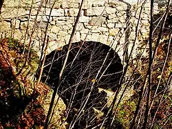 Skilton Road Bridge |
December 10, 1991 (#91001744) |
Skilton Rd. over the Nonewaug River 41°37′45″N 73°09′33″W |
Watertown | |
| 130 | Jason Skinner House |  Jason Skinner House |
June 19, 1985 (#85001331) |
21 Wintergreen Circle 41°45′58″N 73°04′15″W |
Harwinton | |
| 131 | South Canaan Congregational Church |  South Canaan Congregational Church |
March 16, 1983 (#83001272) |
CT 63 and Barnes Rd. 41°57′42″N 73°20′07″W |
Canaan | |
| 132 | South School | 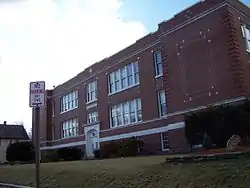 South School |
March 27, 1986 (#86000522) |
362 S. Main St. 41°47′36″N 73°07′17″W |
Torrington | 1915 school designed by Wilson Potter, a New York City-based architect of schools throughout the northeast[12] |
| 133 | Southbury Training School | 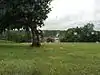 Southbury Training School |
May 1, 1992 (#92000368) |
1484 S. Britain Rd. 41°27′49″N 73°16′23″W |
Roxbury | Extends into Southbury in New Haven County. |
| 134 | Sports Building | 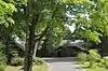 Sports Building |
February 22, 1984 (#84001088) |
Windrow Rd. 41°58′22″N 73°13′13″W |
Norfolk | |
| 135 | Steward's House-Foreign Mission School | 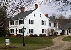 Steward's House-Foreign Mission School |
October 31, 2016 (#16000858) |
14 Bolton Hill Rd. 41°50′40″N 73°19′57″W |
Cornwall | |
| 136 | Robbins Stoeckel House | 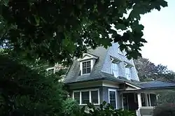 Robbins Stoeckel House |
August 2, 1982 (#82004465) |
Litchfield Rd. 41°59′02″N 73°12′03″W |
Norfolk | |
| 137 | Sun Terrace |  Sun Terrace |
December 20, 1978 (#78002849) |
Stub Hollow Rd. 41°51′15″N 73°00′47″W |
New Hartford | |
| 138 | Sunny Ridge Historic District |  Sunny Ridge Historic District |
November 22, 1995 (#95001346) |
2 and 20 Nettleton Hollow Rd., 145 Old Litchfield Rd., 6 Romford Rd., and 10-32 Sunny Ridge Rd. 41°39′27″N 73°16′36″W |
Washington | |
| 139 | Tamarack Lodge Bungalow | .JPG.webp) Tamarack Lodge Bungalow |
September 16, 1977 (#77001499) |
South of Norfolk off CT 272 at Dennis Hill Park 41°56′55″N 73°11′58″W |
Norfolk | |
| 140 | Terryville Waterwheel | 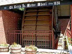 Terryville Waterwheel |
January 4, 2002 (#01001412) |
262 Main St. 41°40′48″N 73°00′55″W |
Plymouth | |
| 141 | Thomaston Opera House | 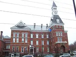 Thomaston Opera House |
April 26, 1972 (#72001319) |
Main St. 41°40′23″N 73°04′32″W |
Thomaston | Building from 1883 |
| 142 | Tom Thumb House | February 22, 1984 (#84001094) |
Windrow Rd. 41°58′14″N 73°13′10″W |
Norfolk | ||
| 143 | Topsmead | 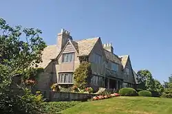 Topsmead |
November 19, 1993 (#93001243) |
25 and 46 Chase Rd. 41°44′49″N 73°09′30″W |
Litchfield | |
| 144 | Torringford Street Historic District | 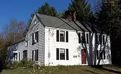 Torringford Street Historic District |
July 31, 1991 (#91000991) |
Torringford St. from Main St. north to W. Hill Rd. 41°50′45″N 73°04′27″W |
Torrington | |
| 145 | Torrington Fire Department Headquarters | 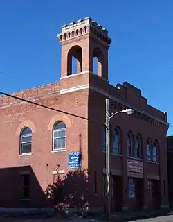 Torrington Fire Department Headquarters |
December 31, 1987 (#87002185) |
117 Water St. 41°48′06″N 73°07′29″W |
Torrington | |
| 146 | Town Hall and District School No. 6 |  Town Hall and District School No. 6 |
November 30, 1987 (#87002109) |
12 South St. 41°40′57″N 73°11′59″W |
Morris | |
| 147 | Trinity Church |  Trinity Church |
April 23, 1976 (#76001981) |
Milton Rd. 41°46′13″N 73°16′03″W |
Litchfield | |
| 148 | Trinity Church |  Trinity Church |
August 1, 1984 (#84001097) |
Main St. 41°40′21″N 73°04′32″W |
Thomaston | |
| 149 | Union Church/St. Paul's Church |  Union Church/St. Paul's Church |
February 21, 1985 (#85000307) |
Riverton Rd. 41°57′44″N 73°01′13″W |
Barkhamsted | |
| 150 | Union Depot | 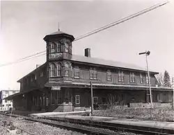 Union Depot |
April 26, 1972 (#72001317) |
U.S. Route 44 42°01′34″N 73°19′48″W |
North Canaan | |
| 151 | United Bank Building |  United Bank Building |
April 12, 1982 (#82004447) |
19-21 Main St. 41°34′38″N 73°24′42″W |
New Milford | |
| 152 | Villa Friuli | 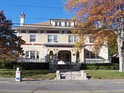 Villa Friuli |
April 11, 1991 (#91000349) |
58 High St. 41°48′11″N 73°07′54″W |
Torrington | |
| 153 | Warner Theatre | 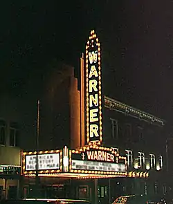 Warner Theatre |
February 16, 1984 (#84001098) |
68-82 Main St. 41°48′06″N 73°07′17″W |
Torrington | |
| 154 | Warren Congregational Church |  Warren Congregational Church |
November 29, 1991 (#91001743) |
4 Sackett Hill Rd. 41°44′37″N 73°20′58″W |
Warren | |
| 155 | Warrenton Woolen Mill |  Warrenton Woolen Mill |
February 12, 1987 (#87000115) |
839 Main St. 41°49′06″N 73°07′25″W |
Torrington | |
| 156 | Washington Green Historic District |  Washington Green Historic District |
November 27, 1995 (#95001345) |
Roughly along Ferry Bridge, Green Hill, Kirby, Roxbury, Wykeham and Woodbury Rds., Parsonage Ln., and The Green 41°37′37″N 73°18′29″W |
Washington | |
| 157 | Water Street Historic District |  Water Street Historic District |
January 15, 2003 (#02001698) |
Roughly along Water St., from Church St. to Prospect St. 41°48′09″N 73°07′35″W |
Torrington | |
| 158 | Watertown Center Historic District |  Watertown Center Historic District |
April 12, 2001 (#01000352) |
Roughly along Deforest, Main, Woodruff, Woodbury, North, and Warren Sts. 41°36′14″N 73°07′11″W |
Watertown | |
| 159 | David Welch House |  David Welch House |
February 16, 1984 (#84001103) |
Potash and Milton Rds. 41°46′13″N 73°15′59″W |
Litchfield | |
| 160 | West Cornwall Covered Bridge | 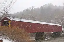 West Cornwall Covered Bridge |
December 30, 1975 (#75001923) |
CT 128 at the Housatonic River 41°52′18″N 73°21′52″W |
Cornwall | |
| 161 | West End Historic District |  West End Historic District |
August 3, 1990 (#90001148) |
Northern side of Main St. between Union and Elm Sts. 41°55′15″N 73°04′18″W |
Winchester* | |
| 162 | West Goshen Historic District | 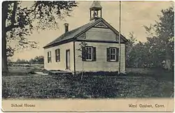 West Goshen Historic District |
October 23, 1987 (#87000982) |
Roughly bounded by CT 4, Beach, Mill and Milton Sts., and Thompson Rd. 41°49′32″N 73°15′16″W |
Goshen | |
| 163 | E. A. Wildman & Co. Tobacco Warehouse | 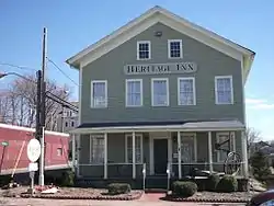 E. A. Wildman & Co. Tobacco Warehouse |
October 20, 1988 (#88000731) |
34 Bridge St. 41°34′35″N 73°24′43″W |
New Milford | |
| 164 | Winchester Soldiers' Monument | 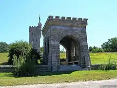 Winchester Soldiers' Monument |
January 26, 1984 (#84001105) |
Crown St. 41°55′29″N 73°04′22″W |
Winchester* | |
| 165 | Winsted Green Historic District |  Winsted Green Historic District |
August 16, 1977 (#77001501) |
U.S. Route 44 and CT 8; also 86 Main St. 41°55′19″N 73°03′39″W |
Winchester* | Second address represents boundary increase added on April 29, 1982 |
| 166 | Winsted Hosiery Mill | 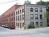 Winsted Hosiery Mill |
February 21, 1985 (#85000308) |
Whiting at Holabird St., in Winsted neighborhood 41°55′24″N 73°03′32″W |
Winchester* | |
| 167 | Winsted Water Works | November 20, 2020 (#100005797) |
Winchester Rd. (north side), Old Waterbury Tpk. / Rugg Brook Rd. 41°54′48″N 73°07′30″W |
Winchester | ||
| 168 | Oliver Wolcott House | 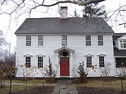 Oliver Wolcott House |
November 11, 1971 (#71001011) |
South St. 41°44′38″N 73°11′09″W |
Litchfield | 1753-built home of Oliver Wolcott, Sr., the soldier and politician, a signer of the U.S. Declaration of Independence and the Articles of Confederation |
| 169 | Woodbury Historic District No. 1 | 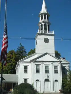 Woodbury Historic District No. 1 |
March 11, 1971 (#71000908) |
Both sides of Main St. (U.S. Route 6) for 2 miles (3.2 km), and radiating roads 41°32′43″N 73°12′23″W |
Woodbury | |
| 170 | Woodbury Historic District No. 2 | 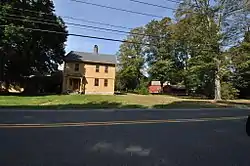 Woodbury Historic District No. 2 |
February 23, 1972 (#72001326) |
Both sides of Main St. from Woodbury–Southbury town line to Middle Quarter Rd. 41°30′56″N 73°12′17″W |
Woodbury | |
| 171 | World War I Memorial |  World War I Memorial |
February 17, 1984 (#84001106) |
Greenwoods Rd. West and North Sts. 41°59′40″N 73°12′10″W |
Norfolk |
- *Addresses of listed places in Winchester are "Winsted, CT"
See also
| Wikimedia Commons has media related to National Register of Historic Places in Litchfield County, Connecticut. |
References
- The latitude and longitude information provided in this table was derived originally from the National Register Information System, which has been found to be fairly accurate for about 99% of listings. Some locations in this table may have been corrected to current GPS standards.
- "National Register of Historic Places: Weekly List Actions". National Park Service, United States Department of the Interior. Retrieved on January 29, 2021.
- Numbers represent an alphabetical ordering by significant words. Various colorings, defined here, differentiate National Historic Landmarks and historic districts from other NRHP buildings, structures, sites or objects.
- "National Register Information System". National Register of Historic Places. National Park Service. March 13, 2009.
- The eight-digit number below each date is the number assigned to each location in the National Register Information System database, which can be viewed by clicking the number.
- Ransom, David E. (March 30, 1980). "National Register of Historic Places Inventory-Nomination: James Alldis House". National Park Service. and Accompanying 9 photos, exterior and interior, from 1980
- Clouette, Bruce (March 31, 2003). "National Register of Historic Places Registration: Bridge No. 560". National Park Service. and Accompanying eight photos, from 2003
- "J. Howard Catlin Papers". Litchfield Historical Society. Retrieved 2017-01-26.
- Kate Ohno, with Carol Clapp and Cheryl Barb (March 2001). "National Register of Historic Places Inventory-Nomination: Migeon Avenue Historic District". National Park Service. and Accompanying 10 photos, exterior and interior, from 2000 and other
- "Blackberry River Inn".
- Susan Chandler; Mark McEachern & Dan Zilka (March 21, 2002). "National Register of Historic Places Inventory-Nomination: Skee's Diner". National Park Service. and Accompanying four photos, exterior and interior, from 1984 and 2002 (captions at p. 15 in text document
- Jack A. Gold & John Herzan (June 1985). "National Register of Historic Places Inventory-Nomination: South School". National Park Service. and Accompanying 7 photos, from 1984
| Lists by county | 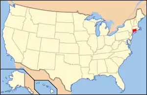 | |
|---|---|---|
| Lists by city or town | ||
| Other lists | ||
Municipalities and communities of Litchfield County, Connecticut, United States | ||
|---|---|---|
| Consolidated city | | |
| Towns | ||
| Boroughs | ||
| CDPs | ||
| Other communities | ||
| Indian reservation | ||
| ||
This article is issued from Wikipedia. The text is licensed under Creative Commons - Attribution - Sharealike. Additional terms may apply for the media files.