National Register of Historic Places listings in New Haven County, Connecticut
This is a list of the National Register of Historic Places listings in New Haven County, Connecticut.
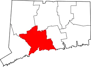
This is intended to be a complete list of the properties and districts on the National Register of Historic Places in New Haven County, Connecticut, United States. The locations of National Register properties and districts for which the latitude and longitude coordinates are included below, may be seen in an online map.[1]
There are 268 properties and districts listed on the National Register in the county, including 10 National Historic Landmarks. The city of New Haven is the location of 67 of these properties and districts, including 9 National Historic Landmarks; they are listed separately, while the 204 properties and districts in the remaining parts of the county, including 1 National Historic Landmark, are listed here. Three sites appear in both lists.
- This National Park Service list is complete through NPS recent listings posted February 5, 2021.[2]
Current listings
New Haven
Exclusive of New Haven
| [3] | Name on the Register[4] | Image | Date listed[5] | Location | City or town | Description |
|---|---|---|---|---|---|---|
| 1 | George S. Abbott Building | 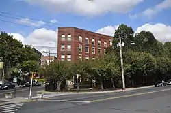 George S. Abbott Building |
June 14, 1982 (#82004359) |
235-247 N. Main St. 41°33′31″N 73°02′20″W |
Waterbury | |
| 2 | Academy of Our Lady of Mercy at Lauralton Hall |  Academy of Our Lady of Mercy at Lauralton Hall |
August 31, 2011 (#11000611) |
200 High St. 41°13′23″N 73°03′52″W |
Milford | |
| 3 | Acadian House | 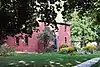 Acadian House |
September 5, 1975 (#75001928) |
Union St. 41°17′07″N 72°40′47″W |
Guilford | |
| 4 | Allis-Bushnell House | 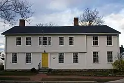 Allis-Bushnell House |
February 25, 1982 (#82004352) |
853 Boston Post Rd. 41°16′45″N 72°35′33″W |
Madison | |
| 5 | American Mills Web Shop | 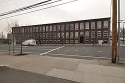 American Mills Web Shop |
March 10, 1983 (#83001276) |
114-152 US 1 41°17′44″N 72°57′20″W |
West Haven | |
| 6 | William Andrew House | 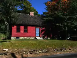 William Andrew House |
December 27, 2002 (#02001695) |
131 Old Tavern Rd. 41°15′55″N 73°00′44″W |
Orange | Historic 18th century house |
| 7 | Moses Andrews House | 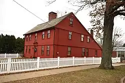 Moses Andrews House |
December 1, 1978 (#78002859) |
424 W. Main St. 41°32′23″N 72°49′03″W |
Meriden | |
| 8 | Ansonia Library |  Ansonia Library |
August 23, 1985 (#85001828) |
53 South Cliff St. 41°20′43″N 73°04′37″W |
Ansonia | |
| 9 | George Atwater House | 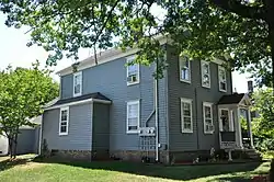 George Atwater House |
January 17, 1992 (#91001921) |
1845 State St. 41°19′57″N 72°54′01″W |
Hamden | |
| 10 | Atwater-Linton House |  Atwater-Linton House |
January 17, 1992 (#91001923) |
1804 State St. 41°19′53″N 72°54′01″W |
Hamden | |
| 11 | George Baldwin House |  George Baldwin House |
September 15, 1977 (#77001411) |
West of North Branford at 530 Foxon Rd. 41°19′54″N 72°48′17″W |
North Branford | |
| 12 | Timothy Baldwin House |  Timothy Baldwin House |
December 1, 1988 (#88002633) |
186 Damascus Rd. 41°17′12″N 72°46′56″W |
Branford | |
| 13 | Zaccheus Baldwin House |  Zaccheus Baldwin House |
December 1, 1988 (#88002631) |
154 Damascus Rd. 41°17′10″N 72°47′09″W |
Branford | |
| 14 | Bank Street Historic District | 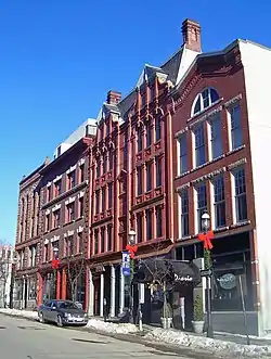 Bank Street Historic District |
July 28, 1983 (#83001277) |
207-231 Bank St. 41°33′11″N 73°02′30″W |
Waterbury | Isolated group of four late 19th-century brick buildings, including one of only two Queen Anne commercial buildings in Waterbury |
| 15 | John Barker House | 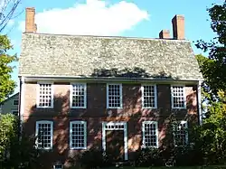 John Barker House |
August 3, 1974 (#74002051) |
898 Clintonville Rd. 41°24′46″N 72°49′29″W |
Wallingford | |
| 16 | Samuel Beach House |  Samuel Beach House |
December 1, 1988 (#88002634) |
94 E. Main St. 41°17′13″N 72°48′24″W |
Branford | |
| 17 | Benedict-Miller House |  Benedict-Miller House |
June 12, 1981 (#81000616) |
32 Hillside Ave. 41°33′42″N 73°02′30″W |
Waterbury | |
| 18 | Beth El Synagogue | 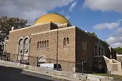 Beth El Synagogue |
May 11, 1995 (#95000560) |
359-375 Cooke St. 41°34′03″N 73°02′27″W |
Waterbury | |
| 19 | Birmingham Green Historic District | 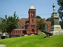 Birmingham Green Historic District |
April 21, 2000 (#00000325) |
Roughly bounded by 5th, Caroline, 4th, and Olivia Sts. 41°19′21″N 73°05′20″W |
Derby | |
| 20 | Bishop School |  Bishop School |
November 30, 1982 (#82001003) |
178 Bishop St. 41°33′50″N 73°02′12″W |
Waterbury | |
| 21 | Blackstone House | 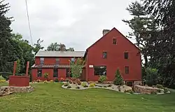 Blackstone House |
December 1, 1988 (#88002639) |
37 1st Ave. 41°15′58″N 72°47′11″W |
Branford | |
| 22 | Joseph Blakeslee House | _elevation_-_Blakeslee_House%252C_1211_Barnes_Road%252C_Wallingford%252C_New_Haven_County%252C_CT_HABS_CONN%252C5-WALF%252C7-3.tif.jpg.webp) Joseph Blakeslee House |
April 13, 1998 (#98000362) |
1211 Barnes Rd. 41°28′47″N 72°46′03″W |
Wallingford | Collapsed and demolished in 2008.[6] |
| 23 | Timothy Bradley House | 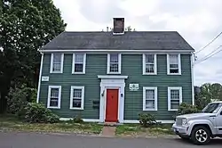 Timothy Bradley House |
December 1, 1988 (#88002630) |
12 Bradley St. 41°16′36″N 72°49′14″W |
Branford | |
| 24 | Branford Center Historic District |  Branford Center Historic District |
May 6, 1987 (#87000636) |
Roughly bounded by U.S. Route 1, the Branford River on the east and the south, and Monroe and Kirkham Sts. 41°16′42″N 72°48′45″W |
Branford | |
| 25 | Branford Electric Railway Historic District | Branford Electric Railway Historic District |
June 3, 1983 (#83001278) |
17 River St. to Court St. 41°15′59″N 72°51′21″W |
Branford and East Haven | Trolley line and historic trolley collection |
| 26 | Branford Point Historic District |  Branford Point Historic District |
September 15, 1988 (#88001583) |
Roughly along Harbor St. north from Curve St. to Branford Point and also Maple St. east from Reynolds St. to Harbor St. 41°15′57″N 72°49′18″W |
Branford | |
| 27 | Bridge No. 1132 | 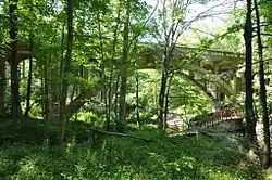 Bridge No. 1132 |
September 29, 2004 (#04001091) |
CT 80 at the Hammonasset River 41°21′26″N 72°36′45″W |
Madison | Open-spandrel concrete arch bridge built in 1934; extends into Killingworth in Middlesex County |
| 28 | Aaron Bronson House |  Aaron Bronson House |
July 29, 1993 (#93000656) |
846 Southford Rd. 41°28′17″N 73°10′58″W |
Southbury | |
| 29 | Josiah Bronson House |  Josiah Bronson House |
February 25, 1982 (#82004356) |
Breakneck Hill Rd. 41°32′51″N 73°07′29″W |
Middlebury | |
| 30 | Buckingham House |  Buckingham House |
July 25, 1977 (#77001406) |
61 North St. 41°13′42″N 73°03′25″W |
Milford | |
| 31 | Bullet Hill School |  Bullet Hill School |
February 23, 1972 (#72001346) |
Main St. and Seymour Rd. 41°28′56″N 73°12′50″W |
Southbury | |
| 32 | Thomas Burgis II House |  Thomas Burgis II House |
December 28, 2000 (#00001562) |
85 Boston St. 41°16′56″N 72°40′41″W |
Guilford | |
| 33 | Canoe Brook Historic District |  Canoe Brook Historic District |
April 11, 2002 (#02000335) |
Roughly along Bradley St., Cherry Hill Rd., Home Place, Lincoln Ave., and Main and N. Harbor Sts. 41°16′37″N 72°49′21″W |
Branford | |
| 34 | Dr. Andrew Castle House |  Dr. Andrew Castle House |
March 31, 2000 (#00000299) |
555 Amity Rd. 41°22′38″N 73°00′04″W |
Woodbridge | |
| 35 | Center Street Cemetery |  Center Street Cemetery |
August 1, 1997 (#97000833) |
2 Center St. 41°27′19″N 72°49′26″W |
Wallingford | |
| 36 | Charter Oak Firehouse | 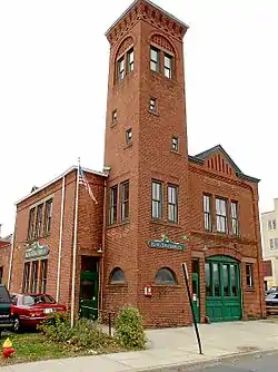 Charter Oak Firehouse |
March 17, 1994 (#94000255) |
105 Hanover St. 41°32′12″N 72°48′24″W |
Meriden | |
| 37 | Chatfield Farmstead |  Chatfield Farmstead |
March 15, 2010 (#10000061) |
265 Seymour Rd. 41°23′36″N 73°02′35″W |
Woodbridge | |
| 38 | Cheshire Historic District | 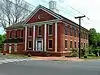 Cheshire Historic District |
August 29, 1986 (#86002793) |
Roughly bounded by Main St., Highland Ave., Wallingford Rd., S. Main, Cornwall, and Spring Sts. 41°29′50″N 72°54′15″W |
Cheshire | |
| 39 | Colony Street-West Main Street Historic District |  Colony Street-West Main Street Historic District |
September 4, 1987 (#87001387) |
1-62 Colony, 55 Grove, 1-119 and 82-110 W. Main Sts. 41°32′19″N 72°48′17″W |
Meriden | |
| 40 | Curtis Memorial Library | 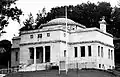 Curtis Memorial Library |
April 27, 1981 (#81000618) |
175 E. Main St. 41°32′08″N 72°47′53″W |
Meriden | |
| 41 | Reuben Curtiss House |  Reuben Curtiss House |
July 29, 1993 (#93000658) |
1770 Bucks Hill Rd. 41°28′33″N 73°10′11″W |
Southbury | |
| 42 | Thomas Darling House and Tavern |  Thomas Darling House and Tavern |
January 17, 1979 (#79002639) |
East of Woodbridge at 1907 Litchfield Turnpike 41°21′41″N 72°58′59″W |
Woodbridge | |
| 43 | James Alexis Darling House |  James Alexis Darling House |
September 4, 2020 (#100005527) |
1932 Litchfield Trnpk. (CT 69) 41°21′53″N 72°58′56″W |
Woodbridge | |
| 44 | Depot Street Bridge | Depot Street Bridge |
March 9, 2007 (#07000108) |
Depot St. 41°26′31″N 73°03′48″W |
Beacon Falls | |
| 45 | Jonathan Dickerman II House |  Jonathan Dickerman II House |
April 15, 1982 (#82004351) |
105 Mt. Carmel Ave. 41°25′11″N 72°54′02″W |
Hamden | |
| 46 | Downtown Seymour Historic District |  Downtown Seymour Historic District |
August 25, 1983 (#83001279) |
Roughly bounded by the Naugatuck River, Main, Wakeley, and DeForest Sts. 41°23′39″N 73°04′28″W |
Seymour | |
| 47 | Downtown Waterbury Historic District |  Downtown Waterbury Historic District |
August 3, 1983 (#83001280) |
Roughly bounded by Main, Meadow, and Elm Sts. 41°33′19″N 73°02′34″W |
Waterbury | Historic core of downtown Waterbury, with most buildings from era after early 20th-century fire. |
| 48 | Dudleytown Historic District |  Dudleytown Historic District |
August 9, 1991 (#91000951) |
Roughly Clapboard Hill Rd. from Tanner Marsh Rd. to Murray Ln., East River Rd. southeast to Trailwood Dr., and Duck Hole Rd. 41°17′58″N 72°39′29″W |
Guilford | |
| 49 | East Haven Green Historic District |  East Haven Green Historic District |
April 11, 2002 (#02000336) |
263, 270, 274 Hemingway Ave., 125, 129, 133, 139, 143, 150 Main St., 3, 7, 11, 15, 23, 27, 39, 47 Park Pl., and 58 and 100 River St. 41°16′28″N 72°52′03″W |
East Haven | |
| 50 | East Haven High School |  East Haven High School |
April 23, 2020 (#100005190) |
200 Tyler St. 41°16′31″N 72°52′34″W |
East Haven | The 1936 school building, not the current one. |
| 51 | East Rock Park |  East Rock Park |
April 15, 1997 (#97000299) |
Roughly bounded by State, Davis, and Livingston Sts., Park and Mitchell Drs., and Whitney Ave. 41°19′41″N 72°54′21″W |
Hamden | Park designed by Frederick Law Olmsted |
| 52 | Edgerton |  Edgerton |
September 19, 1988 (#88001469) |
840 Whitney Ave. 41°20′04″N 72°54′51″W |
Hamden | Estate site that is now a park; extends into New Haven |
| 53 | Eells-Stow House | 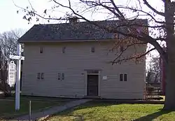 Eells-Stow House |
June 17, 1977 (#77001407) |
34 High St. 41°13′08″N 73°03′28″W |
Milford | |
| 54 | Jared Eliot House | 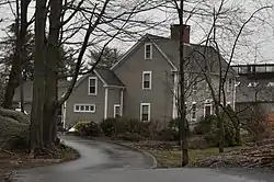 Jared Eliot House |
November 14, 1985 (#85002792) |
88 Old Chaffinch Island Rd. 41°16′17″N 72°41′17″W |
Guilford | |
| 55 | Elton Hotel |  Elton Hotel |
June 30, 1983 (#83001282) |
16-30 W. Main St. 41°33′24″N 73°02′30″W |
Waterbury | 1906 Second Renaissance Revival hotel built in wake of fire to replace lost Scovill Hotel |
| 56 | Falkner's Island Lighthouse | .jpg.webp) Falkner's Island Lighthouse |
May 29, 1990 (#89001467) |
Long Island Sound, 5 miles south of Guilford 41°12′42″N 72°39′15″W |
Guilford | |
| 57 | Farmington Canal-New Haven and Northampton Canal | 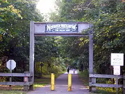 Farmington Canal-New Haven and Northampton Canal |
September 12, 1985 (#85002664) |
Roughly from Suffield in Hartford County to New Haven in New Haven County 41°19′26″N 72°55′51″W |
Hamden, Cheshire, and New Haven | Extends into New Haven as well as into Hartford County. Built as a canal, later became a railroad line, and now a multi-use trail. |
| 58 | Farmington Canal Lock | 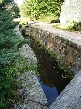 Farmington Canal Lock |
February 16, 1973 (#73001949) |
487 N. Brooksvale Rd. 41°28′34″N 72°55′23″W |
Cheshire | 1822 lock on the Farmington Canal |
| 59 | Farmington Canal Lock No. 13 |  Farmington Canal Lock No. 13 |
May 6, 1982 (#82004350) |
Brooksvale Ave. 41°27′32″N 72°55′06″W |
Hamden | |
| 60 | First Congregational Church of Cheshire | 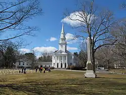 First Congregational Church of Cheshire |
February 16, 1973 (#73001950) |
111 Church Dr. 41°29′53″N 72°54′13″W |
Cheshire | |
| 61 | First Congregational Church of East Haven | 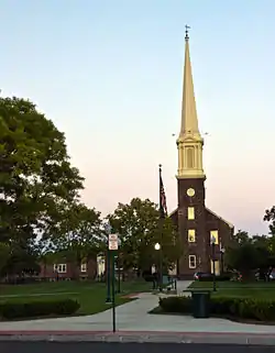 First Congregational Church of East Haven |
March 25, 1982 (#82004349) |
251 Main St. 41°16′41″N 72°52′19″W |
East Haven | |
| 62 | Fourth District School |  Fourth District School |
August 29, 1985 (#85001917) |
Old Post Rd. 41°23′41″N 72°47′28″W |
North Branford | |
| 63 | Edward Frisbie Homestead |  Edward Frisbie Homestead |
May 16, 1985 (#85001058) |
240 Stony Creek Rd. 41°16′31″N 72°45′27″W |
Branford | |
| 64 | Edward Frisbie House |  Edward Frisbie House |
December 1, 1988 (#88002638) |
699 E. Main St. 41°18′15″N 72°45′22″W |
Branford | |
| 65 | Lewis Fulton Memorial Park |  Lewis Fulton Memorial Park |
December 27, 1990 (#90001951) |
Roughly bounded by Cook, Pine, Fern and Charlotte Sts. 41°34′14″N 73°02′22″W |
Waterbury | |
| 66 | Solomon Goffe House |  Solomon Goffe House |
January 16, 1979 (#79002645) |
677 N. Colony St. 41°33′10″N 72°47′19″W |
Meriden | Historic saltbox house |
| 67 | Griswold House |  Griswold House |
October 10, 1975 (#75001929) |
Boston St. 41°17′00″N 72°40′29″W |
Guilford | |
| 68 | Guilford Historic Town Center | 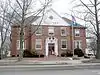 Guilford Historic Town Center |
July 6, 1976 (#76001988) |
Bounded by West River, Interstate 95, East Creek and Long Island Sound 41°16′49″N 72°40′37″W |
Guilford | |
| 69 | Hamden Bank & Trust Building | 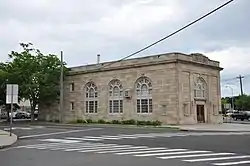 Hamden Bank & Trust Building |
March 1, 1990 (#90000148) |
1 Circular Ave. 41°20′47″N 72°56′04″W |
Hamden | |
| 70 | Hamden High School | 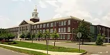 Hamden High School |
December 12, 1994 (#94001378) |
2040 Dixwell Ave. 41°22′03″N 72°55′19″W |
Hamden | |
| 71 | Hamden Memorial Town Hall | 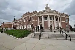 Hamden Memorial Town Hall |
April 12, 2001 (#01000355) |
2372 Whitney Ave. 41°23′02″N 72°54′09″W |
Hamden | |
| 72 | Hamilton Park | 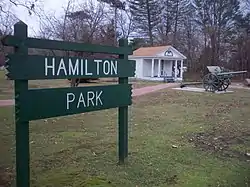 Hamilton Park |
August 15, 1996 (#96000846) |
Roughly bounded by Silver St., E. Main St., Idylwood Ave., Plank Rd., the Mad River, and Interstate 84 41°32′36″N 73°01′04″W |
Waterbury | |
| 73 | Hammonasset Paper Mill Site |  Hammonasset Paper Mill Site |
February 23, 1996 (#96000128) |
Green Hill Road at the Hammonasset River[7] 41°19′27″N 72°35′36″W |
Madison | Extends into Killingworth in Middlesex County |
| 74 | Thomas Harrison House |  Thomas Harrison House |
December 1, 1988 (#88002644) |
23 N. Harbor St. 41°16′34″N 72°49′23″W |
Branford | |
| 75 | Hebrew Congregation of Woodmont |  Hebrew Congregation of Woodmont |
July 21, 1995 (#95000860) |
15 and 17 Edgefield Ave. 41°13′33″N 73°00′05″W |
Milford | |
| 76 | Enoch Hibbard House and George Granniss House |  Enoch Hibbard House and George Granniss House |
April 9, 1979 (#79002640) |
33 and 41 Church St. 41°33′21″N 73°02′37″W |
Waterbury | |
| 77 | Hillside Historic District |  Hillside Historic District |
August 20, 1987 (#87001384) |
Roughly bounded by Woodlawn Terrace, W. Main, and Willow 41°33′37″N 73°02′28″W |
Waterbury | |
| 78 | Isaac Hoadley House |  Isaac Hoadley House |
December 1, 1988 (#88002647) |
9 Totoket Rd. 41°16′52″N 72°46′32″W |
Branford | |
| 79 | John Hoadley House |  John Hoadley House |
December 1, 1988 (#88002674) |
213 Leete's Island Rd. 41°17′14″N 72°45′33″W |
Branford | |
| 80 | Orrin Hoadley House |  Orrin Hoadley House |
December 1, 1988 (#88002646) |
15 Sunset Hill Rd. 41°17′00″N 72°46′53″W |
Branford | |
| 81 | Home Woolen Company | Home Woolen Company |
November 29, 1984 (#84000410) |
Main St. 41°26′34″N 73°03′45″W |
Beacon Falls | |
| 82 | David Hotchkiss House |  David Hotchkiss House |
May 1, 1981 (#81000617) |
Waterbury Rd. 41°30′44″N 72°59′05″W |
Prospect | |
| 83 | House at 161 Damascus Road |  House at 161 Damascus Road |
December 1, 1988 (#88002632) |
161 Damascus Rd. 41°17′07″N 72°46′53″W |
Branford | |
| 84 | House at 29 Flat Rock Road |  House at 29 Flat Rock Road |
December 1, 1988 (#88002640) |
29 Flat Rock Rd. 41°17′06″N 72°45′19″W |
Branford | |
| 85 | Eliphalet Howd House |  Eliphalet Howd House |
December 1, 1988 (#88002637) |
675 E. Main St. 41°18′10″N 72°45′28″W |
Branford | |
| 86 | Howd-Linsley House |  Howd-Linsley House |
December 10, 1986 (#86003382) |
1795 Middletown Ave. 41°24′34″N 72°46′06″W |
North Branford | |
| 87 | John I. Howe House | 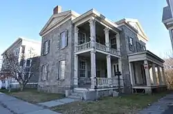 John I. Howe House |
February 6, 1989 (#88003229) |
213 Caroline St. 41°19′24″N 73°05′16″W |
Derby | Home of pin manufacturing pioneer |
| 88 | Hubbard Park | 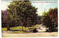 Hubbard Park |
December 15, 1997 (#97001466) |
Roughly bounded by W. Main St., Interstate 691, CT 66, Reservoir Ave., Edgewood Dr., and Berlin and Southington town lines 41°33′45″N 72°50′05″W |
Meriden and, in Hartford County, Berlin and Southington | A park |
| 89 | Gen. David Humphreys House | 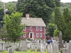 Gen. David Humphreys House |
March 17, 1972 (#72001321) |
37 Elm St. 41°19′52″N 73°04′30″W |
Ansonia | |
| 90 | William Hurd House | 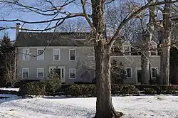 William Hurd House |
July 29, 1993 (#93000659) |
327 Hulls Hill Rd. 41°27′25″N 73°10′29″W |
Southbury | |
| 91 | Hurley Road Historic District |  Hurley Road Historic District |
July 29, 1993 (#93000662) |
6 and 17 Hurley Rd. 41°28′33″N 73°09′31″W |
Southbury | |
| 92 | Hyland-Wildman House |  Hyland-Wildman House |
March 26, 1976 (#76001989) |
Boston St. 41°16′57″N 72°40′43″W |
Guilford | |
| 93 | Ives-Baldwin House |  Ives-Baldwin House |
May 1, 2003 (#03000308) |
474 Baldwin Ave. 41°32′39″N 72°45′42″W |
Meriden | |
| 94 | Elam Ives House |  Elam Ives House |
October 12, 2010 (#10000832) |
95 Ives St. 41°24′13″N 72°53′43″W |
Hamden | |
| 95 | Alphonso Johnson House |  Alphonso Johnson House |
January 17, 1992 (#91001922) |
1 Gilbert Ave. 41°21′26″N 72°56′15″W |
Hamden | |
| 96 | Franklin Johnson House |  Franklin Johnson House |
November 23, 1998 (#98001420) |
153 S. Main St. 41°27′06″N 72°49′15″W |
Wallingford | |
| 97 | Theophilus Jones House |  Theophilus Jones House |
January 30, 1992 (#91001981) |
40 Jones Rd. 41°26′51″N 72°51′10″W |
Wallingford | |
| 98 | John Kendrick House |  John Kendrick House |
April 12, 1982 (#82004360) |
119 W. Main St. 41°33′22″N 73°02′36″W |
Waterbury | 1865 brick Italianate house is one of the few remaining residential structures on Waterbury Green |
| 99 | Kraus Corset Factory |  Kraus Corset Factory |
February 12, 1987 (#87000128) |
Roosevelt Dr. and 3rd St. 41°19′13″N 73°05′29″W |
Derby | |
| 100 | Laurel Beach Casino |  Laurel Beach Casino |
November 1, 2018 (#100003074) |
102 6th Ave. 41°11′04″N 73°05′43″W |
Milford | |
| 101 | Pelatiah Leete House |  Pelatiah Leete House |
October 1, 1974 (#74002048) |
Southwest of Guilford off CT 146 41°15′58″N 72°42′53″W |
Guilford | |
| 102 | Isaac C. Lewis Cottage |  Isaac C. Lewis Cottage |
July 25, 1997 (#97000811) |
255 Thimble Islands Rd. 41°15′46″N 72°45′00″W |
Branford | |
| 103 | Little Pootatuck Brook Archeological Site |  Little Pootatuck Brook Archeological Site |
June 28, 1990 (#90000980) |
Address Restricted |
Southbury | |
| 104 | Madison Green Historic District | 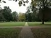 Madison Green Historic District |
June 28, 1982 (#82004353) |
446-589 Boston Post Rd. and structures surrounding the green 41°16′41″N 72°36′19″W |
Madison | |
| 105 | Maltby-Stevens Factory Site |  Maltby-Stevens Factory Site |
January 27, 2000 (#99001668) |
Address Restricted |
North Branford | |
| 106 | Marion Historic District |  Marion Historic District |
December 21, 1988 (#88001423) |
Along Marion Ave. and Meriden-Waterbury Turnpike 41°33′50″N 72°55′29″W |
Cheshire | Extends into Southington; see the Hartford County list. |
| 107 | Richard Mansfield House |  Richard Mansfield House |
March 11, 1971 (#71000906) |
35 Jewett St. 41°20′23″N 73°04′14″W |
Ansonia | |
| 108 | Matthews and Willard Factory | 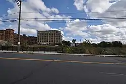 Matthews and Willard Factory |
January 14, 1988 (#87002419) |
16 Cherry Ave. 41°33′24″N 73°02′10″W |
Waterbury | Demolished. |
| 109 | Medad Stone Tavern | 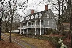 Medad Stone Tavern |
January 30, 2009 (#08001378) |
197 Three Mile Course 41°17′03″N 72°41′46″W |
Guilford | |
| 110 | Meeting House Hill Historic District |  Meeting House Hill Historic District |
December 14, 1987 (#87002132) |
Roughly bounded by Long Hill, Great Hill, and Ledge Hill Rds. 41°22′00″N 72°43′42″W |
Guilford | |
| 111 | Meigs-Bishop House | 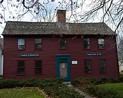 Meigs-Bishop House |
June 16, 1988 (#88000745) |
45 Wall St. 41°16′52″N 72°35′40″W |
Madison | |
| 112 | Meriden Curtain Fixture Company Factory | 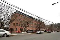 Meriden Curtain Fixture Company Factory |
December 4, 1986 (#86003290) |
122 Charles St. 41°31′52″N 72°47′30″W |
Meriden | |
| 113 | Middlebury Center Historic District |  Middlebury Center Historic District |
May 9, 1985 (#85001019) |
Roughly bounded by Library Rd., North and South Sts., and Whittemore Rd. 41°31′35″N 73°07′33″W |
Middlebury | |
| 114 | Milford Point Hotel | 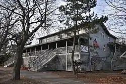 Milford Point Hotel |
January 22, 1988 (#87002417) |
Milford Point Rd. 41°10′33″N 73°06′07″W |
Milford | Now the Connecticut Audubon Society Coastal Center. |
| 115 | Henry F. Miller House | 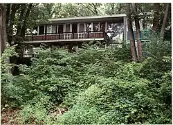 Henry F. Miller House |
April 25, 2001 (#01000399) |
30 Derby Ave. 41°18′02″N 72°59′15″W |
Orange | International style house |
| 116 | Mount Carmel Congregational Church and Parish House |  Mount Carmel Congregational Church and Parish House |
December 27, 1991 (#91001847) |
3280 and 3284 Whitney Ave., 195 Sherman Ave. 41°24′50″N 72°54′09″W |
Hamden | |
| 117 | Jonathan Murray House | 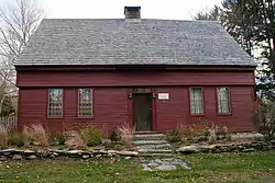 Jonathan Murray House |
April 12, 1982 (#82004354) |
76 Scotland Rd. 41°17′11″N 72°34′49″W |
Madison | |
| 118 | Naugatuck Center Historic District | 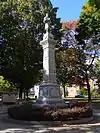 Naugatuck Center Historic District |
July 30, 1999 (#99000859) |
Roughly bounded by Fairview Ave., Hillside Ave., Terrace Ave., Water St., and Pleasant View St. 41°29′29″N 73°03′27″W |
Naugatuck | |
| 119 | Nehemiah Royce House | 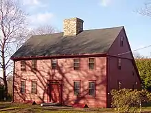 Nehemiah Royce House |
August 24, 1998 (#98000966) |
538 N. Main St. 41°27′59″N 72°48′48″W |
Wallingford | |
| 120 | New England Cement Company Kiln and Quarry | 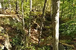 New England Cement Company Kiln and Quarry |
April 25, 2001 (#00001454) |
Address Restricted 41°22′36″N 72°58′40″W |
Woodbridge | |
| 121 | Norcross Brothers Granite Quarry | 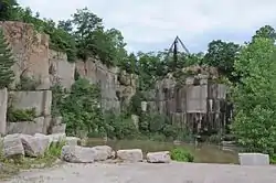 Norcross Brothers Granite Quarry |
June 6, 2003 (#03000315) |
Quarry Rd. 41°17′01″N 72°44′32″W |
Branford | |
| 122 | North Branford Center Historic District | 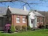 North Branford Center Historic District |
December 9, 1999 (#99001472) |
Roughly along Church and North Sts. 41°19′46″N 72°45′52″W |
North Branford | |
| 123 | Northford Center Historic District |  Northford Center Historic District |
December 31, 2002 (#02001629) |
Roughly along Middletown Ave. and parts of Old Post Rd. 41°24′00″N 72°46′59″W |
North Branford | |
| 124 | Norton House |  Norton House |
December 1, 1988 (#88002645) |
200 Pine Orchard Rd. 41°16′16″N 72°46′57″W |
Branford | |
| 125 | Old West Haven High School |  Old West Haven High School |
October 24, 1985 (#85003368) |
278 Main St. 41°16′23″N 72°56′49″W |
West Haven | Also formerly the Giannotti Junior High School. |
| 126 | Orange Center Historic District |  Orange Center Historic District |
August 10, 1989 (#89001089) |
Roughly Orange Center Rd. from Orange Cemetery to Nan Dr. 41°16′36″N 73°01′40″W |
Orange | Includes the federal style 1810 Orange Congregational Church by David Hoadley and the 1878 stick style Academy schoolhouse |
| 127 | Osbornedale |  Osbornedale |
June 13, 1986 (#86001256) |
500 Hawthorne Ave. 41°19′51″N 73°06′27″W |
Derby | Historic nineteenth-century farmhouse |
| 128 | Overlook Historic District |  Overlook Historic District |
June 7, 1988 (#88000662) |
Roughly bounded by Hecla St., Farmington and Columbia Boulevard, Cables Ave. and Clowes Terrace, and Lincoln and Fiske Sts. 41°34′13″N 73°02′54″W |
Waterbury | |
| 129 | Palace Theater | 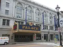 Palace Theater |
June 30, 1983 (#83001284) |
86-110 E. Main St. 41°33′19″N 73°02′23″W |
Waterbury | |
| 130 | Hezekiah Palmer House |  Hezekiah Palmer House |
December 1, 1988 (#88002641) |
340-408 Leete's Island Rd. 41°16′30″N 72°45′25″W |
Branford | |
| 131 | Isaac Palmer House |  Isaac Palmer House |
December 1, 1988 (#88002643) |
736-756 Main St. 41°16′47″N 72°48′57″W |
Branford | |
| 132 | Samuel Parsons House |  Samuel Parsons House |
April 12, 1982 (#82004358) |
180 S. Main St. 41°27′04″N 72°49′14″W |
Wallingford | |
| 133 | Pine Orchard Union Chapel |  Pine Orchard Union Chapel |
July 19, 2000 (#00000815) |
25 Chapel Dr. 41°16′00″N 72°46′34″W |
Branford | |
| 134 | Pines Bridge Historic District |  Pines Bridge Historic District |
May 27, 1988 (#88000577) |
3-17 Bishop St., 70-99 Old Broadway, 2-10 Philip Pl., and 9-56 State St. 41°23′15″N 72°52′23″W |
North Haven | |
| 135 | Pistol Factory Dwelling |  Pistol Factory Dwelling |
December 27, 1991 (#91001846) |
1322 Whitney Ave. 41°20′57″N 72°54′51″W |
Hamden | |
| 136 | Elisha Pitkin House |  Elisha Pitkin House |
April 6, 1979 (#79002646) |
173 High Woods Dr. 41°18′56″N 72°42′07″W |
Guilford | |
| 137 | Plaster House |  Plaster House |
July 29, 1993 (#93000660) |
117 Plaster House Rd. 41°27′00″N 73°10′01″W |
Southbury | |
| 138 | Col. Asa Platt House |  Col. Asa Platt House |
December 31, 2002 (#02001630) |
2 Tyler City Rd. 41°17′12″N 73°00′41″W |
Orange | Federal-style house from 1810 |
| 139 | Prospect Green Historic District |  Prospect Green Historic District |
June 16, 2000 (#00000560) |
2, 8, 10, 12, 17, 19, 21, 23, 25, 27, and 30 Center St. 41°30′04″N 72°58′42″W |
Prospect | |
| 140 | Quaker Farms Historic District |  Quaker Farms Historic District |
August 9, 1991 (#91000993) |
467-511 Quaker Farms Rd. 41°25′34″N 73°09′24″W |
Oxford | |
| 141 | Red Bridge | 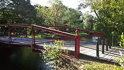 Red Bridge |
December 10, 1993 (#93001345) |
Near Oregon Rd. over the Quinnipiac River 41°31′20″N 72°50′20″W |
Meriden | |
| 142 | Nathaniel Richardson House |  Nathaniel Richardson House |
September 19, 1977 (#77001405) |
Northeast of Middlebury on Kelly Rd. 41°32′40″N 73°05′37″W |
Middlebury | Probably demolished. |
| 143 | Rising Sun Tavern |  Rising Sun Tavern |
August 21, 1979 (#79002638) |
Old Tavern Lane 41°22′20″N 72°49′27″W |
North Haven | |
| 144 | River Park Historic District |  River Park Historic District |
August 14, 1986 (#86002648) |
Roughly bounded by Boston Post Rd., Cherry St. and Amtrak line, and High St. 41°13′38″N 73°03′30″W |
Milford | |
| 145 | Riverside Cemetery |  Riverside Cemetery |
September 20, 1988 (#88001525) |
Riverside St. from Sunnyside to Summit Sts. 41°32′52″N 73°02′57″W |
Waterbury | |
| 146 | John Rogers House |  John Rogers House |
December 1, 1988 (#88002642) |
690 Leete's Island Rd. 41°16′12″N 72°44′14″W |
Branford | |
| 147 | Route 146 Historic District |  Route 146 Historic District |
April 5, 1990 (#90000569) |
Route 146 between Flat Rock Rd. and West River bridge 41°16′07″N 72°42′50″W |
Branford and Guilford | |
| 148 | Russian Village Historic District |  Russian Village Historic District |
December 8, 1988 (#88002687) |
Roughly Kiev Dr. and Russian Village Rd. between U.S. Route 6 and the Pomperaug River 41°26′56″N 73°15′10″W |
Southbury | |
| 149 | Sabbathday House |  Sabbathday House |
October 10, 1975 (#75001931) |
19 Union St. 41°17′07″N 72°40′50″W |
Guilford | |
| 150 | Salem School |  Salem School |
November 3, 1983 (#83003582) |
124 Meadow St. 41°29′26″N 73°03′27″W |
Naugatuck | |
| 151 | Sanford Road Historic District |  Sanford Road Historic District |
July 29, 1993 (#93000657) |
480 and 487 Sanford Rd. 41°27′41″N 73°11′05″W |
Southbury | |
| 152 | Sanford-Humphreys House |  Sanford-Humphreys House |
May 11, 1982 (#82004357) |
61-63 West St. 41°23′39″N 73°04′47″W |
Seymour | |
| 153 | Seymour High School and Annex |  Seymour High School and Annex |
November 17, 1983 (#83003583) |
100 Bank St. 41°23′51″N 73°04′36″W |
Seymour | Former high school, later an elementary school, now offices including medical offices |
| 154 | Sheffield Street Bridge |  Sheffield Street Bridge |
April 12, 2001 (#01000353) |
Sheffield St. over Hancock Brook 41°35′50″N 73°02′52″W |
Waterbury | |
| 155 | Shelley House |  Shelley House |
February 9, 1989 (#89000017) |
248 Boston Post Rd. 41°16′42″N 72°37′45″W |
Madison | |
| 156 | Short Beach Historic District |  Short Beach Historic District |
October 22, 2017 (#100004544) |
Roughly bounded by Shore Dr., Beckett & Clarke Aves., Bungalow & Little Bay Lns, Court, Pentecost & Bristol Sts. 41°15′27″N 72°50′56″W |
Branford | |
| 157 | Samuel Simpson House |  Samuel Simpson House |
June 18, 1986 (#86001334) |
1370 Scard Rd. 41°26′24″N 72°45′29″W |
Wallingford | Moved from N. Main St. |
| 158 | Sleeping Giant Tower | 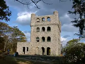 Sleeping Giant Tower |
September 4, 1986 (#86001754) |
200 Mt. Carmel Ave. at Mt. Carmel summit, Sleeping Giant State Park 41°25′50″N 72°53′27″W |
Hamden | |
| 159 | South Britain Historic District |  South Britain Historic District |
February 12, 1987 (#87000125) |
E. Flat Hill, Hawkins, Library, and Middle Rds., and 497-864 S. Britain Rd. 41°28′09″N 73°15′03″W |
Southbury | |
| 160 | Southbury Historic District No. 1 |  Southbury Historic District No. 1 |
March 11, 1971 (#71000917) |
Main St. from Woodbury town line to Old Waterbury Rd. 41°29′42″N 73°12′37″W |
Southbury | |
| 161 | Southbury Training School |  Southbury Training School |
May 1, 1992 (#92000368) |
1484 S. Britain Rd. 41°27′49″N 73°16′23″W |
Southbury | Extends into Roxbury; see the Litchfield County list. |
| 162 | Southwest District School |  Southwest District School |
April 2, 1982 (#82004363) |
155 Nichols Rd. 41°34′49″N 72°59′10″W |
Wolcott | |
| 163 | St. Peter's Episcopal Church |  St. Peter's Episcopal Church |
August 21, 1979 (#79002644) |
61, 71, 81 River St. 41°13′27″N 73°03′27″W |
Milford | |
| 164 | Stapleton Building |  Stapleton Building |
January 14, 1988 (#87002421) |
751 N. Main St. 41°33′49″N 73°01′58″W |
Waterbury | Demolished. |
| 165 | State Park Supply Yard |  State Park Supply Yard |
September 4, 1986 (#86001757) |
51 Mill Rd. 41°16′37″N 72°33′39″W |
Madison | |
| 166 | Sterling Opera House |  Sterling Opera House |
November 8, 1968 (#68000040) |
Northwestern corner of 4th and Elizabeth Sts. 41°19′18″N 73°05′24″W |
Derby | Amelia Earhart, John L. Sullivan, Harry Houdini, George Burns, Lionel Barrymore, Ethel Barrymore, Red Skelton, and John Philip Sousa appeared on this stage. |
| 167 | Stevenson Dam Hydroelectric Plant |  Stevenson Dam Hydroelectric Plant |
September 29, 2000 (#00001073) |
CT 34 over the Housatonic River 41°23′03″N 73°10′16″W |
Oxford | Dam, bridge, and powerhouse built in 1917 on the Housatonic River; extends into Monroe in Fairfield County |
| 168 | Stick Style House at Stony Creek |  Stick Style House at Stony Creek |
December 27, 1972 (#72001322) |
34 Prospect Hill 41°15′56″N 72°44′44″W |
Branford | |
| 169 | Stony Creek-Thimble Islands Historic District |  Stony Creek-Thimble Islands Historic District |
December 16, 1988 (#88002844) |
Roughly Thimble Islands Rd. between Route 146 and Long Island Sound and the Thimble Islands 41°15′33″N 72°45′18″W |
Branford | |
| 170 | Swain-Harrison House |  Swain-Harrison House |
October 10, 1975 (#75001924) |
124 W. Main St. 41°16′41″N 72°49′34″W |
Branford | |
| 171 | Taylor Memorial Library |  Taylor Memorial Library |
August 21, 1979 (#79002642) |
5 Broad St. 41°13′20″N 73°03′27″W |
Milford | |
| 172 | Orrin Todd House |  Orrin Todd House |
December 26, 1991 (#91001845) |
3369 Whitney Ave. 41°25′02″N 72°54′11″W |
Hamden | |
| 173 | Tranquility Farm |  Tranquility Farm |
September 23, 1982 (#82004355) |
West of Middlebury on CT 64 41°31′54″N 73°08′16″W |
Middlebury | |
| 174 | Bronson B. Tuttle House |  Bronson B. Tuttle House |
November 29, 1990 (#90001803) |
380 Church St. 41°29′43″N 73°03′19″W |
Naugatuck | |
| 175 | John Tyler House |  John Tyler House |
December 1, 1988 (#88002635) |
242-250 E. Main St. 41°17′29″N 72°47′46″W |
Branford | |
| 176 | Solomon Tyler House |  Solomon Tyler House |
December 1, 1988 (#88002636) |
260-268 E. Main St. 41°17′31″N 72°47′41″W |
Branford | |
| 177 | Union School |  Union School |
November 13, 1987 (#87001899) |
174 Center St. 41°16′29″N 72°56′49″W |
West Haven | |
| 178 | Upper Main Street Historic District |  Upper Main Street Historic District |
December 2, 1982 (#82001004) |
36-100 and 85-117 Main St. 41°20′41″N 73°04′47″W |
Ansonia | |
| 179 | US Post Office-Ansonia Main |  US Post Office-Ansonia Main |
December 12, 1985 (#85003327) |
237 Main St. 41°20′35″N 73°04′43″W |
Ansonia | |
| 180 | US Post Office-Meriden Main |  US Post Office-Meriden Main |
January 21, 1986 (#86000129) |
39 N. Colony St. 41°32′41″N 72°48′04″W |
Meriden | |
| 181 | US Post Office-Milford Main |  US Post Office-Milford Main |
September 25, 1986 (#86002959) |
6 W. River St. 41°13′27″N 73°03′30″W |
Milford | |
| 182 | US Post Office-Naugatuck Main |  US Post Office-Naugatuck Main |
January 21, 1986 (#86000130) |
Church and Cedar Sts. 41°29′32″N 73°03′23″W |
Naugatuck | |
| 183 | Wallingford Center Historic District | 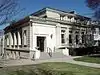 Wallingford Center Historic District |
December 2, 1993 (#93001242) |
Roughly Main St. from Ward St. to Church St. 41°27′11″N 72°49′14″W |
Wallingford | |
| 184 | Wallingford Railroad Station | 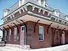 Wallingford Railroad Station |
November 19, 1993 (#93001245) |
51 Quinnipiac St. (37 Hall Ave.) 41°27′24″N 72°49′32″W |
Wallingford | |
| 185 | Ward-Heitman House | 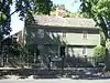 Ward-Heitman House |
January 8, 2003 (#02001691) |
277 Elm St. 41°16′34″N 72°57′08″W |
West Haven | |
| 186 | Washington Avenue Bridge |  Washington Avenue Bridge |
April 12, 2001 (#01000354) |
Washington Ave. over the Mad River 41°32′38″N 73°02′18″W |
Waterbury | |
| 187 | Washington Bridge | Washington Bridge |
September 29, 2004 (#04001093) |
U.S. Route 1 at the Housatonic River 41°12′01″N 73°06′39″W |
Milford | A moveable bridge; extends into Stratford in Fairfield County |
| 188 | Waterbury Brass Mill |  Waterbury Brass Mill |
September 5, 1975 (#75001943) |
Idlewood Ave. in Hamilton Park 41°32′26″N 73°01′04″W |
Waterbury | Site of a large brass mill; now athletic fields. |
| 189 | Waterbury Clock Company |  Waterbury Clock Company |
November 30, 1982 (#82001005) |
N. Elm and Cherry Sts. and Cherry Ave. 41°33′30″N 73°02′06″W |
Waterbury | |
| 190 | Waterbury Municipal Center Complex | 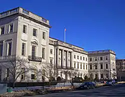 Waterbury Municipal Center Complex |
October 10, 1978 (#78002882) |
195, 235, and 236 Grand St. and 7, 35, and 43 Field St. 41°33′13″N 73°02′36″W |
Waterbury | Cass Gilbert-designed complex from 1910s meant to create one unified complex of city government, corporate headquarters and charitable office in accord with City Beautiful movement principles. |
| 191 | Waterbury Union Station |  Waterbury Union Station |
March 8, 1978 (#78002881) |
389 Meadow St. 41°33′18″N 73°02′51″W |
Waterbury | 1908 station meant to be grand entrance to city being rebuilt after fire; clock tower has become symbol of the city |
| 192 | Webster School |  Webster School |
June 14, 1982 (#82004365) |
Easton Ave. at Aetna St. 41°34′00″N 73°01′53″W |
Waterbury | |
| 193 | West Haven Green Historic District | 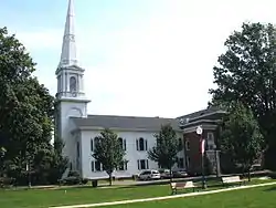 West Haven Green Historic District |
August 11, 2000 (#00000832) |
Roughly along Main St., Campbell St., Church St., and Savin St. 41°16′15″N 72°57′01″W |
West Haven | |
| 194 | Adin Wheeler House and Theodore F. Wheeler Wheelwright Shop |  Adin Wheeler House and Theodore F. Wheeler Wheelwright Shop |
July 29, 1993 (#93000661) |
125 Quaker Farms Rd. 41°27′37″N 73°09′49″W |
Southbury | |
| 195 | Wheeler-Beecher House |  Wheeler-Beecher House |
July 15, 1977 (#77001400) |
562 Amity Rd. 41°25′42″N 72°59′44″W |
Bethany | |
| 196 | Henry Whitfield House | 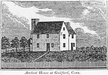 Henry Whitfield House |
September 25, 1997 (#72001327) |
248 Old Whitfield St. 41°16′40″N 72°40′31″W |
Guilford | The oldest house in Connecticut, built in 1639 |
| 197 | Eli Whitney Gun Factory |  Eli Whitney Gun Factory |
August 13, 1974 (#74002049) |
915-940 Whitney Ave. 41°20′09″N 72°54′38″W |
Hamden | |
| 198 | Whitneyville Congregational Church |  Whitneyville Congregational Church |
July 28, 1995 (#95000906) |
1247-1253 Whitney Ave. 41°20′48″N 72°54′47″W |
Hamden | |
| 199 | Wilby High School |  Wilby High School |
June 14, 1982 (#82004366) |
260 Grove St. 41°33′36″N 73°02′45″W |
Waterbury | |
| 200 | Warham Williams House | Warham Williams House |
March 11, 1971 (#71000915) |
Old Post Rd. and CT 17 and 22 41°23′33″N 72°47′31″W |
North Branford | Moved to Roxbury, Connecticut in 1978.[8] |
| 201 | Wolcott Green Historic District |  Wolcott Green Historic District |
March 31, 2000 (#00000297) |
Roughly bounding Wolcott Green 41°36′05″N 72°58′33″W |
Wolcott | |
| 202 | Harcourt Wood Memorial Library | 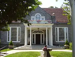 Harcourt Wood Memorial Library |
January 4, 1982 (#82004348) |
313 Elizabeth St. 41°19′36″N 73°05′20″W |
Derby | |
| 203 | Woodbridge Green Historic District | 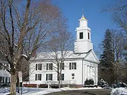 Woodbridge Green Historic District |
April 18, 2003 (#03000233) |
3, 4, 7, 11 Meetinghouse Ln. and 4 and 10 Newton Rd. 41°21′14″N 73°00′46″W |
Woodbridge | |
| 204 | Wooster Sawmill and Gristmill Site |  Wooster Sawmill and Gristmill Site |
August 17, 2001 (#01000879) |
Address Restricted |
Oxford |
See also
| Wikimedia Commons has media related to National Register of Historic Places in New Haven County, Connecticut. |
References
- The latitude and longitude information provided in this table was derived originally from the National Register Information System, which has been found to be fairly accurate for about 99% of listings. Some locations in this table may have been corrected to current GPS standards.
- "National Register of Historic Places: Weekly List Actions". National Park Service, United States Department of the Interior. Retrieved on February 5, 2021.
- Numbers represent an alphabetical ordering by significant words. Various colorings, defined here, differentiate National Historic Landmarks and historic districts from other NRHP buildings, structures, sites or objects.
- "National Register Information System". National Register of Historic Places. National Park Service. March 13, 2009.
- The eight-digit number below each date is the number assigned to each location in the National Register Information System database, which can be viewed by clicking the number.
- "Historic Properties Commission Minutes, January 2009" (PDF). Town of Wallingford. Retrieved 2017-01-18.
- "Madison Historic Sites". Madison Historical Society. Archived from the original on 2015-03-20. Retrieved 2014-11-21.
- "History of North Branford". North Branford Public Library. Retrieved 2018-12-01.
| Lists by county |  | |
|---|---|---|
| Lists by city or town | ||
| Other lists | ||