Bethlehem, Connecticut
Bethlehem is a town in Litchfield County, Connecticut, United States. The population was 3,607 at the 2010 census,[2] up from 3,422 at the 2000 census. The town center is a historic district and a census-designated place (CDP).
Bethlehem, Connecticut | |
|---|---|
 Seal | |
 Location in Litchfield County, Connecticut | |
| Coordinates: 41°38′21″N 73°12′31″W | |
| Country | United States |
| State | Connecticut |
| NECTA | Waterbury, CT |
| Region | Central Naugatuck Valley |
| Incorporated | 1787 |
| Government | |
| • Type | Selectman-town meeting |
| • First selectman | Leonard Assard (D) |
| • Selectman | David W. Deaken, Jr. (D) |
| • Selectman | David C. Butkus, Jr. (R) |
| Area | |
| • Total | 19.7 sq mi (50.9 km2) |
| • Land | 19.4 sq mi (50.2 km2) |
| • Water | 0.3 sq mi (0.7 km2) |
| Elevation | 860 ft (262 m) |
| Population (2010)[1] | |
| • Total | 3,607 |
| • Density | 190/sq mi (72/km2) |
| Time zone | UTC-5 (Eastern) |
| • Summer (DST) | UTC-4 (Eastern) |
| ZIP code | 06751 |
| Area code(s) | 203/475 |
| FIPS code | 09-04930 |
| GNIS feature ID | 0213391 |
| Website | www |
The town's name has prompted thousands of visitors each December to mail their Christmas cards at the local post office in order to get a "Bethlehem" postmark. The post office also has nearly 100 Christmas-related stamps for customers to decorate their envelopes during the holiday season.[3]
Bethlehem is one of the two towns in Litchfield County served by the area code 203/area code 475 overlay. The other is the town of Woodbury.
Education
- Since 1970, elementary education has been handled by Regional School District 14, including Bethlehem Elementary School.[4]
- Nonnewaug High School in neighboring Woodbury is the primary regional high school.
- The Woodhall School is a private high school located in town.
Geography
Bethlehem is in southern Litchfield County and is bordered by Morris to the north, Watertown to the east, Woodbury to the south, and Washington to the west. According to the United States Census Bureau, Bethlehem has a total area of 19.7 square miles (51 km2), of which 19.4 square miles (50 km2) are land and 0.3 square miles (0.8 km2), or 1.45%, are water.[2] The Bethlehem Village census-designated place (CDP) corresponding to the center portion of the town has a total area of 8.1 square miles (20.9 km2), of which 7.8 square miles (20.2 km2) are land and 0.3 square miles (0.7 km2), or 3.30%, are water.[5] The two largest water bodies in the town are Long Meadow Pond and the Bronson E. Lockwood Reservoir, both in the northern part of town.
Connecticut Route 61 passes through the town center, leading north to Morris and Litchfield, and south to US 6 in Woodbury. Connecticut Route 132 takes a winding route through the town, leading south to Woodbury and east into Watertown.
On the eastern side of town is a ridge called "the Devil's Backbone", one of more than 30 Connecticut places named after the devil.[3]
Principal community
Demographics
| Historical population | |||
|---|---|---|---|
| Census | Pop. | %± | |
| 1820 | 932 | — | |
| 1860 | 815 | — | |
| 1870 | 750 | −8.0% | |
| 1880 | 655 | −12.7% | |
| 1890 | 543 | −17.1% | |
| 1900 | 576 | 6.1% | |
| 1910 | 550 | −4.5% | |
| 1920 | 536 | −2.5% | |
| 1930 | 644 | 20.1% | |
| 1940 | 715 | 11.0% | |
| 1950 | 1,015 | 42.0% | |
| 1960 | 1,486 | 46.4% | |
| 1970 | 1,923 | 29.4% | |
| 1980 | 2,573 | 33.8% | |
| 1990 | 3,071 | 19.4% | |
| 2000 | 3,422 | 11.4% | |
| 2010 | 3,607 | 5.4% | |
| 2014 (est.) | 3,501 | [6] | −2.9% |
| U.S. Decennial Census[7] | |||
At the 2010 census Bethlehem had a population of 3,607. The racial composition of the population was 97.9% white, 0.4% black or African American, 0.1% Native American, 0.5% Asian, 0.2% from some other race and 0.9% from two or more races. 1.7% of the population were Hispanic or Latino of any race.[8]
At the 2000 census,[9] there were 3,422 people, 1,246 households and 935 families residing in the town. The population density was 176.8 per square mile (68.2/km2). There were 1,388 housing units at an average density of 71.7 per square mile (27.7/km2). The racial makeup of the town was 97.49% White, 0.26% African American, 0.06% Native American, 0.79% Asian, 0.03% Pacific Islander, 0.38% from other races and 0.99% from two or more races. Hispanic or Latino of any race were 0.64% of the population.
There were 1,246 households, of which 35.2% had children under the age of 18 living with them, 65.7% were married couples living together, 6.6% had a female householder with no husband present, and 24.9% were non-families. 19.6% of all households were made up of individuals, and 7.8% had someone living alone who was 65 years of age or older. The average household size was 2.69 and the average family size was 3.11.
25.2% of the population were under the age of 18, 4.5% from 18 to 24, 26.6% from 25 to 44, 30.8% from 45 to 64, and 12.9% who were 65 years of age or older. The median age was 42 years. For every 100 females, there were 94.3 males. For every 100 females age 18 and over, there were 93.4 males.
The median household income was $68,542 and the median family income was $78,863. Males had a median income of $51,623 compared with $37,500 for females. The per capita income was $29,672. About 0.5% of families and 2.6% of the population were below the poverty line, including none of those under age 18 and 11.2% of those age 65 or over.
| Voter registration and party enrollment as of October 29, 2019[10] | |||||
|---|---|---|---|---|---|
| Party | Active voters | Inactive voters | Total voters | Percentage | |
| Republican | 942 | 7 | 949 | 33.32% | |
| Democratic | 687 | 10 | 697 | 24.47% | |
| Unaffiliated | 1,143 | 6 | 1,149 | 40.34% | |
| Minor Parties | 51 | 2 | 53 | 1.86% | |
| Total | 2,823 | 25 | 2,848 | 100% | |
| Presidential Election Results[11][12] | |||
|---|---|---|---|
| Year | Democratic | Republican | Third Parties |
| 2020 | 39.6% 937 | 58.9% 1,393 | 1.5% 37 |
| 2016 | 34.7% 801 | 60.7% 1,405 | 4.6% 106 |
| 2012 | 41.0% 894 | 58.3% 1,272 | 0.7% 16 |
| 2008 | 45.2% 1,027 | 53.3% 1,214 | 1.5% 34 |
| 2004 | 40.0% 922 | 57.8% 1,337 | 2.2% 52 |
| 2000 | 40.2% 817 | 52.3% 1,064 | 7.5% 153 |
| 1996 | 37.1% 711 | 45.1% 867 | 17.8% 342 |
| 1992 | 30.7% 620 | 40.5% 822 | 28.8% 585 |
| 1988 | 36.9% 643 | 61.7% 1,078 | 1.4% 26 |
| 1984 | 31.2% 467 | 68.6% 1,026 | 0.2% 3 |
| 1980 | 31.0% 452 | 56.0% 816 | 13.0% 189 |
| 1976 | 41.8% 542 | 57.9% 755 | 0.3% 5 |
| 1972 | 34.9% 408 | 64.5% 755 | 0.6% 8 |
| 1968 | 40.2% 377 | 53.4% 502 | 6.4% 60 |
| 1964 | 61.6% 507 | 39.4% 330 | 0.00% 0 |
| 1960 | 34.0% 282 | 66.0% 548 | 0.00% 0 |
| 1956 | 22.5% 159 | 77.5% 548 | 0.00% 0 |
Transportation
Route 61 is the main north-south road while Route 132 is the main east-west road through the town.
Local media
- Waterbury Republican-American, an independent daily newspaper
- Voices, a local newspaper serving Southbury, Middlebury, Oxford, Seymour, Naugatuck, Woodbury, Bethelhem, New Preston, Washington, Washington Depot, Roxbury, Bridgewater, Monroe, Sandy Hook and Newtown
- Macaroni Kid, an events calendar for families in Bridgewater, Roxbury, Bethlehem, Woodbury, Southbury, Oxford, Watertown, Oakville, Middlebury, Waterbury and western Naugatuck
Points of interest
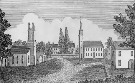
- Bellamy-Ferriday House and Garden, built in 1760 and added to the National Register of Historic Places in 1982.
- The Bethlehem Green Historic District contains 63 properties and was listed on the National Register of Historic Places in 1982.
- Old Bethlehem Historical Society Museum
- Christ Episcopal Church (Bethlehem, Connecticut)
Abbey of Regina Laudis
The town is home to the Benedictine Abbey of Regina Laudis, founded in 1947, one of the first houses of contemplative Benedictine nuns in the United States. Robert Leather, a Protestant industrialist, donated 400 acres (1.6 km2) of land on which the convent is located. The convent now has 37 nuns.
The abbey is known for its commitment to the arts, especially the performance of Gregorian chant. The acting background of Mother Dolores Hart, O.S.B., has prompted the convent to sponsor annual summer theatre productions.
Hart has worked with fellow artists, including James and Dawn Douglas, to found the Act Association, a group that performs at The Gary-The Olivia Theater, an open-air venue which seats about 200 people. Built in 1982 with the help of actress Patricia Neal, this open-air theater seats about 200 people. Productions have included plays by Shakespeare, Sartre, opera and musical reviews. Patricia Neal and James Douglas appeared in She Stoops to Conquer in 1999.
Notable people
- Christine Baranski, actress, and her husband, the actor and playwright Matthew Cowles
- Joseph Bellamy (1719–1790), influential Congregationalist theologian in the 18th century, was pastor at the Congregational church in town for 50 years, until his death
- Dolores Hart, former actress who appeared with Elvis Presley, became a Roman Catholic nun at the Benedictine Abbey of Regina Laudis in town, ultimately becoming head (or "prioress") of the convent. Her formal title now is the Reverend Mother Dolores Hart.
- David Leavitt (1791–1879), New York City banker, financier and art collector, born at Bethlehem to the Connecticut legislator and businessman David Leavitt Sr.
- Noella Marcellino, Benedictine nun who earned a doctorate in microbiology from the University of Connecticut and became a Roman Catholic nun at the Benedictine Abbey of Regina Laudis in town. She won a Fulbright scholarship to France to collect and examine native strains of fungi from traditional cheese caves, with an emphasis on Geotrichum candidum, and stayed an additional three years on a grant from the French government in order to analyze the samples.
References
- U.S. Census Bureau Population Estimates
- "Geographic Identifiers: 2010 Census Summary File 1 (G001), Bethlehem town, Litchfield County, Connecticut". American FactFinder. U.S. Census Bureau. Archived from the original on February 13, 2020. Retrieved October 4, 2019.
- "AAA Connecticut, Massachusetts & Rhode Island Tour Book", 2007, published by the American Automobile Association, page 38
- https://www.ctreg14.org
- "Geographic Identifiers: 2010 Census Summary File 1 (G001), Bethlehem Village CDP, Connecticut". American FactFinder. U.S. Census Bureau. Archived from the original on February 13, 2020. Retrieved October 4, 2019.
- "Annual Estimates of the Resident Population for Incorporated Places: April 1, 2010 to July 1, 2014". Archived from the original on 2015-05-23. Retrieved June 4, 2015.
- "Census of Population and Housing". Census.gov. Retrieved June 4, 2015.
- 2010 population by race and Hispanic or Latino by place chart for Connecticut from the US Census
- "U.S. Census website". United States Census Bureau. Retrieved January 31, 2008.
- "Registration and Party Enrollment Statistics as of October 29, 2019" (PDF). Connecticut Secretary of State. Retrieved 2020-02-17.
- "General Election Statements of Vote, 1922 – Current". CT Secretary of State. Retrieved July 10, 2020.
- "Election Night Reporting". CT Secretary of State. Retrieved December 16, 2020.
- http://www.bethlehemfair.com/
- "The Cult of the Cloves". The New York Times. September 29, 2010. Retrieved October 5, 2010.
This weekend brings the North Quabbin Garlic and Arts Festival to Orange, Mass., near Amherst, and the Easton Garlic Fest to Easton, Pa. The Connecticut Garlic and Harvest Festival visits Bethlehem on Oct. 9 and 10.
External links
- Official website
- Old Bethlehem Historical Society Museum
- The Joseph Bellamy House: The Great Awakening in Puritan New England, a National Park Service Teaching with Historic Places (TwHP) lesson plan
Municipalities and communities of Litchfield County, Connecticut, United States | ||
|---|---|---|
| Consolidated city | 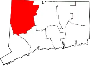 | |
| Towns | ||
| Boroughs | ||
| CDPs | ||
| Other communities | ||
| Indian reservation | ||
| ||
| Topics | |||||||
|---|---|---|---|---|---|---|---|
| States | |||||||
| Major cities | |||||||
| State capitals | |||||||
| Transportation |
| ||||||
| |||||||
| Authority control |
|---|