National Register of Historic Places listings in McDonough County, Illinois
This is a list of the National Register of Historic Places listings in McDonough County, Illinois.

Location of McDonough County in Illinois
This is intended to be a complete list of the properties and districts on the National Register of Historic Places in McDonough County, Illinois, United States. Latitude and longitude coordinates are provided for many National Register properties and districts; these locations may be seen together in a map.[1]
There are 8 properties and districts listed on the National Register in the county.
- This National Park Service list is complete through NPS recent listings posted January 29, 2021.[2]
Current listings
| [3] | Name on the Register | Image | Date listed[4] | Location | City or town | Description |
|---|---|---|---|---|---|---|
| 1 | William S. Bailey House | 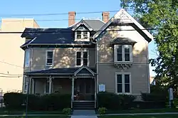 William S. Bailey House |
August 28, 2012 (#12000553) |
100 S. Campbell St. 40°27′29″N 90°40′08″W |
Macomb | |
| 2 | Moses King Brick and Tile Works | 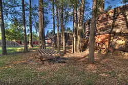 Moses King Brick and Tile Works |
August 8, 2001 (#01000866) |
738 N. Coal St. 40°26′02″N 90°47′48″W |
Colchester | |
| 3 | Clarence Kleinkopf Round Barn | 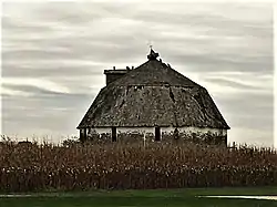 Clarence Kleinkopf Round Barn |
August 26, 1982 (#82002586) |
North of Colchester 40°27′18″N 90°48′40″W |
Colchester | |
| 4 | Lamoine Hotel | 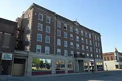 Lamoine Hotel |
September 16, 2010 (#10000760) |
201 N. Randolph St. 40°27′36″N 90°40′12″W |
Macomb | |
| 5 | Macomb Courthouse Square Historic District |  Macomb Courthouse Square Historic District |
May 22, 2013 (#13000295) |
Roughly bounded by E. and W. Washington, S. McArthur, E. Calhoun, and S. Campbell Sts. 40°27′34″N 90°40′16″W |
Macomb | |
| 6 | McDonough County Courthouse | 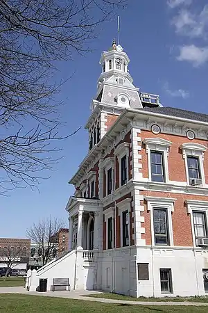 McDonough County Courthouse |
October 30, 1972 (#72001448) |
Public Sq. 40°27′33″N 90°39′58″W |
Macomb | |
| 7 | Welling-Everly Horse Barn | 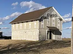 Welling-Everly Horse Barn |
August 29, 1985 (#85001911) |
Off U.S. Route 136 40°26′00″N 90°32′05″W |
Adair | |
| 8 | Western Illinois State Normal School Building | 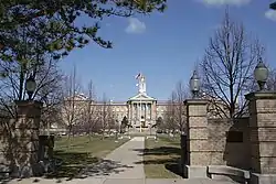 Western Illinois State Normal School Building |
May 20, 1998 (#98000470) |
1 University Cir. 40°27′51″N 90°41′00″W |
Macomb |
See also
| Wikimedia Commons has media related to National Register of Historic Places in McDonough County, Illinois. |
References
- The latitude and longitude information provided in this table was derived originally from the National Register Information System, which has been found to be fairly accurate for about 99% of listings. Some locations in this table may have been corrected to current GPS standards.
- "National Register of Historic Places: Weekly List Actions". National Park Service, United States Department of the Interior. Retrieved on January 29, 2021.
- Numbers represent an alphabetical ordering by significant words. Various colorings, defined here, differentiate National Historic Landmarks and historic districts from other NRHP buildings, structures, sites or objects.
- The eight-digit number below each date is the number assigned to each location in the National Register Information System database, which can be viewed by clicking the number.
| Topics | |
|---|---|
| Lists by state |
|
| Lists by insular areas | |
| Lists by associated state | |
| Other areas | |
| Related | |
| |
Municipalities and communities of McDonough County, Illinois, United States | ||
|---|---|---|
| Cities | Map of Illinois highlighting McDonough County | |
| Villages | ||
| Townships | ||
| CDPs | ||
| Other unincorporated communities |
| |
| Ghost towns | ||
| Footnotes | ‡This populated place also has portions in an adjacent county or counties | |
| ||
This article is issued from Wikipedia. The text is licensed under Creative Commons - Attribution - Sharealike. Additional terms may apply for the media files.