National Register of Historic Places listings in McLean County, Illinois
This is a list of the National Register of Historic Places listings in McLean County, Illinois.

Location of McLean County in Illinois
This is intended to be a complete list of the properties and districts on the National Register of Historic Places in McLean County, Illinois, United States. Latitude and longitude coordinates are provided for many National Register properties and districts; these locations may be seen together in a map.[1]
There are 34 properties and districts listed on the National Register in the county, including 1 National Historic Landmark. Another two properties were once listed, but have since been removed.
- This National Park Service list is complete through NPS recent listings posted January 29, 2021.[2]
Current listings
| [3] | Name on the Register | Image | Date listed[4] | Location | City or town | Description |
|---|---|---|---|---|---|---|
| 1 | Warren Bane Site | 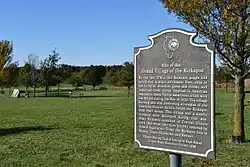 Warren Bane Site |
March 19, 1982 (#82002588) |
Northeast of the junction of 3000E and 750N[5] 40°23′51″N 88°40′44″W |
Ellsworth | |
| 2 | Ruben M. Benjamin House | 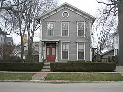 Ruben M. Benjamin House |
August 30, 1978 (#78003109) |
510 East Grove Street 40°28′41″N 88°59′16″W |
Bloomington | |
| 3 | Benjaminville Friends Meetinghouse and Burial Ground | 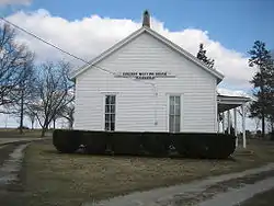 Benjaminville Friends Meetinghouse and Burial Ground |
December 13, 1983 (#83003584) |
North of Holder 40°28′35″N 88°48′21″W |
Holder | |
| 4 | Bloomington Central Business District | 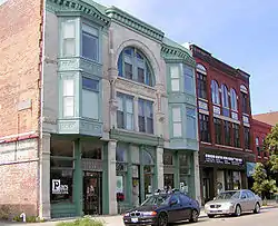 Bloomington Central Business District |
February 28, 1985 (#85000363) |
Roughly bounded by Main, Center and Front Streets 40°28′50″N 88°59′35″W |
Bloomington | |
| 5 | Bloomington High School | 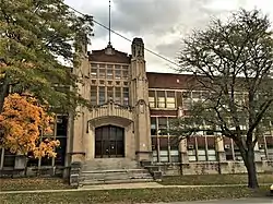 Bloomington High School |
April 19, 2018 (#100002327) |
510 E Washington St. 40°28′47″N 88°59′15″W |
Bloomington | The old high school building on East Washington Street, not the current high school. |
| 6 | Camelback Bridge | 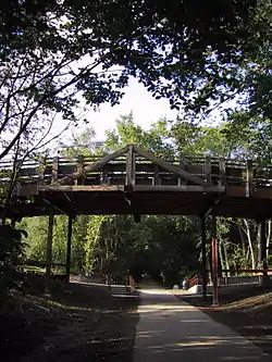 Camelback Bridge |
May 15, 1997 (#97000383) |
Virginia Avenue, across the Constitution Trail 40°29′53″N 88°59′01″W |
Normal | |
| 7 | Cedar Crest Addition Historic District | 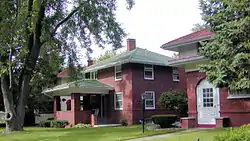 Cedar Crest Addition Historic District |
November 15, 2006 (#06001022) |
Roughly bounded by Constitutional Trail, Division Street, Highland Avenue and Fell Avenue 40°29′46″N 88°59′07″W |
Normal | |
| 8 | Children's Village-Illinois Soldiers' and Sailors' Children's School | May 21, 2018 (#100002418) |
1100 N Beech St. 40°31′09″N 88°58′40″W |
Normal | ||
| 9 | Clover Lawn |  Clover Lawn |
October 18, 1972 (#72001479) |
1000 East Monroe Drive 40°28′56″N 88°58′47″W |
Bloomington | |
| 10 | John W. Cook Hall | 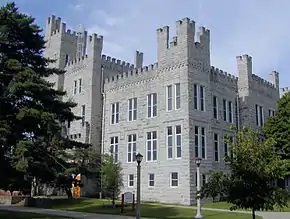 John W. Cook Hall |
February 20, 1986 (#86000268) |
Illinois State University, U.S. Route 51 40°30′33″N 88°59′32″W |
Normal | |
| 11 | George H. Cox House | 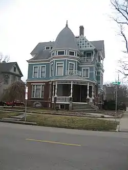 George H. Cox House |
November 14, 1985 (#85002838) |
701 East Grove Street 40°28′40″N 88°59′08″W |
Bloomington | |
| 12 | David Davis III & IV House | 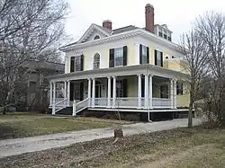 David Davis III & IV House |
November 12, 1982 (#82000400) |
1005 East Jefferson 40°28′50″N 88°58′48″W |
Bloomington | |
| 13 | Duncan Manor | 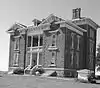 Duncan Manor |
February 9, 1979 (#79003164) |
Southwest of Towanda off Illinois Route 4 40°33′06″N 88°54′36″W |
Towanda | |
| 14 | East Grove Street District–Bloomington | 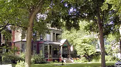 East Grove Street District–Bloomington |
February 26, 1987 (#86003176) |
400–700 East Grove Street 40°28′39″N 88°59′22″W |
Bloomington | |
| 15 | Franklin Square | 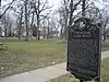 Franklin Square |
January 11, 1976 (#76002164) |
300 and 400 blocks of East Chestnut and East Walnut Streets, 900 block of North Prairie and North McLean Streets 40°29′12″N 88°59′25″W |
Bloomington | |
| 16 | Robert Greenlee House |  Robert Greenlee House |
February 7, 1997 (#97000033) |
806 North Evans Street 40°29′06″N 88°59′14″W |
Bloomington | |
| 17 | John M. Hamilton House | 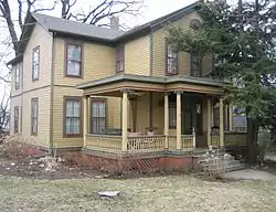 John M. Hamilton House |
September 6, 1978 (#78003110) |
502 South Clayton Street 40°28′33″N 88°59′10″W |
Bloomington | |
| 18 | Holy Trinity Church Rectory and Convent | 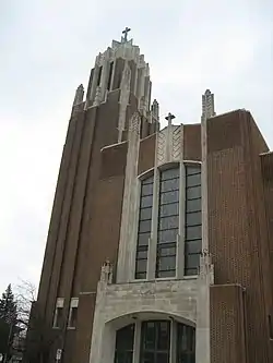 Holy Trinity Church Rectory and Convent |
December 8, 1983 (#83003585) |
704 North Main and 106 West Chestnut Streets 40°29′06″N 88°59′39″W |
Bloomington | |
| 19 | Hubbard House | 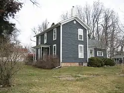 Hubbard House |
February 1, 1979 (#79003163) |
310 Broadway 40°36′33″N 88°59′15″W |
Hudson | |
| 20 | LeRoy Commercial Historic District | 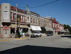 LeRoy Commercial Historic District |
February 16, 1996 (#96000089) |
111–123, 200–223, 300 Center and 106–118 Chestnut Streets 40°20′49″N 88°45′38″W |
Le Roy | |
| 21 | McLean County Courthouse and Square | .jpg.webp) McLean County Courthouse and Square |
February 6, 1973 (#73002160) |
Main, Washington, Center, and Jefferson Streets 40°28′40″N 88°59′39″W |
Bloomington | |
| 22 | George H. Miller House | 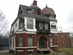 George H. Miller House |
July 20, 1978 (#78003111) |
405 West Market Street 40°28′56″N 88°59′48″W |
Bloomington | |
| 23 | Miller–Davis Law Buildings |  Miller–Davis Law Buildings |
April 27, 1979 (#79003162) |
101–103 North Main Street and 102–104 East Front Street 40°28′48″N 88°59′35″W |
Bloomington | |
| 24 | Normal Theater | 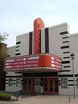 Normal Theater |
July 25, 1997 (#97000818) |
209 North Street 40°30′33″N 88°59′11″W |
Normal | |
| 25 | John Patton Log Cabin | 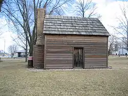 John Patton Log Cabin |
August 1, 1986 (#86002008) |
Lexington Park District Park 40°38′55″N 88°46′48″W |
Lexington | |
| 26 | Matthew T. Scott House | 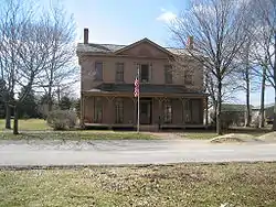 Matthew T. Scott House |
February 10, 1983 (#83000331) |
227 1st Avenue 40°44′21″N 88°43′41″W |
Chenoa | |
| 27 | Scott–Vrooman House | 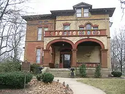 Scott–Vrooman House |
August 18, 1983 (#83000330) |
701 East Taylor Street 40°28′33″N 88°59′07″W |
Bloomington | |
| 28 | Sprague's Super Service | 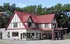 Sprague's Super Service |
April 25, 2008 (#08000327) |
305 E. Pine St. 40°31′03″N 88°58′51″W |
Normal | |
| 29 | Stevenson House | 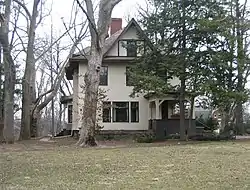 Stevenson House |
May 24, 1974 (#74002196) |
1316 East Washington Street 40°28′18″N 88°58′11″W |
Bloomington | |
| 30 | US Army Aircraft C-53-DO-41-20124 | August 1, 1996 (#96000857) |
1.25 miles (2.01 km) east of junction of Illinois Route 9 and Interstate 55 Business 40°29′07″N 88°55′52″W |
Bloomington | ||
| 31 | David Hyatt Van Dolah House | 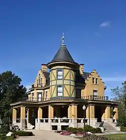 David Hyatt Van Dolah House |
September 14, 2015 (#15000590) |
10 N. Spencer St. 40°38′32″N 88°47′37″W |
Lexington | |
| 32 | Margaret and Bird Van Leer Broadview Mansion | 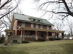 Margaret and Bird Van Leer Broadview Mansion |
June 7, 2016 (#16000327) |
1301 S. Fell Avenue 40°29′49″N 88°59′14″W |
Normal | |
| 33 | White Building | 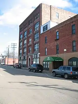 White Building |
June 17, 1994 (#94000612) |
215–223 East Douglas Street 40°28′58″N 88°59′28″W |
Bloomington | |
| 34 | White Place Historic District | 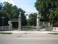 White Place Historic District |
August 12, 1988 (#88001230) |
White Place, Clinton Boulevard, and east side of Fell Avenue between Empire and Emerson Streets 40°29′27″N 88°59′06″W |
Bloomington |
Former listings
| [3] | Name on the Register | Image | Date listed | Date removed | Location | City or town | Summary |
|---|---|---|---|---|---|---|---|
| 1 | Jesse Fell House | April 19, 1978 (#78003112) | Unknown | 502 S. Fell St. |
Normal | Demolished in 1980.[6] | |
| 2 | Gildersleeve House | July 28, 1977 (#77001517) | January 2, 2020 | 108 Broadway 40°36′25″N 88°59′18″W |
Hudson | Demolished in 2000.[7] |
See also
| Wikimedia Commons has media related to National Register of Historic Places in McLean County, Illinois. |
References
- The latitude and longitude information provided in this table was derived originally from the National Register Information System, which has been found to be fairly accurate for about 99% of listings. Some locations in this table may have been corrected to current GPS standards.
- "National Register of Historic Places: Weekly List Actions". National Park Service, United States Department of the Interior. Retrieved on January 29, 2021.
- Numbers represent an alphabetical ordering by significant words. Various colorings, defined here, differentiate National Historic Landmarks and historic districts from other NRHP buildings, structures, sites or objects.
- The eight-digit number below each date is the number assigned to each location in the National Register Information System database, which can be viewed by clicking the number.
- Wagner, Mark. National Register of Historic Places Inventory/Nomination: Warren Bane Site. National Park Service, 1981-02-17, 7.
- "Normal's rich past dealt a blow with razing of Fell house in 1980".
- "Archived copy" (PDF). Archived from the original (PDF) on 2013-12-24. Retrieved 2014-01-12.CS1 maint: archived copy as title (link)
| Topics | |
|---|---|
| Lists by state |
|
| Lists by insular areas | |
| Lists by associated state | |
| Other areas | |
| Related | |
| |
Municipalities and communities of McLean County, Illinois, United States | ||
|---|---|---|
| Cities | Map of Illinois highlighting McLean County | |
| Town | ||
| Villages | ||
| Townships | ||
| CDP | ||
| Other unincorporated communities | ||
| Ghost towns | ||
| ||
This article is issued from Wikipedia. The text is licensed under Creative Commons - Attribution - Sharealike. Additional terms may apply for the media files.