National Register of Historic Places listings in Ogle County, Illinois
This is a list of the National Register of Historic Places listings in Ogle County, Illinois.
Location of Ogle County in Illinois
This is intended to be a complete list of the properties and districts on the National Register of Historic Places in Ogle County, Illinois, United States. Latitude and longitude coordinates are provided for many National Register properties and districts; these locations may be seen together in a map.[1]
There are 27 properties and districts listed on the National Register in the county.
- This National Park Service list is complete through NPS recent listings posted January 29, 2021.[2]
Current listings
| [3] | Name on the Register | Image | Date listed[4] | Location | City or town | Description |
|---|---|---|---|---|---|---|
| 1 | Zenas Aplington House | 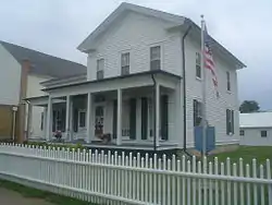 Zenas Aplington House |
September 5, 2017 (#100001565) |
123 N. Franklin Ave. 41°59′14″N 89°34′40″W |
Polo | |
| 2 | Bryant H. and Lucie Barber House | 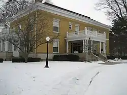 Bryant H. and Lucie Barber House |
February 10, 1993 (#92001849) |
103 North Barber Avenue 41°59′11″N 89°34′54″W |
Polo | |
| 3 | Henry D. Barber House | 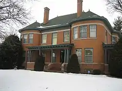 Henry D. Barber House |
March 28, 1974 (#74000770) |
410 West Mason Street 41°59′11″N 89°34′56″W |
Polo | |
| 4 | Buffalo Grove Lime Kiln | 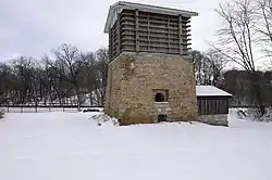 Buffalo Grove Lime Kiln |
November 20, 2002 (#02001348) |
Galena Trail Road 41°59′10″N 89°36′37″W |
Polo | |
| 5 | Buffalo Township Public Library | 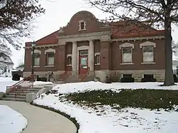 Buffalo Township Public Library |
November 7, 1995 (#95001236) |
302 West Mason Street 41°59′11″N 89°34′50″W |
Polo | |
| 6 | Dr. William Burns House | 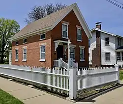 Dr. William Burns House |
August 27, 2018 (#100002824) |
201 N Franklin Ave. 41°59′15″N 89°34′39″W |
Polo | |
| 7 | Chana School | 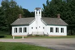 Chana School |
December 6, 2005 (#05001369) |
201 North River Road 42°00′50″N 89°20′00″W |
Oregon | |
| 8 | Chicago, Burlington, and Quincy Railroad Depot | 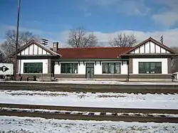 Chicago, Burlington, and Quincy Railroad Depot |
July 25, 1997 (#97000817) |
400 Collins Street 42°00′06″N 89°19′59″W |
Oregon | |
| 9 | City and Town Hall | 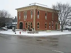 City and Town Hall |
August 18, 1992 (#92001006) |
Junction of Fourth Avenue and Sixth Street 41°55′21″N 89°04′02″W |
Rochelle | |
| 10 | John Deere House and Shop | 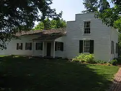 John Deere House and Shop |
October 15, 1966 (#66000327) |
Illinois and Clinton Streets 41°53′46″N 89°24′57″W |
Grand Detour | |
| 11 | Flagg Township Public Library | 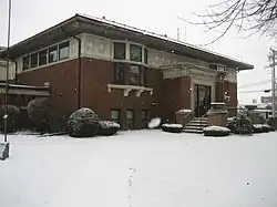 Flagg Township Public Library |
October 25, 1973 (#73000713) |
Northeast corner of 7th Street at 4th Avenue 41°55′24″N 89°04′05″W |
Rochelle | |
| 12 | Samuel M. Hitt House | 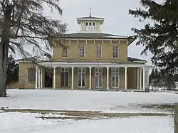 Samuel M. Hitt House |
November 14, 1985 (#85002841) |
7782 Illinois Route 64 West 42°03′21″N 89°29′12″W |
Mount Morris | |
| 13 | William H. Holcomb House | 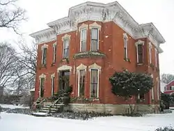 William H. Holcomb House |
October 25, 1973 (#73000714) |
526 North 7th Street 41°55′23″N 89°04′19″W |
Rochelle | |
| 14 | Indian Statue |  Indian Statue |
November 5, 2009 (#09000871) |
Lowden Memorial State Park, 1411 N. River Rd. 42°00′50″N 89°20′00″W |
Oregon | |
| 15 | John McGrath House | 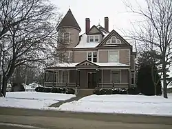 John McGrath House |
May 2, 1996 (#96000513) |
403 West Mason Street 41°59′10″N 89°34′54″W |
Polo | |
| 16 | William Moats Farm | 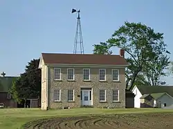 William Moats Farm |
February 12, 1987 (#86003724) |
Wood Road 41°54′05″N 89°14′50″W |
Ashton | |
| 17 | Ogle County Courthouse | 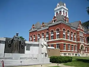 Ogle County Courthouse |
September 10, 1981 (#81000222) |
Courthouse Square 42°00′50″N 89°20′00″W |
Oregon | |
| 18 | Oregon Commercial Historic District | 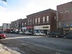 Oregon Commercial Historic District |
August 16, 2006 (#06000713) |
Roughly bounded by Jefferson, Franklin, 5th and 3rd Streets 42°00′53″N 89°19′56″W |
Oregon | |
| 19 | Oregon Public Library | 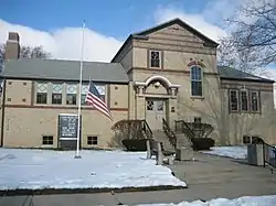 Oregon Public Library |
May 9, 2003 (#03000352) |
300 Jefferson Street 42°00′48″N 89°19′48″W |
Oregon | |
| 20 | Pinehill | 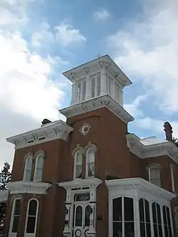 Pinehill |
July 24, 1978 (#78001179) |
400 Mix Street 42°01′05″N 89°20′26″W |
Oregon | |
| 21 | Polo Independent Order of Odd Fellows Lodge No. 197 | 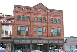 Polo Independent Order of Odd Fellows Lodge No. 197 |
December 6, 2004 (#04001302) |
117 West Mason Street 41°59′09″N 89°34′43″W |
Polo | |
| 22 | Rochelle Downtown Historic District | 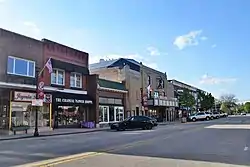 Rochelle Downtown Historic District |
December 31, 2018 (#100003265) |
Primarily 300-400 blks. Lincoln Hwy, 400 blk. Cherry & 400-500 blks. W. 4th Aves., 400 blk. Dewey & 300 blk. N. 6th Sts. 41°55′20″N 89°03′59″W |
Rochelle | |
| 23 | Soldier's Monument | 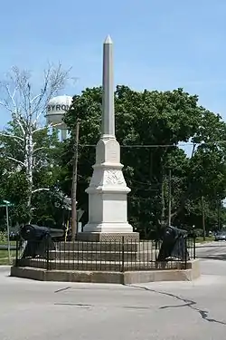 Soldier's Monument |
February 14, 1985 (#85000268) |
Chestnut and 2nd Streets 42°07′36″N 89°15′16″W |
Byron | |
| 24 | Stillman's Run Battle Site | 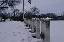 Stillman's Run Battle Site |
December 8, 1983 (#83003587) |
Roosevelt and Spruce Streets 42°06′24″N 89°10′34″W |
Stillman Valley | |
| 25 | Village of Davis Junction Town Hall | 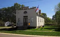 Village of Davis Junction Town Hall |
June 10, 2008 (#08000504) |
202 Pacific Ave. 42°06′00″N 89°05′50″W |
Davis Junction | [5] |
| 26 | David and Julia Watson House | 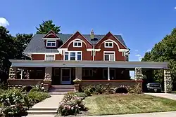 David and Julia Watson House |
May 8, 2017 (#100000963) |
103 N. Maple Ave. 41°59′12″N 89°35′07″W |
Polo | |
| 27 | White Pines State Park Lodge and Cabins | 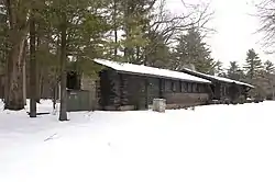 White Pines State Park Lodge and Cabins |
March 4, 1985 (#85002404) |
RR #1 41°59′40″N 89°27′53″W |
Mount Morris |
See also
| Wikimedia Commons has media related to National Register of Historic Places in Ogle County, Illinois. |
References
- The latitude and longitude information provided in this table was derived originally from the National Register Information System, which has been found to be fairly accurate for about 99% of listings. Some locations in this table may have been corrected to current GPS standards.
- "National Register of Historic Places: Weekly List Actions". National Park Service, United States Department of the Interior. Retrieved on January 29, 2021.
- Numbers represent an alphabetical ordering by significant words. Various colorings, defined here, differentiate National Historic Landmarks and historic districts from other NRHP buildings, structures, sites or objects.
- The eight-digit number below each date is the number assigned to each location in the National Register Information System database, which can be viewed by clicking the number.
- Little, Kelly and Benjamin, Susan. Village of Davis Junction Town Hall, National Register of Historic Places Registration Form, HAARGIS Database, Illinois Historic Preservation Agency, January 2, 2008, (listing confirmed on page 14-15), accessed January 22, 2011.
External links
- Ogle County Listings at nationalregisterofhistoricplaces.com
| Topics | |
|---|---|
| Lists by state |
|
| Lists by insular areas | |
| Lists by associated state | |
| Other areas | |
| Related | |
| |
Municipalities and communities of Ogle County, Illinois, United States | ||
|---|---|---|
| Cities | Map of Illinois highlighting Ogle County | |
| Villages | ||
| Townships | ||
| CDPs | ||
| Other unincorporated communities | ||
| Footnotes | ‡This populated place also has portions in an adjacent county or counties | |
| ||
This article is issued from Wikipedia. The text is licensed under Creative Commons - Attribution - Sharealike. Additional terms may apply for the media files.