National Register of Historic Places listings in Park County, Montana
This is a list of the National Register of Historic Places listings in Park County, Montana.
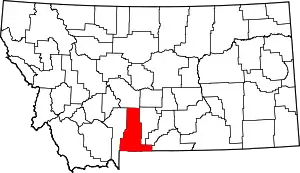
Location of Park County in Montana
This is intended to be a complete list of the properties and districts on the National Register of Historic Places in Park County, Montana, United States. The locations of National Register properties and districts for which the latitude and longitude coordinates are included below, may be seen in a map.[1]
There are 31 properties and districts listed on the National Register in the county, including 1 National Historic Landmark.
- This National Park Service list is complete through NPS recent listings posted January 29, 2021.[2]
Current listings
| [3] | Name on the Register | Image | Date listed[4] | Location | City or town | Description |
|---|---|---|---|---|---|---|
| 1 | B Street District | 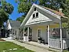 B Street District |
September 5, 1979 (#79001408) |
307-317 B St. 45°39′35″N 110°33′18″W |
Livingston | Four small one-story houses |
| 2 | Oliver and Lucy Bonnell Gothic Arch Roofed Barn | September 15, 2004 (#04000978) |
247 Shields River Road, E. 45°47′31″N 110°29′55″W |
Clyde Park | ||
| 3 | Carbella Bridge | 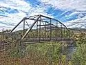 Carbella Bridge |
January 4, 2010 (#09001184) |
Milepost 0 on Tom Miner Rd., near its junction with U.S. Route 89 45°12′16″N 110°54′06″W |
Gardiner | |
| 4 | Carter Bridge | Carter Bridge |
April 28, 2011 (#11000226) |
Milepost 31.6 on MT 540 45°35′49″N 110°34′02″W |
Livingston vicinity | Reinforced Concrete Bridges in Montana, 1900-1958 MPS |
| 5 | Chicken Creek Farmstead Historic District | December 12, 2008 (#08001194) |
790 Rock Creek Rd., N. 45°53′23″N 110°25′32″W |
Clyde Park | ||
| 6 | Chico Hot Springs | 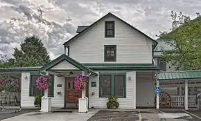 Chico Hot Springs |
August 21, 1998 (#98001085) |
2 miles northeast of Chico, 3.5 miles southeast of Emigrant 45°20′10″N 110°41′35″W |
Pray | |
| 7 | Commercial District | 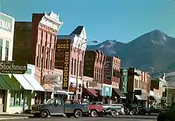 Commercial District |
September 5, 1979 (#79001409) |
Roughly bounded by Park, C, Clark, 3rd, and Callendar Sts. 45°39′34″N 110°33′48″W |
Livingston | |
| 8 | Convict Grade Historic District | August 3, 2015 (#15000485) |
1 mi. E. of jct. with US 89 45°43′46″N 110°26′15″W |
Springdale vicinity | ||
| 9 | Cooke City Store | March 27, 1986 (#86000527) |
Main St. 45°01′10″N 109°56′02″W |
Cooke City | ||
| 10 | Detention Hospital | 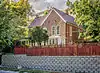 Detention Hospital |
September 5, 1979 (#79001410) |
325 E. Gallatin St. 45°40′04″N 110°33′35″W |
Livingston | |
| 11 | East Side Residential District | 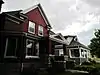 East Side Residential District |
September 5, 1979 (#79001411) |
Roughly bounded by I, Clark, E, and Park Sts. 45°39′53″N 110°33′07″W |
Livingston | |
| 12 | Ebert Ranch | September 5, 1979 (#79001412) |
U.S. Route 89 45°42′03″N 110°31′11″W |
Livingston | ||
| 13 | Gardiner Jail |  Gardiner Jail |
August 3, 2015 (#15000486) |
2nd St. 45°01′55″N 110°42′21″W |
Gardiner | |
| 14 | Harvat Ranch | September 5, 1979 (#79001413) |
Southeast of Livingston off U.S. Route 89 45°40′05″N 110°31′59″W |
Livingston | ||
| 15 | John Hepburn Place |  John Hepburn Place |
October 19, 2005 (#05001177) |
626 E. River Rd. 45°17′40″N 110°49′53″W |
Emigrant | |
| 16 | KPRK Radio | 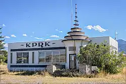 KPRK Radio |
September 5, 1979 (#79001414) |
East of Livingston off U.S. Route 89 45°40′22″N 110°32′24″W |
Livingston | |
| 17 | Krohne Island House | September 5, 1979 (#79001415) |
Krohne Island 45°40′15″N 110°32′30″W |
Livingston | ||
| 18 | Krohne Spring House | 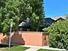 Krohne Spring House |
September 5, 1979 (#79001416) |
329 S. H St. 45°39′47″N 110°32′53″W |
Livingston | |
| 19 | Livingston Memorial Hospital | 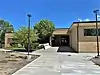 Livingston Memorial Hospital |
April 16, 2018 (#100002309) |
504 S. 13th St. 45°38′59″N 110°34′08″W |
Livingston | |
| 20 | Billy Miles & Bros. Grain Elevator | 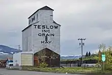 Billy Miles & Bros. Grain Elevator |
September 23, 2020 (#100005604) |
Jct. of East Park St. (US 89 Bus.) and North G St. 45°39′58″N 110°33′15″W |
Livingston | |
| 21 | North Entrance Road Historic District | 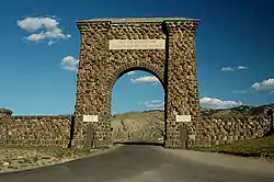 North Entrance Road Historic District |
May 22, 2002 (#02000529) |
Yellowstone National Park 45°00′24″N 110°41′58″W |
Yellowstone National Park | Road between North Entrance and Mammoth Hot Springs; extends into Park County, Wyoming. |
| 22 | Northeast Entrance Station | 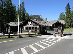 Northeast Entrance Station |
May 28, 1987 (#87001435) |
U.S. Route 212 45°00′17″N 110°00′33″W |
Yellowstone National Park | |
| 23 | Northside School | 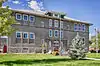 Northside School |
September 5, 1979 (#79001417) |
118 W. Chinook St. 45°39′51″N 110°33′49″W |
Livingston | |
| 24 | OTO Homestead and Dude Ranch | 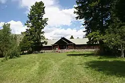 OTO Homestead and Dude Ranch |
October 12, 2004 (#99000054) |
15 miles north of Gardiner 45°08′41″N 110°21′13″W |
Gardiner | |
| 25 | Red Lodge-Cooke City Approach Road Historic District |  Red Lodge-Cooke City Approach Road Historic District |
May 8, 2014 (#14000219) |
US 212 45°01′06″N 109°56′25″W |
Cooke City | Extends into Carbon County, Montana and Park County, Wyoming |
| 26 | Rolfson House | 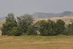 Rolfson House |
September 5, 1979 (#79001418) |
West of Livingston on Bozeman Rd. 45°39′42″N 110°40′17″W |
Livingston | |
| 27 | Sixty-Three Ranch | 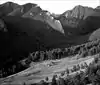 Sixty-Three Ranch |
December 7, 1982 (#82000595) |
Address Restricted |
Livingston | |
| 28 | Trowbridge Dairy | 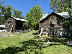 Trowbridge Dairy |
September 5, 1979 (#79001419) |
207 S. M St. 45°40′04″N 110°32′40″W |
Livingston | |
| 29 | Urbach Cabin | 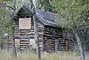 Urbach Cabin |
September 5, 1979 (#79001420) |
9th St. Island 45°38′54″N 110°33′34″W |
Livingston | |
| 30 | US Post Office-Livingston Main | 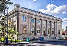 US Post Office-Livingston Main |
March 14, 1986 (#86000685) |
105 N. 2nd St. 45°39′39″N 110°33′40″W |
Livingston | |
| 31 | West Side Residential District |  West Side Residential District |
September 5, 1979 (#79001421) |
Roughly bounded by Sacajawea Park, 7th, Park, and 3rd Sts. 45°39′26″N 110°33′42″W |
Livingston |
See also
| Wikimedia Commons has media related to National Register of Historic Places in Park County, Montana. |
References
- The latitude and longitude information provided in this table was derived originally from the National Register Information System, which has been found to be fairly accurate for about 99% of listings. Some locations in this table may have been corrected to current GPS standards.
- "National Register of Historic Places: Weekly List Actions". National Park Service, United States Department of the Interior. Retrieved on January 29, 2021.
- Numbers represent an alphabetical ordering by significant words. Various colorings, defined here, differentiate National Historic Landmarks and historic districts from other NRHP buildings, structures, sites or objects.
- The eight-digit number below each date is the number assigned to each location in the National Register Information System database, which can be viewed by clicking the number.
Municipalities and communities of Park County, Montana, United States | ||
|---|---|---|
| City | Park County map | |
| Town | ||
| CDPs | ||
| Unincorporated communities | ||
| Ghost towns | ||
| ||
| Topics | |
|---|---|
| Lists by state |
|
| Lists by insular areas | |
| Lists by associated state | |
| Other areas | |
| Related | |
| |
This article is issued from Wikipedia. The text is licensed under Creative Commons - Attribution - Sharealike. Additional terms may apply for the media files.