National Register of Historic Places listings in Portland, Louisville, Kentucky
This is a list of properties and historic districts on the National Register of Historic Places in the Portland neighborhood of Louisville, Kentucky (roughly bounded by the Ohio River on the north; N. 10th St. to the east; W. Market St. to the south; and I-264 and the Shawnee Golf Course to the west. Latitude and longitude coordinates of the 33 sites listed on this page may be displayed in a map or exported in several formats by clicking on one of the links in the adjacent box.[1]
National Register sites elsewhere in Jefferson County are listed separately.
- This National Park Service list is complete through NPS recent listings posted January 29, 2021.[2]
Current listings
| [3] | Name on the Register | Image | Date listed[4] | Location | Description |
|---|---|---|---|---|---|
| 1 | Baker-Hawkins House | 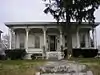 Baker-Hawkins House |
August 21, 1980 (#80001593) |
3603 W. Market St. 38°15′42″N 85°48′36″W |
|
| 2 | C.A. Bridges Tobacco Warehouse | 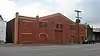 C.A. Bridges Tobacco Warehouse |
September 8, 1983 (#83002640) |
1719-1723 W. Main St. 38°15′34″N 85°46′45″W |
|
| 3 | Brown Tobacco Warehouse | 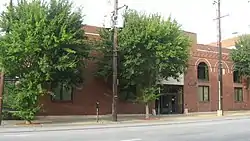 Brown Tobacco Warehouse |
September 8, 1983 (#83002643) |
1019-1025 W. Main St. 38°15′29″N 85°46′03″W |
|
| 4 | Firehouse No. 13 | 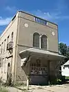 Firehouse No. 13 |
March 10, 1981 (#81000284) |
100 N. 34th St. 38°15′44″N 85°48′25″W |
|
| 5 | Givens Headley and Co. Tobacco Warehouse | 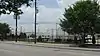 Givens Headley and Co. Tobacco Warehouse |
September 8, 1983 (#83002672) |
1119-1121 W. Main St. 38°15′30″N 85°46′09″W |
|
| 6 | Greve, Burlage, and Company | 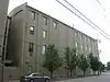 Greve, Burlage, and Company |
September 8, 1983 (#83002674) |
312-316 N. 15th St. 38°15′43″N 85°46′28″W |
|
| 7 | Greve, Buhrlage, and Company | 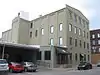 Greve, Buhrlage, and Company |
September 8, 1983 (#83002675) |
1501 Lytle St. 38°15′41″N 85°46′28″W |
|
| 8 | Benjamin Grove House | 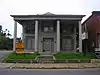 Benjamin Grove House |
November 15, 1984 (#84000371) |
518 N. 26th St. 38°16′13″N 85°47′27″W |
|
| 9 | Ideal Theatre | 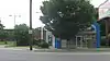 Ideal Theatre |
September 8, 1983 (#83002686) |
2315-2319 W. Market St. 38°15′33″N 85°47′20″W |
|
| 10 | James F. Irvin House | 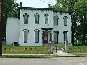 James F. Irvin House |
September 8, 1983 (#83002688) |
2910 Northwestern Parkway 38°16′30″N 85°47′40″W |
|
| 11 | LeCompte Saloon | March 5, 2018 (#100002155) |
3200 Rudd Ave. 38°16′35″N 85°47′59″W |
||
| 12 | Lower West Market Street District |  Lower West Market Street District |
November 4, 1982 (#82001561) |
1500-2200 W. Market St. 38°15′28″N 85°46′51″W |
|
| 13 | Meek-Miller House | 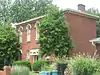 Meek-Miller House |
September 10, 1979 (#79001012) |
3123 Northwestern Parkway 38°16′31″N 85°47′54″W |
|
| 14 | Monon Freight Depot | 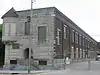 Monon Freight Depot |
September 8, 1983 (#83002707) |
1400 W. Main St. 38°15′30″N 85°46′24″W |
|
| 15 | Montgomery Street School | 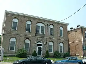 Montgomery Street School |
May 6, 1982 (#82002713) |
2500-2506 Montgomery St. 38°16′18″N 85°47′19″W |
|
| 16 | National Foundry and Machine Company | 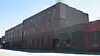 National Foundry and Machine Company |
May 1, 1980 (#80001610) |
1402 W. Main St. 38°15′30″N 85°46′28″W |
|
| 17 | National Tobacco Work Branch Stemmery | 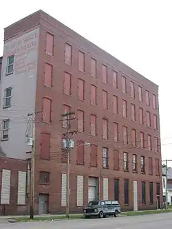 National Tobacco Work Branch Stemmery |
September 8, 1983 (#83002709) |
2410-2418 W. Main St. 38°15′36″N 85°47′25″W |
|
| 18 | National Tobacco Works | 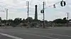 National Tobacco Works |
September 8, 1983 (#83002710) |
1800-1810 W. Main St. 38°15′32″N 85°46′50″W |
|
| 19 | National Tobacco Works Branch Drying House | 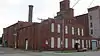 National Tobacco Works Branch Drying House |
September 8, 1983 (#83002711) |
2400 W. Main St. 38°15′36″N 85°47′24″W |
|
| 20 | Peaslee-Gaulbert Warehouse | 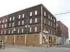 Peaslee-Gaulbert Warehouse |
September 8, 1983 (#83002719) |
1427 Lytle St. 38°15′41″N 85°46′27″W |
|
| 21 | Planter's Tobacco Warehouse | 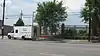 Planter's Tobacco Warehouse |
September 8, 1983 (#83002723) |
1027-1031 W. Main St. 38°15′29″N 85°46′04″W |
|
| 22 | Portland Historic District | 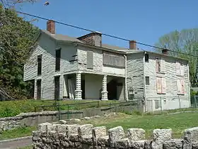 Portland Historic District |
February 21, 1980 (#80001615) |
Roughly bounded by Missouri Ave., Pflanz Ave., Bank, N. 33rd, and N. 37th Sts. 38°16′28″N 85°48′08″W |
|
| 23 | Portland Proper | 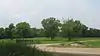 Portland Proper |
September 13, 2006 (#06000812) |
31st St. and Northwestern Parkway 38°16′42″N 85°48′18″W |
|
| 24 | J.V. Reed and Company | 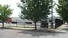 J.V. Reed and Company |
September 8, 1983 (#83002725) |
1100 W. Main St. 38°15′28″N 85°46′06″W |
|
| 25 | Theodore Roosevelt Elementary School | 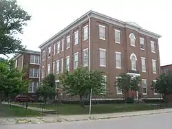 Theodore Roosevelt Elementary School |
March 22, 1982 (#82002719) |
222 N. 17th St. 38°15′41″N 85°46′41″W |
|
| 26 | St. Cecilia School Building | 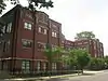 St. Cecilia School Building |
November 26, 2004 (#04001252) |
2530 Slevin St. 38°15′54″N 85°47′30″W |
|
| 27 | St. Patrick's Roman Catholic Church, Rectory, and School | 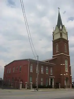 St. Patrick's Roman Catholic Church, Rectory, and School |
March 1, 1982 (#82002723) |
1301-1305 W. Market St. 38°15′26″N 85°46′19″W |
|
| 28 | Shafer's Hall | March 18, 2019 (#100003478) |
617 N. 27th St. 38°16′21″N 85°47′29″W |
||
| 29 | Steam Engine Company No. 4 | 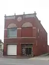 Steam Engine Company No. 4 |
November 7, 1980 (#80004497) |
1617 W. Main St. 38°15′33″N 85°46′38″W |
|
| 30 | Thornburgh House | 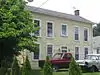 Thornburgh House |
December 8, 1983 (#83003735) |
376 N. 26th St. 38°16′00″N 85°47′35″W |
|
| 31 | Tobacco Realty Company | 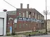 Tobacco Realty Company |
September 8, 1983 (#83002742) |
118-126 N. 10th St. 38°15′31″N 85°46′00″W |
|
| 32 | U.S. Marine Hospital | U.S. Marine Hospital |
January 9, 1978 (#78001368) |
2215 Portland Ave. 38°16′14″N 85°47′04″W |
|
| 33 | Western Junior High School | 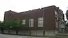 Western Junior High School |
September 8, 1983 (#83002748) |
2201 W. Main St. 38°15′37″N 85°47′12″W |
|
| 34 | Wrampelmeier Furniture Company | 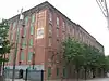 Wrampelmeier Furniture Company |
September 8, 1983 (#83002754) |
226-228 N. 15th St. 38°15′40″N 85°46′29″W |
Former listings
| [3] | Name on the Register | Image | Date listed | Date removed | Location | Summary |
|---|---|---|---|---|---|---|
| 1 | William G. Meier Warehouse | September 8, 1983 (#83002704) | December 11, 2009 | 2100 Rowan St. 38°15′40″N 85°47′04″W |
||
| 2 | National Tobacco Works Warehouse | September 8, 1983 (#83002712) | December 11, 2009 | 101-113 S. 24th St. 38°15′35″N 85°47′20″W |
See also
References
- The latitude and longitude information provided in this table was derived originally from the National Register Information System, which has been found to be fairly accurate for about 99% of listings. Some locations in this table may have been corrected to current GPS standards.
- "National Register of Historic Places: Weekly List Actions". National Park Service, United States Department of the Interior. Retrieved on January 29, 2021.
- Numbers represent an alphabetical ordering by significant words. Various colorings, defined here, differentiate National Historic Landmarks and historic districts from other NRHP buildings, structures, sites or objects.
- The eight-digit number below each date is the number assigned to each location in the National Register Information System database, which can be viewed by clicking the number.
| Topics | |
|---|---|
| Lists by state |
|
| Lists by insular areas | |
| Lists by associated state | |
| Other areas | |
| Related | |
| |

This article is issued from Wikipedia. The text is licensed under Creative Commons - Attribution - Sharealike. Additional terms may apply for the media files.