National Register of Historic Places listings in Powell County, Montana
This is a list of the National Register of Historic Places listings in Powell County, Montana.
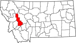
Location of Powell County in Montana
This is intended to be a complete list of the properties and districts on the National Register of Historic Places in Powell County, Montana, United States. The locations of National Register properties and districts for which the latitude and longitude coordinates are included below, may be seen in a map.[1]
There are 17 properties and districts listed on the National Register in the county, including 1 National Historic Landmark.
- This National Park Service list is complete through NPS recent listings posted January 29, 2021.[2]
Current listings
| [3] | Name on the Register | Image | Date listed[4] | Location | City or town | Description |
|---|---|---|---|---|---|---|
| 1 | Nick J. Bielenberg House | 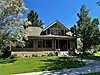 Nick J. Bielenberg House |
August 10, 1979 (#79003719) |
801 Milwaukee Ave. 46°24′03″N 112°43′34″W |
Deer Lodge | |
| 2 | Charter Oak Mine and Mill | February 6, 2001 (#01000038) |
United States Forest Service Road 227 B-1 in Helena National Forest 46°29′23″N 112°25′03″W |
Elliston | ||
| 3 | William E. Coleman House | 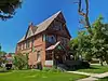 William E. Coleman House |
May 21, 1979 (#79001422) |
500 Missouri Ave. 46°23′55″N 112°43′51″W |
Deer Lodge | |
| 4 | Conley Street Bridge | 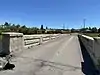 Conley Street Bridge |
April 28, 2011 (#11000227) |
Clark Fork River Crossing on Conley St. 46°23′26″N 112°44′14″W |
Deer Lodge | Reinforced Concrete Bridges in Montana, 1900-1958 MPS |
| 5 | Deer Lodge American Women's League Chapter House | 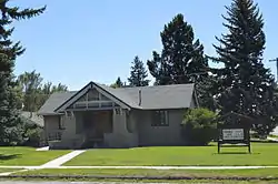 Deer Lodge American Women's League Chapter House |
June 14, 1982 (#82003177) |
802 Missouri Ave. 46°23′54″N 112°43′38″W |
Deer Lodge | |
| 6 | Deer Lodge Central Business Historic District | 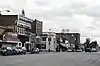 Deer Lodge Central Business Historic District |
August 13, 2008 (#08000767) |
Roughly bounded by Cottonwood Ave. to the north, Montana Ave. to the south, 2nd St. to the west, and 4th St. to the east 46°23′54″N 112°44′07″W |
Deer Lodge | |
| 7 | Fitzpatrick Ranch Historic District | 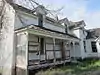 Fitzpatrick Ranch Historic District |
July 8, 1981 (#81000365) |
Northwest of Avon 46°47′19″N 112°46′38″W |
Avon | |
| 8 | Grant-Kohrs Ranch/Warren Ranch | 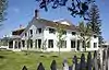 Grant-Kohrs Ranch/Warren Ranch |
July 11, 2003 (#03000127) |
Cattle Drive at Grant-Kohrs Ranch National Historic Site 46°24′57″N 112°44′44″W |
Deer Lodge | |
| 9 | Grant-Kohrs Ranch National Historic Site | Grant-Kohrs Ranch National Historic Site |
August 25, 1972 (#72000738) |
Edge of Deer Lodge 46°24′31″N 112°44′17″W |
Deer Lodge | |
| 10 | William K. Kohrs Free Memorial Library | 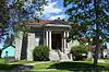 William K. Kohrs Free Memorial Library |
May 7, 1979 (#79001423) |
5th St. and Missouri Ave. 46°23′56″N 112°43′06″W |
Deer Lodge | |
| 11 | Little Blackfoot River Bridge | _-_Powell_County%252C_Montana.png.webp) Little Blackfoot River Bridge |
January 4, 2010 (#09001185) |
Milepost 0 on County Road 186 near its junction with U.S. Route 12 46°34′24″N 112°39′50″W |
Avon | |
| 12 | MacDonald Pass Airway Beacon |  MacDonald Pass Airway Beacon |
July 29, 2014 (#14000462) |
United States Route 12 46°33′16″N 112°18′32″W |
Helena vicinity | |
| 13 | Montana Territorial and State Prison | 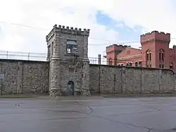 Montana Territorial and State Prison |
September 3, 1976 (#76001126) |
925 Main St. 46°23′33″N 112°44′07″W |
Deer Lodge | |
| 14 | Northern Pacific Railroad Completion Site, 1883 | 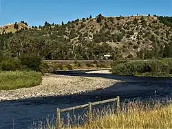 Northern Pacific Railroad Completion Site, 1883 |
August 19, 1983 (#83001075) |
Off Interstate 90 46°33′03″N 112°51′36″W |
Goldcreek | |
| 15 | Prison Brickyard Historic District | 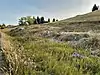 Prison Brickyard Historic District |
April 14, 1988 (#88000430) |
Gravel road off Interstate 90, ¼ mile south of Deer Lodge 46°23′12″N 112°43′37″W |
Deer Lodge | |
| 16 | Rialto Theater | 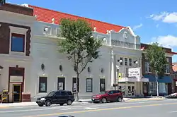 Rialto Theater |
February 19, 1998 (#98000124) |
418 Main St. 46°24′02″N 112°44′08″W |
Deer Lodge | |
| 17 | Trask Hall | 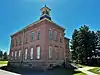 Trask Hall |
April 30, 1982 (#82003178) |
703 5th Ave. 46°23′40″N 112°43′52″W |
Deer Lodge | A building at the College of Montana |
See also
| Wikimedia Commons has media related to National Register of Historic Places in Powell County, Montana. |
References
- The latitude and longitude information provided in this table was derived originally from the National Register Information System, which has been found to be fairly accurate for about 99% of listings. Some locations in this table may have been corrected to current GPS standards.
- "National Register of Historic Places: Weekly List Actions". National Park Service, United States Department of the Interior. Retrieved on January 29, 2021.
- Numbers represent an alphabetical ordering by significant words. Various colorings, defined here, differentiate National Historic Landmarks and historic districts from other NRHP buildings, structures, sites or objects.
- The eight-digit number below each date is the number assigned to each location in the National Register Information System database, which can be viewed by clicking the number.
| Topics | |
|---|---|
| Lists by state |
|
| Lists by insular areas | |
| Lists by associated state | |
| Other areas | |
| Related | |
| |
Municipalities and communities of Powell County, Montana, United States | ||
|---|---|---|
| City | Powell County map | |
| CDPs | ||
| Unincorporated community | ||
| ||
This article is issued from Wikipedia. The text is licensed under Creative Commons - Attribution - Sharealike. Additional terms may apply for the media files.