National Register of Historic Places listings in St. James Parish, Louisiana
This is a list of the National Register of Historic Places listings in St. James Parish, Louisiana.
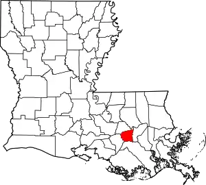
Location of St. James Parish in Louisiana
This is intended to be a complete list of the properties and districts on the National Register of Historic Places in St. James Parish, Louisiana, United States. The locations of National Register properties and districts for which the latitude and longitude coordinates are included below, may be seen in a map.[1]
There are 20 properties and districts listed on the National Register in the parish, including 1 National Historic Landmark. Another two properties were once listed, but have been removed.
- This National Park Service list is complete through NPS recent listings posted January 29, 2021.[2]
Current listings
| [3] | Name on the Register[4] | Image | Date listed[5] | Location | City or town | Description |
|---|---|---|---|---|---|---|
| 1 | Bay Tree |  Bay Tree |
November 21, 1991 (#91001738) |
3785 Louisiana Highway 18 30°00′11″N 90°46′51″W |
Vacherie | |
| 2 | Chauvin House |  Chauvin House |
July 25, 2003 (#03000681) |
10138 Louisiana Highway 44 30°05′15″N 90°54′20″W |
Convent | |
| 3 | Colonial Sugars Historic District |  Colonial Sugars Historic District |
October 11, 1994 (#94000858) |
1250 S. 5th Ave. 30°02′56″N 90°41′01″W |
Gramercy | |
| 4 | Desire Plantation House | 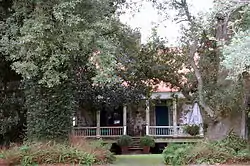 Desire Plantation House |
May 15, 1986 (#86001054) |
Louisiana Highway 644 29°56′39″N 90°41′49″W |
Vacherie | Built circa 1835, French Creole perique tobacco plantation. Private. |
| 5 | Felicity Plantation | 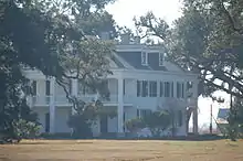 Felicity Plantation |
March 8, 2010 (#10000062) |
3351 Louisiana Highway 18 30°00′25″N 90°46′22″W |
Vacherie | Sister plantation to St. Joseph Plantation, built circa 1850 and privately owned. |
| 6 | Graugnard Farms Plantation House |  Graugnard Farms Plantation House |
May 14, 1992 (#92000510) |
5825 Louisiana Highway 18 29°59′28″N 90°50′07″W |
St. James | |
| 7 | Lambert House |  Lambert House |
May 10, 2005 (#05000407) |
5669 Louisiana Highway 44 29°59′49″N 90°48′46″W |
Convent | |
| 8 | Laura Plantation |  Laura Plantation |
February 3, 1993 (#92001842) |
2247 Louisiana Highway 18 30°00′21″N 90°43′26″W |
Vacherie | Plantation heiress and manager Laura Lacoul Gore's (1861-1963) autobiography Memories of the Old Plantation Home: A Creole Family Album (Nov. 2000) tells the family's history and her experience living at the plantation. Open to the public. |
| 9 | Little Texas |  Little Texas |
May 14, 1992 (#92000511) |
2834 Louisiana Highway 44 30°01′21″N 90°43′11″W |
Paulina | |
| 10 | Lutcher & Moore Cypress Lumber Co., Ltd., Headquarters Building |  Lutcher & Moore Cypress Lumber Co., Ltd., Headquarters Building |
May 13, 1994 (#94000411) |
2049 Railroad St. 30°02′25″N 90°41′52″W |
Lutcher | |
| 11 | Lutcher United Methodist Church |  Lutcher United Methodist Church |
February 13, 1992 (#92000042) |
2347 Texas St. 30°02′34″N 90°41′59″W |
Lutcher | |
| 12 | Manresa House of Retreats/Jefferson College | 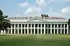 Manresa House of Retreats/Jefferson College |
January 31, 1985 (#85000162) |
Louisiana Highway 44 29°59′34″N 90°49′15″W |
Convent | |
| 13 | Mather House |  Mather House |
May 30, 2001 (#01000569) |
5666 Louisiana Highway 44 29°59′45″N 90°48′48″W |
Convent | |
| 14 | Millet House |  Millet House |
December 9, 1999 (#99001478) |
509 E. Jefferson Highway 30°02′40″N 90°41′08″W |
Gramercy | |
| 15 | Oak Alley Plantation | .jpg.webp) Oak Alley Plantation |
December 2, 1974 (#74002187) |
2.5 miles north of Vacherie 30°00′16″N 90°46′36″W |
Vacherie | |
| 16 | OLIVE JEANETTE |  OLIVE JEANETTE |
October 3, 1991 (#91001421) |
Main St. 30°02′30″N 90°41′47″W |
Lutcher | |
| 17 | Our Lady of Peace Catholic Church |  Our Lady of Peace Catholic Church |
May 22, 2013 (#13000299) |
13281 LA 644 29°56′40″N 90°40′56″W |
Vacherie | |
| 18 | Judge Felix Poché Plantation House |  Judge Felix Poché Plantation House |
December 3, 1980 (#80004251) |
River Rd. 30°00′44″N 90°49′37″W |
Convent | |
| 19 | St. Joseph Plantation House | 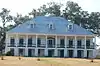 St. Joseph Plantation House |
September 6, 2005 (#05000987) |
3535 Louisiana Highway 18 30°00′22″N 90°46′20″W |
Vacherie | Early 19th-century plantation, joined in 1890 with Felicity Plantation to form the St. Joseph Plantation & Manufacturing Company. Privately owned. |
| 20 | St. Michael's Church Historic District |  St. Michael's Church Historic District |
November 15, 1979 (#79003121) |
Louisiana Highway 44 30°00′40″N 90°49′31″W |
Convent |
Former listings
| [3] | Name on the Register | Image | Date listed | Date removed | Location | City or town | Summary |
|---|---|---|---|---|---|---|---|
| 1 | Colomb House | August 7, 1980 (#80004250) | January 31, 2019 | Northwest of Convent on River Rd. 30°04′02″N 90°51′24″W |
Convent | ||
| 2 | Longview | September 21, 1983 (#83000537) | January 31, 2019 | Louisiana Highway 44 30°02′13″N 90°41′52″W |
Lutcher |
See also
| Wikimedia Commons has media related to National Register of Historic Places in Saint James Parish, Louisiana. |
References
- The latitude and longitude information provided in this table was derived originally from the National Register Information System, which has been found to be fairly accurate for about 99% of listings. Some locations in this table may have been corrected to current GPS standards.
- "National Register of Historic Places: Weekly List Actions". National Park Service, United States Department of the Interior. Retrieved on January 29, 2021.
- Numbers represent an alphabetical ordering by significant words. Various colorings, defined here, differentiate National Historic Landmarks and historic districts from other NRHP buildings, structures, sites or objects.
- "National Register Information System". National Register of Historic Places. National Park Service. March 13, 2009.
- The eight-digit number below each date is the number assigned to each location in the National Register Information System database, which can be viewed by clicking the number.
| Topics | |
|---|---|
| Lists by state |
|
| Lists by insular areas | |
| Lists by associated state | |
| Other areas | |
| Related | |
| |
Municipalities and communities of St. James Parish, Louisiana, United States | ||
|---|---|---|
| Towns | | |
| CDPs | ||
| Unincorporated community | ||
| Footnotes | ‡This populated place also has portions in an adjacent parish or parishes | |
| ||
This article is issued from Wikipedia. The text is licensed under Creative Commons - Attribution - Sharealike. Additional terms may apply for the media files.