National Register of Historic Places listings in Tate County, Mississippi
This is a list of the National Register of Historic Places listings in Tate County, Mississippi.
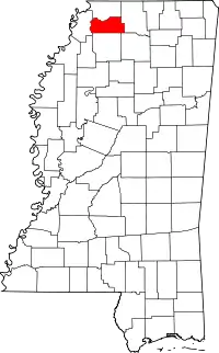
Location of Tate County in Mississippi
This is intended to be a complete list of the properties and districts on the National Register of Historic Places in Tate County, Mississippi, United States. Latitude and longitude coordinates are provided for many National Register properties and districts; these locations may be seen together in a map.[1]
There are 10 properties and districts listed on the National Register in the county. Another 2 properties were once listed but have been removed.
- This National Park Service list is complete through NPS recent listings posted February 5, 2021.[2]
Current listings
| [3] | Name on the Register[4] | Image | Date listed[5] | Location | City or town | Description |
|---|---|---|---|---|---|---|
| 1 | College Street Historic District | March 31, 1994 (#94000206) |
Roughly along N. Center, College, N. Front, N. Panola, N. Ward and W. Main Sts. 34°37′11″N 89°58′00″W |
Senatobia | ||
| 2 | Downtown Senatobia Historic District |  Downtown Senatobia Historic District |
March 31, 1994 (#94000205) |
Roughly along N. and S. Center, N. and S. Front, W. Main, W. Tate, and N. and S. Ward Sts. 34°37′07″N 89°57′56″W |
Senatobia | |
| 3 | McGehee Plantation | July 3, 2007 (#07000648) |
950 Ed Nelson Dr. 34°33′35″N 89°57′12″W |
Senatobia | ||
| 4 | North Panola Street Historic District | March 31, 1994 (#94000207) |
101 S. Panola St. and 104, 106, and 108 N. Panola St. 34°37′07″N 89°58′09″W |
Senatobia | ||
| 5 | North Park Street Historic District | March 31, 1994 (#94000208) |
113-209 N. Park St. 34°37′15″N 89°57′48″W |
Senatobia | ||
| 6 | South Panola Street Historic District | March 31, 1994 (#94000204) |
200-401 S. Panola St. 34°36′56″N 89°58′06″W |
Senatobia | ||
| 7 | South Ward Street Historic District | March 31, 1994 (#94000199) |
Roughly along Church, W. Gilmore, and S. Ward Sts. 34°36′50″N 89°57′58″W |
Senatobia | ||
| 8 | Southeast Senatobia Historic District | March 31, 1994 (#94000202) |
Roughly along S. Park, S. Park (West), E. Gilmore, E. Tate, and S. Heard Sts. 34°37′00″N 89°57′40″W |
Senatobia | ||
| 9 | Tate County Agricultural High School Historic District | March 31, 1994 (#94000201) |
510 N. Panola St. 34°37′32″N 89°58′09″W |
Senatobia | ||
| 10 | Tate County Courthouse |  Tate County Courthouse |
March 30, 1994 (#94000200) |
201 S. Ward St. 34°37′00″N 89°57′57″W |
Senatobia |
Former listings
| [3] | Name on the Register | Image | Date listed | Date removed | Location | City or town | Summary |
|---|---|---|---|---|---|---|---|
| 1 | Hickahala Creek Bridge | November 16, 1988 (#88002479) | March 15, 1996 | Spans Hickahala Creek on CR |
Senatobia vicinity | Listed in 1988, removed from NRHP in 1996[6] | |
| 2 | Senatobia Christian Church | March 30, 1994 (#94000203) | November 8, 1996 | 407 W Tate St. |
Senatobia | Listed in 1994 |
See also
| Wikimedia Commons has media related to National Register of Historic Places in Tate County, Mississippi. |
References
- The latitude and longitude information provided in this table was derived originally from the National Register Information System, which has been found to be fairly accurate for about 99% of listings. Some locations in this table may have been corrected to current GPS standards.
- "National Register of Historic Places: Weekly List Actions". National Park Service, United States Department of the Interior. Retrieved on February 5, 2021.
- Numbers represent an alphabetical ordering by significant words. Various colorings, defined here, differentiate National Historic Landmarks and historic districts from other NRHP buildings, structures, sites or objects.
- "National Register Information System". National Register of Historic Places. National Park Service. March 13, 2009.
- The eight-digit number below each date is the number assigned to each location in the National Register Information System database, which can be viewed by clicking the number.
- WEEKLY LIST OF ACTIONS TAKEN ON PROPERTIES: 11/24/97 THROUGH 11/28/97
Municipalities and communities of Tate County, Mississippi, United States | ||
|---|---|---|
| City | Map of Mississippi highlighting Tate County | |
| Town | ||
| Unincorporated communities | ||
| ||
| Topics | |
|---|---|
| Lists by state |
|
| Lists by insular areas | |
| Lists by associated state | |
| Other areas | |
| Related | |
| |
This article is issued from Wikipedia. The text is licensed under Creative Commons - Attribution - Sharealike. Additional terms may apply for the media files.