National Register of Historic Places listings in The Highlands, Louisville, Kentucky
This is a list of properties and historic districts on the National Register of Historic Places in The Highlands, Louisville, Kentucky. The table below includes 30 listings in the following neighborhoods:
Latitude and longitude coordinates of the sites listed on this page may be displayed in a map or exported in several formats by clicking on one of the links in the box below the map to the right.[1]
National Register sites elsewhere in Jefferson County are listed separately.
- This National Park Service list is complete through NPS recent listings posted February 5, 2021.[2]
Current listings
| [3] | Name on the Register | Image | Date listed[4] | Location | Neighborhood | Description |
|---|---|---|---|---|---|---|
| 1 | Leslie V. Abbott House | 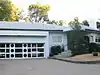 Leslie V. Abbott House |
July 30, 2013 (#13000558) |
2401 Newburg Rd. 38°12′49″N 85°42′01″W |
Belknap | |
| 2 | Willam R. Belknap School | 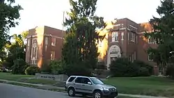 Willam R. Belknap School |
August 12, 1982 (#82002706) |
1800 Sils Ave. 38°13′19″N 85°41′23″W |
Belknap | |
| 3 | Bullock-Clifton House |  Bullock-Clifton House |
May 6, 1982 (#82002707) |
1824 Rosedale Ave. 38°13′27″N 85°42′15″W |
Deer Park | |
| 4 | Calvary Evangelical Lutheran Church | March 13, 2017 (#100000740) |
1838 Bardstown Rd. 38°13′39″N 85°41′59″W |
|||
| 5 | John B. Castleman Monument | 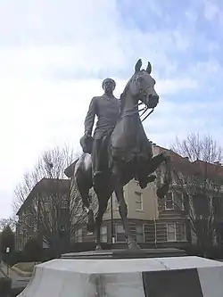 John B. Castleman Monument |
July 17, 1997 (#97000690) |
Junction of Cherokee Rd. and Cherokee Parkway 38°14′07″N 85°42′45″W |
Cherokee Triangle | |
| 6 | Cave Hill Cemetery | 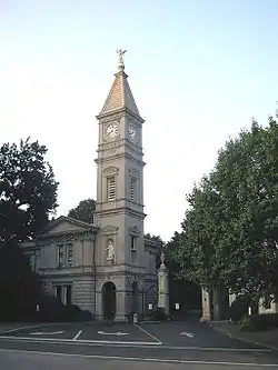 Cave Hill Cemetery |
December 11, 1979 (#79000999) |
701 Baxter Ave. 38°14′44″N 85°42′56″W |
Cherokee Triangle | |
| 7 | Cave Hill National Cemetery | 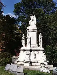 Cave Hill National Cemetery |
September 3, 1998 (#98001133) |
701 Baxter Ave. 38°14′56″N 85°43′20″W |
Cherokee Triangle | |
| 8 | Cherokee Triangle Area Residential District | 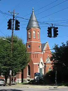 Cherokee Triangle Area Residential District |
June 30, 1976 (#76000902) |
Roughly bounded by Bardstown Rd., Sherwood Ave., and Broadway, east to the junction of Grinstead Dr. and Cherokee Parkway 38°14′22″N 85°42′56″W |
Cherokee Triangle | |
| 9 | Commodore Apartment Building | 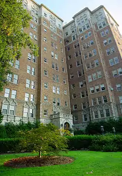 Commodore Apartment Building |
April 29, 1982 (#82002709) |
2140 Bonnycastle Ave. 38°13′58″N 85°42′03″W |
Bonnycastle | |
| 10 | Engelhard House | 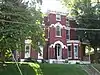 Engelhard House |
December 5, 1980 (#80001599) |
1080 Baxter Ave. 38°14′15″N 85°43′21″W |
Tyler Park | |
| 11 | Farmington | 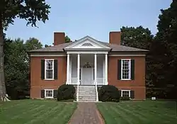 Farmington |
October 18, 1972 (#72000536) |
3033 Bardstown Rd. 38°12′53″N 85°40′05″W |
Hawthorne | |
| 12 | Nicholas Finzer House | 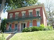 Nicholas Finzer House |
May 9, 1979 (#79001004) |
1212 Hull St. 38°14′53″N 85°43′39″W |
Irish Hill | |
| 13 | Hayfield | August 19, 1980 (#80001600) |
1809 Tyler Lane 38°12′28″N 85°41′10″W |
Hayfield Dundee | ||
| 14 | Highlands Historic District | 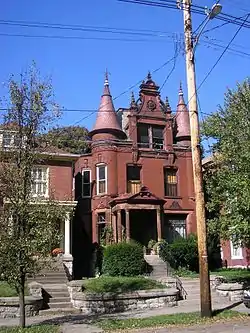 Highlands Historic District |
February 11, 1983 (#83002680) |
Roughly bounded by Barrett Ave., Eastern Parkway, Bardstown Road, and Fernwood, Woodbourne, Ellerbee, and Sherwood Aves. 38°14′22″N 85°43′36″W |
Original Highlands | |
| 15 | Howard-Gettys House |  Howard-Gettys House |
February 8, 1978 (#78001356) |
1226 Bates Ct. 38°13′45″N 85°43′24″W |
Tyler Park | |
| 16 | Humphrey-McMeekin House | 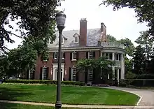 Humphrey-McMeekin House |
March 20, 1986 (#86000475) |
2240 Douglass Boulevard 38°13′42″N 85°41′09″W |
Highlands-Douglass | |
| 17 | Kentucky Home School for Girls | August 2, 2017 (#100001422) |
2305 Douglass Blvd. 38°13′48″N 85°41′09″W |
|||
| 18 | Klotz Confectionary Company | February 11, 2016 (#16000007) |
731 Brent St. 38°14′35″N 85°44′05″W |
|||
| 19 | Nelson Distillery Warehouse | June 27, 2014 (#14000423) |
100 Distillery Commons Dr. 38°15′00″N 85°43′23″W |
Irish Hill | Now the Distillery Commons. | |
| 20 | Rose Hill | 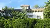 Rose Hill |
December 3, 1980 (#80001616) |
1835 Hampden Ct. 38°13′43″N 85°41′54″W |
Highlands-Douglass | |
| 21 | Saint Francis of Assisi Complex | 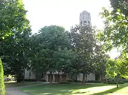 Saint Francis of Assisi Complex |
May 29, 1987 (#87000850) |
1960 Bardstown Rd. 38°13′33″N 85°41′52″W |
Deer Park | |
| 22 | St. James Roman Catholic Church, Rectory, and School | 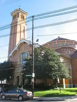 St. James Roman Catholic Church, Rectory, and School |
March 1, 1982 (#82002722) |
1430 Bardstown Rd., 1826 Edenside Ave, and 1818 Edenside Ave. 38°13′57″N 85°42′39″W |
Tyler Park | |
| 23 | Valentine Schneikert House | 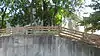 Valentine Schneikert House |
April 17, 1986 (#86000848) |
1234 Lexington Rd. 38°14′58″N 85°43′38″W |
Irish Hill | |
| 24 | Schuster Building |  Schuster Building |
March 19, 1980 (#80001618) |
1500-1512 Bardstown Rd. 38°13′54″N 85°42′32″W |
Deer Park | |
| 25 | Steam Engine Company No. 11 | 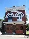 Steam Engine Company No. 11 |
November 7, 1980 (#80001623) |
1122 Rogers St. 38°14′45″N 85°43′38″W |
Irish Hill | |
| 26 | Steam Engine Company No. 20 | 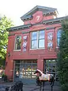 Steam Engine Company No. 20 |
November 7, 1980 (#80001626) |
1330 Bardstown Rd. 38°14′04″N 85°42′51″W |
Tyler Park | |
| 27 | Steam Engine Company No. 20 | 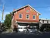 Steam Engine Company No. 20 |
November 7, 1980 (#80004498) |
1735 Bardstown Rd. 38°13′45″N 85°42′06″W |
Bonnycastle | |
| 28 | Struss House | November 7, 2003 (#03001112) |
1920 Winston Ave. 38°12′55″N 85°41′09″W |
Hayfield Dundee | ||
| 29 | Union Monument in Louisville | 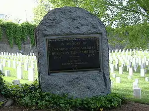 Union Monument in Louisville |
July 17, 1997 (#97000687) |
701 Baxter Ave. 38°14′54″N 85°43′20″W |
Irish Hill | Cave Hill Cemetery, junction of Payne St. and Lexington Rd. |
| 30 | David Wilson House | 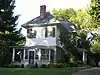 David Wilson House |
March 26, 1987 (#87000511) |
2215 Carolina Ave. 38°13′46″N 85°41′02″W |
Highlands-Douglass | |
| 31 | Woodbourne House | 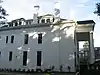 Woodbourne House |
February 7, 2008 (#08000008) |
2024 Woodford Pl. 38°13′33″N 85°41′38″W |
Highlands-Douglass |
Former listing
| [3] | Name on the Register | Image | Date listed | Date removed | Location | Neighborhood | Summary |
|---|---|---|---|---|---|---|---|
| 1 | August Bloedner Monument | 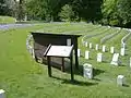 August Bloedner Monument |
July 17, 1997 (#97000688) | November 19, 2010 | 701 Baxter Ave. 38°14′54″N 85°43′19″W |
Cherokee Triangle | Cave Hill Cemetery, junction of Payne St. and Lexington Rd. |
See also
References
- The latitude and longitude information provided in this table was derived originally from the National Register Information System, which has been found to be fairly accurate for about 99% of listings. Some locations in this table may have been corrected to current GPS standards.
- "National Register of Historic Places: Weekly List Actions". National Park Service, United States Department of the Interior. Retrieved on February 5, 2021.
- Numbers represent an alphabetical ordering by significant words. Various colorings, defined here, differentiate National Historic Landmarks and historic districts from other NRHP buildings, structures, sites or objects.
- The eight-digit number below each date is the number assigned to each location in the National Register Information System database, which can be viewed by clicking the number.
| Topics | |
|---|---|
| Lists by state |
|
| Lists by insular areas | |
| Lists by associated state | |
| Other areas | |
| Related | |
| |
This article is issued from Wikipedia. The text is licensed under Creative Commons - Attribution - Sharealike. Additional terms may apply for the media files.