National Register of Historic Places listings in Union County, Illinois
This is a list of the National Register of Historic Places listings in Union County, Illinois.
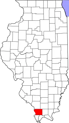
Location of Union County in Illinois
This is intended to be a complete list of the properties and districts on the National Register of Historic Places in Union County, Illinois, United States. Latitude and longitude coordinates are provided for many National Register properties and districts; these locations may be seen together in a map.[1]
There are 8 properties and districts listed on the National Register in the county. Another property was once listed but has been removed.
- This National Park Service list is complete through NPS recent listings posted February 5, 2021.[2]
Current listings
| [3] | Name on the Register | Image | Date listed[4] | Location | City or town | Description |
|---|---|---|---|---|---|---|
| 1 | Campground Church and Cemetery Site | 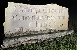 Campground Church and Cemetery Site |
May 8, 2017 (#100000965) |
50 Tunnel Ln. 37°27′39″N 89°08′19″W |
Anna | |
| 2 | Giant City State Park Lodge and Cabins | 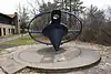 Giant City State Park Lodge and Cabins |
March 4, 1985 (#85002403) |
RR #1 37°35′32″N 89°11′00″W |
Makanda | |
| 3 | St. Anne's Episcopal Church |  St. Anne's Episcopal Church |
February 5, 2003 (#02001758) |
507 S. Main St. 37°27′28″N 89°15′11″W |
Anna | |
| 4 | St. Paulus Evangelisch Lutherischen Gemeinde | 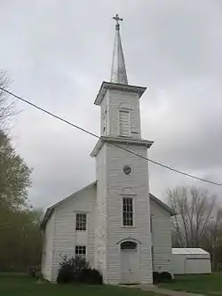 St. Paulus Evangelisch Lutherischen Gemeinde |
November 24, 1980 (#80001413) |
South of Jonesboro off Illinois Route 127 37°24′56″N 89°16′31″W |
Jonesboro | |
| 5 | Stinson Memorial Library | 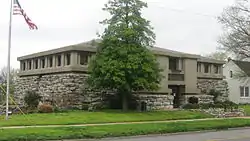 Stinson Memorial Library |
June 9, 1978 (#78001193) |
409 S. Main St. 37°27′30″N 89°15′06″W |
Anna | |
| 6 | Thompson Brothers Rock Art | 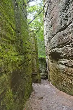 Thompson Brothers Rock Art |
December 29, 2015 (#15000933) |
Giant City Nature Trail[5] 37°35′42″N 89°11′36″W |
Makanda | |
| 7 | Union Lookout | 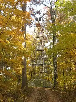 Union Lookout |
February 5, 2003 (#02001759) |
¾ miles south of the junction of County Road 13 and Trail of Tears State Forest Rd. 37°28′44″N 89°21′28″W |
Jonesboro | |
| 8 | Ware Mounds and Village Site | 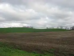 Ware Mounds and Village Site |
October 18, 1977 (#77000490) |
West of the junction of Illinois Routes 3 and 146 at Ware[6] 37°26′47″N 89°24′00″W |
Ware |
See also
| Wikimedia Commons has media related to National Register of Historic Places in Union County, Illinois. |
References
- The latitude and longitude information provided in this table was derived originally from the National Register Information System, which has been found to be fairly accurate for about 99% of listings. Some locations in this table may have been corrected to current GPS standards.
- "National Register of Historic Places: Weekly List Actions". National Park Service, United States Department of the Interior. Retrieved on February 5, 2021.
- Numbers represent an alphabetical ordering by significant words. Various colorings, defined here, differentiate National Historic Landmarks and historic districts from other NRHP buildings, structures, sites or objects.
- The eight-digit number below each date is the number assigned to each location in the National Register Information System database, which can be viewed by clicking the number.
- Wagner, Mark, et. al. National Register of Historic Places Registration Form: Thompson Brothers Rock Art. Illinois Historic Preservation Agency, December 8, 2014, 5.
- Maruszak, Kathleen. National Register of Historic Places Inventory/Nomination: Ware Mounds and Village Site. National Park Service, 1976-11, 5.
| Topics | |
|---|---|
| Lists by state |
|
| Lists by insular areas | |
| Lists by associated state | |
| Other areas | |
| Related | |
| |
Municipalities and communities of Union County, Illinois, United States | ||
|---|---|---|
| Cities | Map of Illinois highlighting Union County | |
| Villages | ||
| Precincts |
| |
| Unincorporated communities | ||
| ||
This article is issued from Wikipedia. The text is licensed under Creative Commons - Attribution - Sharealike. Additional terms may apply for the media files.