New Hampshire Route 114
New Hampshire Route 114 (abbreviated NH 114) is a 60.433-mile-long (97.257 km) secondary north–south highway in central New Hampshire. The highway runs between Bedford in Hillsborough County and Grantham in Sullivan County.
| ||||
|---|---|---|---|---|
| Route information | ||||
| Maintained by NHDOT | ||||
| Length | 60.433 mi[1] (97.257 km) | |||
| Major junctions | ||||
| South end | ||||
| ||||
| North end | ||||
| Location | ||||
| Counties | Hillsborough, Merrimack, Sullivan | |||
| Highway system | ||||
| ||||

The southern terminus of NH 114 is at New Hampshire Route 101 in Bedford. The northern terminus is at New Hampshire Route 10 in Grantham. The highway maintains a northwest-southeast alignment from Bedford northward.
Route description
NH 114's southern terminus is in the northeastern corner of Bedford at the end of the NH 101 freeway; at the intersection the freeway continues as NH 114 as a surface road while NH 101 turns left to follow Boynton Street. From here the route runs north-northwest into the town of Goffstown. The road has no secondary name along this segment, it is simply signed as "NH Route 114". At the intersection with Mast Road at the eastern edge of the village of Pinardville within Goffstown, NH 114 turns west to join Mast Road, while NH 114A has its northern terminus here, following Mast Road eastward. Mast Road becomes South Mast Street upon entering Goffstown village at the geographic center of the town. Upon meeting NH 13, the two routes join together for a short concurrency along Main Street through the center of the village, before NH 114 leaves to the west along North Mast Street while NH 13 continues north along High Street. Following the Piscataquog River, NH 114 passes briefly into the town of New Boston crossing the extreme northeastern corner of town, before entering the town of Weare.
Upon entering Weare, NH 114 changes its name to South Stark Highway, and passes by the north end of Daniels Lake. At Three Corners in Weare, NH 114 joins NH 77 in a concurrency, and also narrowly misses the eastern terminus of NH 149, which ends a short distance away. At the center of town at Weare village, the name changes to North Stark Highway. NH 77 leaves to the east after a bridge across the Piscataquog, then 114 leaves Weare and enters Henniker.

In Henniker, NH 114 changes its name to Weare Road and travels northwestward through a rural area of the town. Passing Pats Peak ski area and New England College and crossing the Contoocook River, NH 114 follows Bridge Street and Maple Street through the main village of Henniker. At the northern edge of the village, NH 114 has an interchange with US 202/NH 9 and changes names once again to Bradford Road. Closely following Amey Brook, NH 114 crosses the extreme southwestern corner of Warner, though there are no intersections with roads connecting to the rest of Warner.
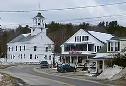
In Bradford, NH 114 passes close by the western shore of Lake Massasecum and meets NH 103 in the northeastern corner of the town, at the main village of Bradford. Nearby is Bement Covered Bridge and Todd Lake. NH 114 turns here from a northeasterly alignment to due north and enters the town of Sutton.
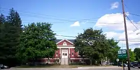
The main north-south road through Sutton, NH 114 passes by the northern end of Blaisdell Lake, crosses and then follows the northern bank of the Lane River, past the village of Sutton Mills, which has the Town Hall and acts as the main village of the town. It next enters the village of North Sutton, passing by Wadleigh State Park and Kezar Lake. It is known in this area as Sutton Road. It passes under, but does not interchange with Interstate 89; access between the two is provided by North Road (I-89 exit 10).
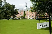
Entering the town of New London along Sutton Road, NH 114 has an intersection with NH 11 and NH 114 turns back to the northwest. The road changes names to Main Street when entering the main village of New London, passing Colby Sawyer College. Newport Road to the west provides access to nearby Lake Sunapee and I-89 (exit 12), while NH 114 passes the eastern shore of Little Sunapee Lake along Little Sunapee Road. Turning westward at the northeastern corner of the lake, NH 114 enters Springfield.
In Springfield, the road closely hugs the north shore of Little Sunapee Lake, then turns north along Main Street, passing west of Gile State Forest. Passing the western shore of Kolelemook Lake, NH 114 passes to the west of the main village of Springfield, forming the main road through the village of West Springfield. NH 114 turns west, then south, then west again before entering the town of Grantham.
Known as Grantham Road in Grantham, NH 114 passes under (but again does not interchange with) I-89 near the northern end of Stocker Pond. Crossing Stocker Brook several times, NH 114 reaches its northern terminus at NH 10 in the main village of Grantham near the North Branch of the Sugar River.
Major intersections
| County | Location[1][2] | mi[1][2] | km | Destinations | Notes | |
|---|---|---|---|---|---|---|
| Hillsborough | Bedford | 0.000 | 0.000 | Southern terminus | ||
| Goffstown | 3.582 | 5.765 | Northern terminus of NH 114A | |||
| 7.417 | 11.937 | Southern end of concurrency with NH 13 | ||||
| 7.737 | 12.451 | Northern end of concurrency with NH 13 | ||||
| Weare | 14.593 | 23.485 | Southern end of concurrency with NH 77 | |||
| 18.972 | 30.532 | Northern end of concurrency with NH 77 | ||||
| Merrimack | Henniker | 26.279– 26.360 | 42.292– 42.422 | Interchange | ||
| Bradford | 34.794 | 55.996 | ||||
| Sutton | 42.913 | 69.062 | North Road to | Exit 10 on I-89 | ||
| New London | 46.042 | 74.097 | ||||
| 48.491 | 78.039 | Newport Road to | Exit 12 on I-89 | |||
| Sullivan | Springfield | 52.261 | 84.106 | Georges Mills Road to | Exit 12A on I-89 | |
| 55.197 | 88.831 | Four Corners Road to | ||||
| Grantham | 60.433 | 97.257 | Northern terminus | |||
1.000 mi = 1.609 km; 1.000 km = 0.621 mi
| ||||||
Suffixed routes
| |
|---|---|
| Location | Manchester–Goffstown |
| Length | 3.696 mi[1] (5.948 km) |
New Hampshire Route 114A (abbreviated NH 114A) is a 3.696-mile-long (5.948 km) north–south highway in Hillsborough County in southeast New Hampshire. The highway connects downtown Manchester with Goffstown and forms the main thoroughfare through the village of Pinardville on the Goffstown/Manchester line..
The southern terminus of NH 114A is at U.S. Route 3 and New Hampshire Route 3A in Manchester on the west side of the Merrimack River. The northern terminus is at the junction with New Hampshire Route 114 in Goffstown. It is known as Mast Road, and follows a northwest–southeast routing into Manchester. In Manchester, it follows Varney Street, Main Street, West Hancock Street and Second Street before coming to an end at the complex interchange between I-293/Everett Turnpike and the Queen City Bridge/US 3/NH 3A.
References
- Bureau of Planning & Community Assistance (February 20, 2015). "NH Public Roads". Concord, New Hampshire: New Hampshire Department of Transportation. Retrieved April 7, 2015.
- Bureau of Planning & Community Assistance (April 3, 2015). "Nodal Reference 2015, State of New Hampshire". New Hampshire Department of Transportation. Retrieved April 7, 2015.
- Town of Bedford, Hillsborough County
- Town of Goffstown, Hillsborough County
- Town of Weare, Hillsborough County
- Town of Henniker, Merrimack County
- Town of Bradford, Merrimack County
- Town of Sutton, Merrimack County
- Town of New London, Merrimack County
- Town of Springfield, Sullivan County
- Town of Grantham, Sullivan County