Bradford (CDP), New Hampshire
Bradford is a census-designated place (CDP) and the main village in the town of Bradford in Merrimack County, New Hampshire, United States. The population of the CDP was 356 at the 2010 census,[1] out of 1,650 in the entire town of Bradford.
Bradford, New Hampshire | |
|---|---|
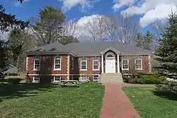 Bradford Public Library | |
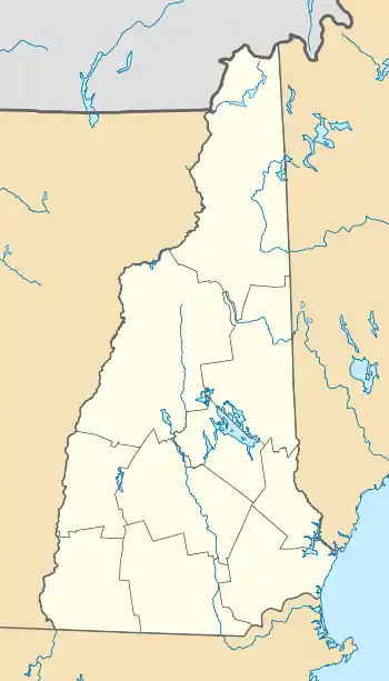 Bradford  Bradford | |
| Coordinates: 43°16′11″N 71°57′30″W | |
| Country | United States |
| State | New Hampshire |
| County | Merrimack |
| Town | Bradford |
| Area | |
| • Total | 0.81 sq mi (2.10 km2) |
| • Land | 0.79 sq mi (2.05 km2) |
| • Water | 0.02 sq mi (0.05 km2) |
| Elevation | 685 ft (209 m) |
| Population (2010) | |
| • Total | 356 |
| • Density | 449/sq mi (173.3/km2) |
| Time zone | UTC-5 (Eastern (EST)) |
| • Summer (DST) | UTC-4 (EDT) |
| ZIP code | 03221 |
| Area code(s) | 603 |
| FIPS code | 33-06900 |
| GNIS feature ID | 2629717 |
Geography
The CDP occupies the northeast part of the town of Bradford, at the outlet of Todd Lake. The northern border of the CDP follows the Bradford/Newbury town line, while the southern boundary follows the Warner River and its West Branch. The CDP is bordered to the east by New Hampshire Route 114.[2] Route 114 leads north 12 miles (19 km) to New London and southeast 9 miles (14 km) to Henniker. New Hampshire Route 103 passes through the center of the CDP, leading east 7 miles (11 km) to Interstate 89 in Warner and northwest 13 miles (21 km) to Newport.
According to the U.S. Census Bureau, the Bradford CDP has a total area of 0.81 square miles (2.1 km2), of which 0.02 square miles (0.05 km2), or 2.27%, are water.[1]
Demographics
As of the census of 2010, there were 356 people, 144 households, and 97 families residing in the CDP. There were 174 housing units, of which 30, or 17.2%, were vacant. 14 of the vacant units were seasonal or vacation properties. The racial makeup of the CDP was 95.2% white, 0.3% African American, 1.4% Native American, 0.6% Asian, 0.0% Pacific Islander, 0.3% some other race, and 2.2% from two or more races. 2.2% of the population were Hispanic or Latino of any race.[3]
Of the 144 households in the CDP, 26.4% had children under the age of 18 living with them, 48.6% were headed by married couples living together, 11.8% had a female householder with no husband present, and 32.6% were non-families. 22.2% of all households were made up of individuals, and 7.0% were someone living alone who was 65 years of age or older. The average household size was 2.47, and the average family size was 2.88.[3]
21.1% of residents in the CDP were under the age of 18, 9.8% were from age 18 to 24, 21.1% were from 25 to 44, 36.5% were from 45 to 64, and 11.5% were 65 years of age or older. The median age was 43.4 years. For every 100 females, there were 95.6 males. For every 100 females age 18 and over, there were 103.6 males.[3]
For the period 2011-15, the estimated median annual income for a household was $54,583, and the median income for a family was $63,438. The per capita income for the CDP was $21,501. 9.7% of the population and 8.8% of families were below the poverty line, along with 16.2% of people under the age of 18 and 6.8% of people 65 or older.[4]
References
- "Geographic Identifiers: 2010 Demographic Profile Data (G001): Bradford CDP, New Hampshire". U.S. Census Bureau, American Factfinder. Archived from the original on February 13, 2020. Retrieved September 27, 2017.
- "TIGERweb: Bradford CDP, New Hampshire". Geography Division, U.S. Census Bureau. Retrieved January 26, 2021.
- "Profile of General Population and Housing Characteristics: 2010 Census Summary File 1 (DP-1): Bradford CDP, New Hampshire". U.S. Census Bureau, American Factfinder. Archived from the original on February 13, 2020. Retrieved September 27, 2017.
- "Selected Economic Characteristics: 2011-2015 American Community Survey 5-Year Estimates (DP03): Bradford CDP, New Hampshire". U.S. Census Bureau, American Factfinder. Archived from the original on February 13, 2020. Retrieved September 27, 2017.
Municipalities and communities of Merrimack County, New Hampshire, United States | ||
|---|---|---|
| Cities | 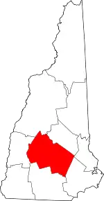 Map of New Hampshire highlighting Merrimack County | |
| Towns | ||
| CDPs | ||
| Other unincorporated communities | ||
| Footnotes | ‡This populated place also has portions in an adjacent county or counties | |
| ||