North East Tunisia
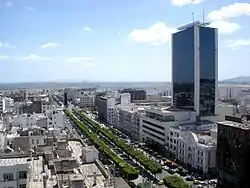
North East Tunisia (Arabic: الشمال الشرقي التونسي) is one of the six geographic and economic regions of Tunisia. It consists of seven governorates: Bizerte, Tunis, Aryanah, Menouba, Ben Arous, Zaghouan and Nabeul. At the 2014 Census, the region had a population of 4,176,779.[1] That makes it the most populated region of the country and it has the highest density with 347 people per square kilometer.
Geography
The North East region is located in the extreme north of the country and africa, Measuring an area of 12,032 km square most of its landscape are Flat Rich of agriculture activities, bounded to the west by the North West region Governorate of Béja, to the north and east by the Mediterranean Sea, and in the south with the Central East region. The region has a coastline length of nearly 227 km.
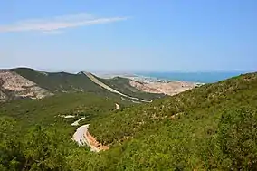
There are four national parks in the North East, three of them are entirely in the region and one is partially in it: Boukornine National Park is between the Tunis Governorate and Ben Arous Governorate, Ichkeul National Park in the Bizerte Governorate, Jebel Chitana-Cap Négro National Park between Bizerte Governorate and Béja Governorate and finally Zembra National Park which is an archipelago of Zembra island and Zembretta island in Nabeul Governorate.
 Boukarnin National Park
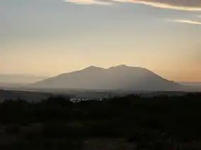 Ichkiil National Park
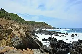 Jbel Chitana Cap Negro
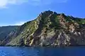 Zembra and Zembretta
Demographics
With 4,176,779[1] people, the North East is the most populated region in the country. The most populated governorates of the North East are:
| Governorate | Area kilometer square | Population (2014) | Population density | Largest town/city |
|---|---|---|---|---|
| Tunis[2] | 346 km2 | 1.056.247 | 3,100/km2 | Tunis (638,845) |
| Nabeul | 2,788 km2 | 787,920 | 280/km2 | Hammamet (97,579) |
| Ben Arous | 761 km2 | 631,842 | 800/km2 | Mohamedia-Fouchana (106,167) |
| Ariana | 482 km2 | 576,088 | 1,200/km2 | Ettadhamen-Mnihla (196,298) |
| Bizerte | 3,750 km2 | 568,219 | 150/km2 | Bizerte (142,966) |
| Menouba | 1,137 km2 | 379,518 | 330/km2 | Douar Hicher (82,532) |
| Zaghouan | 2,768 km2 | 176,945 | 64/km2 | El Fahs (23,556) |
Cities and towns
There are several cities and towns with populations that exceed 100,000. These are the 10 most populated cities:
| City | Population (2014) | Population density |
|---|---|---|
| Tunis | 638,845 | 3,004 hab./km2 |
| Ettadhamen-Mnihla | 196,298 | 8,200 hab./km2 |
| Bizerte | 142,966 | 3,363 hab./km2 |
| La Soukra | 129,693 | No data |
| Aryanah | 114,486 | 636 hab./km2 |
| Mohamedia-Fouchana | 106,167 | No data |
| El Mourouj | 104,538 | 4,864 hab./km2 |
| Hammamet | 97,579 | 2,700 hab./km2 |
| Raoued | 94,691 | No data |
| Douar Hicher | 82,532 | No data |
Transportation
The region is linked through many networks of roads. National roads are the most used ones despite been Risky in winter. They pass many rivers and water dams and are often narrow with only two-way. Many national roads may be blocked due to flooding. Highways are considered to be the best choice of travelling, starting in Bizerte with A4 motorway reaching Tunis then stretching through A1 motorway passing Ben Arous, Zaghouan and Hammamet to finally get to Nabeul.
There is also a train connecting Bizerte to Tunis then stretched from Tunis to Hammamet but the trains are old and slow with a travel speed of about 65 km/h.
The Tunis–Carthage International Airport is the most important and busiest Tunisian airport. It is connected to other Tunisian airports through Tunisair Express.
There is also Métro léger de Tunis light metro rail in Tunis that covers the Grand Tunis area with a 43 kilometers of line and 67 stations. It has a capacity to carry more than 600,000 persons a day.
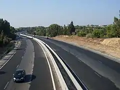 Tunis Hammamet Highway
 A1 toll in Mornag at sunset
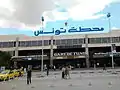 Tunis train station
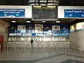 Inside Tunis train station
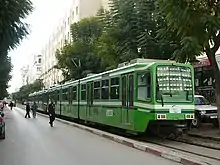 An old Metro vehicle
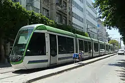 Bidirectional Alstom Citadis 302 on Line 6 in June 2012
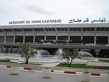 Tunis-Carthage International Airport
.jpg.webp) Carthage airport Terminal 2
Carthage airport Terminal 2
References
- (in French) Census 2014 (National Institute of Statistics) Archived 2014-10-29 at the Wayback Machine
- https://www.citypopulation.de/Tunisia-Cities.html
External link
- North-East Tunisia Details (in Arabic)
Governorates and regions of Tunisia | ||
|---|---|---|
| Governorates | ||
| Regions | ||
WikiProject Tunisia | ||