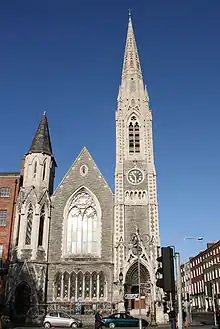
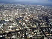
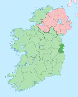
Northside, Dublin
The Northside[1] (Irish: Taobh Ó Thuaidh) is the part of Dublin city that lies to the north of the River Liffey.


Definition
Not an administrative area, the Northside is variously defined. It generally includes those parts of Dublin city which lie north of the River Liffey. County Dublin settlements, north of the M50 motorway, such as Swords and Malahide, that have developed into suburbs of Dublin city, are also sometimes included.
Popular culture
James Joyce set several of the Dubliners stories on the Northside, reflecting his childhood sojourns in Drumcondra and Fairview. Among the more recent best-selling writers to have written extensively about the Northside are Dermot Bolger and Booker Prize winner Roddy Doyle, who set several of his novels in the fictional Northside area of Barrytown.
The soap opera Fair City is set in Carrigstown, a fictional suburb within Dublin's Northside. According to the RTÉ Guide, Carrigstown is bounded by Drumcondra to the north, the city centre to the south, East Wall to the east and Phibsboro to the west.[2]
Areas of the Northside
The Northside includes Dublin city centre north of the Liffey, of whose many streets some are noted below, and districts such as Smithfield and Summerhill. Some older districts, such as Oxmantown, no longer exist. Beyond the centre, areas of the Northside include the below, most (at least two names were invented in the 1960s) of the names being of long heritage, though until recently many were rural townlands. Some are distinct suburbs or villages, others are parts of larger areas:
- Artane
- Ashtown
- Balbriggan
- Ballybough
- Ballyboughal
- Baldoyle
- Balgriffin
- Ballygall
- Ballymun
- Bayside
- Beaumont
- Blanchardstown
- Broadstone
- Cabra
- Castleknock
- Clonee
- Clongriffin
- Clonsilla
- Clontarf
- Coolock
- Corduff
- Darndale
- Dollymount
- Donabate
- Donaghmede
- Donnycarney
- Drumcondra
- East Wall
- Fairview
- Finglas
- Glasnevin
- Grangegorman
- Harmonstown
- Howth
- Kilbarrack
- Killester
- Kilmore
- Kinsealy
- Malahide
- Marino
- Mulhuddart
- North Wall
- North Strand
- Ongar
- Oxmantown
- Phibsboro
- Portmarnock
- Priorswood
- Raheny
- Santry
- Sheriff Street
- Skerries
- Smithfield
- Stoneybatter
- Sutton
- Summerhill
- Swords
- Tyrellstown
- Whitehall.
The 'area' is administered both by Dublin City Council (formerly Dublin Corporation) and Fingal County Council, responsible for 84% and 16% of the land area which lies inside the M50 motorway and north of the river Liffey respectively (excluding the Howth peninsula).
Postcodes
In general, Dublin postal districts on the Northside are odd numbers, while Southside codes are even. One exception is the Phoenix Park, which is on the Northside but forms part of an even-numbered district (Dublin 8). The reason behind this is explained by eminent Dublin historian Pat Liddy: "Long before there were postal codes the James's St Postal Sorting Office looked after the Phoenix Park because it was considered to be closer and more convenient than Phibsborough (Dublin 7). James's St continued in this role when the postal codes were introduced so Dublin 8 it had to be."
Landmarks

Well known places and sights on the Northside include:
- Abbey Street
- Abbey Theatre, the Irish National Theatre
- Ambassador Theatre
- Áras an Uachtaráin, the residence of the President
- Beaumont Hospital
- Bull Island
- Dollymount
- Capel Street
- Casino at Marino
- Castleknock Castle
- Clontarf Castle
- Croke Park
- Dalymount Park
- Dublin City Gallery The Hugh Lane
- Dublin City University
- Dublin Port
- Dublin Port Tunnel
- Dublin Writers Museum
- Dublin Zoo
- Dorset Street
- Dunsink Observatory
- Farmleigh
- Four Courts
- Garden of Remembrance
- Gardiner Street
- Gate Theatre
- GPO
- Glasnevin Cemetery
- Henrietta Street
- Henry Street
- Howth Castle
- Howth Head
- International Financial Services Centre
- James Joyce Centre
- King's Inns
- Law Society of Ireland
- Malahide Castle and regional park
- Mater Hospital
- Morton Stadium
- Moore Street
- Mountjoy Prison
- Mountjoy Square
- National Aquatic Centre
- National Botanic Gardens
- National Museum of Ireland (Collins Museum)
- National Transport Museum of Ireland
- National Wax Museum
- North Circular Road
- O'Connell Street
- Old Jameson Whiskey Distillery
- Parnell Square
- Parnell Street
- Phoenix Park
- Rotunda Hospital
- Royal Canal
- Smithfield
- Spire of Dublin
- Saint Anne's Park
- St. Brendan's Hospital, Dublin
- St. Doulagh's Church
- St. Mary's Church
- St Mary's Pro-Cathedral
- St. Michan's Church
- Swords Castle
- Talbot Street
- The Custom House
- The Helix
- Tolka Park
- 3Arena
Major transport hubs include Connolly Station, Busáras (the national central bus station) and Dublin Airport.
Many state bodies such as the national meteorological office, Met Éireann, the Central Fisheries Board, the national enterprise and trade board, Enterprise Ireland, the National Standards Authority of Ireland, Sustainable Energy Ireland, the Department of Education and Skills, the Department of the Environment, Community and Local Government, the National Food Centre, the Irish Marine Institute in Corduff and the Department of Defence are based on the Northside.
The main shopping area in the north inner city, and busiest shopping street in Ireland, is Henry Street/Mary Street, just off O'Connell street. Four of the six city centre shopping centres are located on the Northside, these are the Jervis Centre, the Ilac Shopping Centre, Irish Life Shopping Mall and the Moore Street Mall, along with Dublin's largest out-of-town centre, at Blanchardstown, and others at Swords, Coolock, Charlestown in northern Finglas, and Donaghmede.
The Cineworld (UGC) cinema on Parnell Street is the largest cinema in Ireland with seventeen screens, while the Savoy, located on O'Connell Street and operated by IMC, is one of Ireland's oldest cinemas.
Higher education institutions include the Grangegorman Campus of Technological University Dublin, the newest university established in Dublin, and Dublin City University, with its campus located primarily in Glasnevin and Drumcondra.
