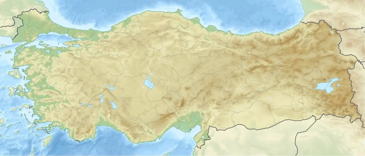
Osmaniye
Osmaniye (pronounced [osˈmaːnije]) is a city in the Çukurova region of Turkey, the capital of Osmaniye Province. Area 3,767 km². Population of Osmaniye city: 219,339. Osmaniye Province: 512,804 (2014). Osmaniye is at an elevation of 125 meters (410.1 feet).
Osmaniye | |
|---|---|
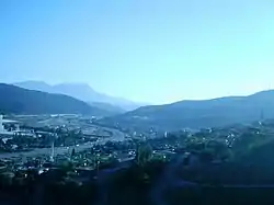 Osmaniye panoramic view | |
 Osmaniye  Osmaniye  Osmaniye .svg.png.webp) Osmaniye | |
| Coordinates: 37°04′30″N 36°15′00″E | |
| Country | Turkey |
| Province | Osmaniye |
| Government | |
| • Mayor | Kadir Kara (MHP) |
| Area | |
| • District | 746.71 km2 (288.31 sq mi) |
| Population (2012)[2] | |
| • Urban | 209,255 |
| • District | 239,910 |
| • District density | 320/km2 (830/sq mi) |
| Website | www.osmaniye.bel.tr |
Located on the eastern edge of the Çukurova plain in the foothills of the Nur Mountains, the gateway between Anatolia and the Middle East, Osmaniye is on the Silk Road, a place of strategic importance and has been a settlement for various civilizations including the Hittites, Persians, Romans and Armenians.
The Islamic presence in the area was first established by the Abbasid Caliph Harun Rashid, auxiliaries in his army being the first Turks to fight in Anatolia. They obviously took a shine to the place and following the Turkish victory over the Byzantines at Malazgirt in 1071 waves of Turkish conquest began. The Nur Mountains were settled by the Ulaşlı tribe of the Turkmens.
The Ulaşlı remained the local power through into the period of the Ottoman Empire and were even involved in the Celali uprisings, during a period of uncertain Ottoman rule in the 17th century. Eventually, in 1865 the Ottoman general Derviş Paşa was charged with bringing law and order to Çukurova. He established his headquarters in the Osmaniye villages of Dereobası, Fakıuşağı, Akyar and brought the Ulaşlı down from the high mountains to the village of Hacıosmanlı. This eventually became the province of Osmaniye. The city of Osmaniye was formally a district governorate and between 1924 and 1933 capital of the province. However, in 1933 the province was abolished and Osmaniye was made the district governorate of Adana province which continued till 1996.
Osmaniye today
Today Osmaniye is a country town, the centre of a rich agricultural region well watered by the Ceyhan river system and well known for growing peanuts. There is plenty of forest too and much of the surrounding countryside is very attractive. However, the town was made a provincial capital in 1996 and as such is now receiving some investment in infrastructure, and beginning to feel more like a city then a rural market town. There is a ring road, and taller buildings. The cuisine is typical of the region; kabab, şalgam (a drink made of pickled turnips), and baklava. The local specialty is a kind of bread/pretzel called simit and tirşik, toğga... etc. In summer the weather is very hot, and most residents of Osmaniye try to escape either to the nearby Mediterranean coast or up into the Nur mountains. The plateau of Zorkun is a popular mountain retreat in summertime. There are also 2 Roman cities remaining, consisting of roads and antique theater, called Hieropolis and Kastabala. The city is only 25 km from the Mediterranean coast of Dörtyol.
Climate
Osmaniye has a hot-summer Mediterranean climate (Köppen climate classification Csa). Summers are very hot and dry while the winters are cool and wet.
| Climate data for Osmaniye | |||||||||||||
|---|---|---|---|---|---|---|---|---|---|---|---|---|---|
| Month | Jan | Feb | Mar | Apr | May | Jun | Jul | Aug | Sep | Oct | Nov | Dec | Year |
| Record high °C (°F) | 23.7 (74.7) |
26.2 (79.2) |
32.0 (89.6) |
36.5 (97.7) |
41.7 (107.1) |
42.6 (108.7) |
42.8 (109.0) |
42.0 (107.6) |
41.2 (106.2) |
38.3 (100.9) |
31.0 (87.8) |
29.0 (84.2) |
42.8 (109.0) |
| Average high °C (°F) | 14.5 (58.1) |
15.6 (60.1) |
18.7 (65.7) |
23.2 (73.8) |
27.6 (81.7) |
31.4 (88.5) |
33.5 (92.3) |
34.2 (93.6) |
32.0 (89.6) |
28.0 (82.4) |
21.2 (70.2) |
15.8 (60.4) |
24.6 (76.4) |
| Average low °C (°F) | 3.2 (37.8) |
4.2 (39.6) |
6.8 (44.2) |
10.7 (51.3) |
14.6 (58.3) |
18.7 (65.7) |
22.3 (72.1) |
22.9 (73.2) |
19.1 (66.4) |
14.3 (57.7) |
7.9 (46.2) |
4.6 (40.3) |
12.4 (54.4) |
| Record low °C (°F) | −8.5 (16.7) |
−6.8 (19.8) |
−4.0 (24.8) |
0.1 (32.2) |
4.6 (40.3) |
11.5 (52.7) |
15.0 (59.0) |
15.0 (59.0) |
7.8 (46.0) |
4.1 (39.4) |
−4.5 (23.9) |
−5.4 (22.3) |
−8.5 (16.7) |
| Average precipitation mm (inches) | 93.7 (3.69) |
106.4 (4.19) |
121.7 (4.79) |
87.9 (3.46) |
73.1 (2.88) |
32.7 (1.29) |
18.4 (0.72) |
14.2 (0.56) |
34.5 (1.36) |
76.4 (3.01) |
113.3 (4.46) |
101.7 (4.00) |
874 (34.41) |
| Average rainy days | 8.8 | 9.1 | 10.3 | 9.4 | 7.1 | 3.2 | 2.6 | 2.5 | 3.9 | 6.3 | 7.2 | 8.8 | 79.2 |
| Mean monthly sunshine hours | 161.2 | 137.2 | 195.3 | 231 | 300.7 | 330 | 337.9 | 297.6 | 291 | 241.8 | 174 | 158.1 | 2,855.8 |
| Source: Devlet Meteoroloji İşleri Genel Müdürlüğü[3] | |||||||||||||
References
- "Area of regions (including lakes), km²". Regional Statistics Database. Turkish Statistical Institute. 2002. Retrieved 2013-03-05.
- "Population of province/district centers and towns/villages by districts - 2012". Address Based Population Registration System (ABPRS) Database. Turkish Statistical Institute. Retrieved 2013-02-27.
- "Archived copy". Archived from the original on 2011-01-19. Retrieved 2011-02-23.CS1 maint: archived copy as title (link)
External links
| Wikimedia Commons has media related to Osmaniye. |
- (in Turkish) Osmaniye governor's official website
- (in Turkish) Osmaniye municipality's official website
- (in English) Osmaniye weather forecast information
- (in Turkish) Osmaniye fm radio website
Osmaniye in [[Osmaniye%7D%7D Province]] of Turkey | ||||||||||||||||||||||||||||
|---|---|---|---|---|---|---|---|---|---|---|---|---|---|---|---|---|---|---|---|---|---|---|---|---|---|---|---|---|
| [[Image:Osmaniye%7D%7D districts.png|100px|center|Districts of Osmaniye%7D%7D]] | |||||||||||||||||||||||||||
Metropolitan municipalities are bolded. | ||||||||||||||||||||||||||||