Outaouais
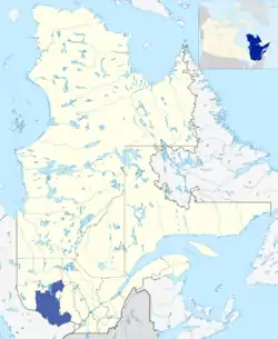
Outaouais (/uːtəweɪ/, French pronunciation: [utawɛ]; also commonly called The Outaouais) is a region of western Quebec, Canada. It includes the city of Gatineau (Hull, Aylmer, Gatineau, Masson-Angers, Buckingham), the Pontiac region, and the town of Maniwaki, and is located on the north side of the Ottawa River opposite Canada's capital, Ottawa. It has a land area of 30,808.69 square kilometres (11,895.30 sq mi) and its population was 382,604 inhabitants as of the 2016 Census.[1]
Outaouais | |
|---|---|
 | |
| Coordinates: 45°47′N 75°05′W | |
| Country | |
| Province | |
| Regional County Municipalities (RCM) and Equivalent Territories (ET) | |
| Government | |
| • Regional conference of elected officers | Paulette Lalande (President) |
| Area | |
| • Land | 30,808.69 km2 (11,895.30 sq mi) |
| Population (2016)[1] | |
| • Total | 382,604 |
| • Density | 12.4/km2 (32/sq mi) |
| Demonym(s) | Outaouaien(ne) |
| Time zone | UTC-5 (EST) |
| • Summer (DST) | UTC-4 (EDT) |
| Postal code | J |
| Area code | 819|873 |
| Website | outaouais.gouv.qc.ca |
| [2] | |
History
The name of the region comes from the French name for the Ottawa River, which in term comes from the French name for the Indigenous Odawa that lived near the region. Prior to European arrival in the region, the areas along the Ottawa River were commonly used by various tribes to trade and gather.
The oldest European settlement in the region is Hull (now a neighborhood of Gatineau) which was founded in 1800 by Philemon Wright as Wright's Town. The settlement quickly became involved in the lumber trade, which continued along the Ottawa River until the late 20th century. None of the original town buildings remain today, as they were destroyed in the 1900 Hull–Ottawa fire. Hull remained a city until 2002, when it was merged with several neighboring cities to form the current city of Gatineau.
Subdivisions
- Regional County Municipalities
| Regional County Municipality (RCM) | Population Canada 2011 Census[3] |
Land Area | Density (pop. per km2) |
Seat of RCM |
|---|---|---|---|---|
| La Vallée-de-la-Gatineau | 20,530 | 12,477.19 km2 (4,817.47 sq mi) | 1.6 | Gracefield |
| Les Collines-de-l'Outaouais | 46,393 | 2,048.24 km2 (790.83 sq mi) | 22.7 | Chelsea |
| Papineau | 22,541 | 2,941.82 km2 (1,135.84 sq mi) | 7.7 | Papineauville |
| Pontiac | 14,358 | 12,992.69 km2 (5,016.51 sq mi) | 1.1 | Campbell's Bay |
| Gatineau (Equivalent territory) | 265,349 | 342.98 km2 (132.43 sq mi) | 773.7 | Gatineau |
- First Nations Reserves
Major communities
School districts
Francophone
Anglophone
References
- "Census Profile, 2016 Census Outaouais [Economic region], Quebec". Statistics Canada. Retrieved November 22, 2019.
- "La région de l'Outaouais, ainsi que ses MRC et TE". Profils des régions et des MRC (in French). Quebec: Institut de la statistique du Québec. 2011. Archived from the original on 3 May 2012. Retrieved 11 September 2012.
- "Population and dwelling counts, for Canada, provinces and territories, and census divisions, 2011 and 2006 censuses". Canada 2011 Census. Statistics Canada. 2012-04-11. Retrieved 14 August 2013.
External links
| Wikimedia Commons has media related to Outaouais. |
- Portail régional de l'Outaouais Official website (in French)
- Répertoire des clubs de golf de la région de l'Outaouais (in French)
| Regional county municipalities and equivalent territories | |
|---|---|
| Municipalities | |
| Subdivisions | |
|---|---|
| Communities | |
| Major cities | |
| Regions | |
Portal:Canada | |
| Authority control |
|---|