Pontiac Regional County Municipality
Pontiac (French: municipalité régionale de comté de Pontiac) is a regional county municipality in the Outaouais region of Quebec, Canada. Campbell's Bay is the county seat. It should not be confused with the municipality of Pontiac, which is located in the neighbouring Les Collines-de-l'Outaouais Regional County Municipality.
Pontiac | |
|---|---|
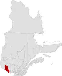 Location in province of Quebec | |
| Coordinates: 46°03′N 76°55′W[1] | |
| Country | |
| Province | |
| Region | Outaouais |
| Effective | January 1, 1983 |
| County seat | Campbell's Bay |
| Government | |
| • Type | Prefecture |
| • Prefect | Jane Toller |
| Area | |
| • Total | 14,105.70 km2 (5,446.24 sq mi) |
| • Land | 12,991.82 km2 (5,016.17 sq mi) |
| Population (2016)[3] | |
| • Total | 14,251 |
| • Density | 1.1/km2 (3/sq mi) |
| • Change 2011-2016 | |
| • Dwellings | 10,208 |
| Time zone | UTC−5 (EST) |
| • Summer (DST) | UTC−4 (EDT) |
| Area code(s) | 819 |
| Website | www |
Subdivisions
There are 18 subdivisions within the RCM:[2]
|
|
|
|

Location of Pontiac in Outaouais Region
Demographics
Population
| Canada census – Pontiac Regional County Municipality community profile | |||
|---|---|---|---|
| 2016 | 2011 | 2006 | |
| Population: | 14,251 (-0.7% from 2011) | 14,358 (-1.6% from 2006) | 14,586 (+0.1% from 2001) |
| Land area: | 12,991.82 km2 (5,016.17 sq mi) | 12,992.69 km2 (5,016.51 sq mi) | 12,984.49 km2 (5,013.34 sq mi) |
| Population density: | 1.1/km2 (2.8/sq mi) | 1.1/km2 (2.8/sq mi) | 1.1/km2 (2.8/sq mi) |
| Median age: | 50.4 (M: 50.1, F: 50.8) | 47.8 (M: 47.3, F: 48.3) | 44.8 (M: 44.3, F: 45.4) |
| Total private dwellings: | 10,208 | 9,224 | 8,993 |
| Median household income: | $50,567 | $45,675 | $39,761 |
| References: 2016[4] 2011[5] 2006[6] earlier[7] | |||
| Year | Pop. | ±% |
|---|---|---|
| 1986 | 15,100 | — |
| 1991 | 15,111 | +0.1% |
| 1996 | 15,576 | +3.1% |
| 2001 | 14,565 | −6.5% |
| 2006 | 14,586 | +0.1% |
| 2011 | 14,358 | −1.6% |
| 2016 | 14,251 | −0.7% |
| Source: [8] | ||
Language
| Canada Census Mother Tongue - Pontiac Regional County Municipality, Quebec[8] | ||||||||||||||||||
|---|---|---|---|---|---|---|---|---|---|---|---|---|---|---|---|---|---|---|
| Census | Total | French |
English |
French & English |
Other | |||||||||||||
| Year | Responses | Count | Trend | Pop % | Count | Trend | Pop % | Count | Trend | Pop % | Count | Trend | Pop % | |||||
2016 |
14,105 |
5,635 | 40.0% | 8,020 | 56.9% | 275 | 1.9% | 195 | 1.4% | |||||||||
2011 |
14,170 |
5,735 | 40.5% | 8,015 | 56.7% | 250 | 1.8% | 170 | 1.2% | |||||||||
2006 |
14,435 |
5,930 | 41.1% | 8,190 | 56.7% | 115 | 0.8% | 200 | 1.4% | |||||||||
2001 |
14,370 |
5,500 | 38.3% | 8,220 | 57.2% | 350 | 2.4% | 300 | 2.1% | |||||||||
1996 |
15,405 |
5,970 | n/a | 38.8% | 9,000 | n/a | 58.4% | 270 | n/a | 1.8% | 165 | n/a | 1.1% | |||||
| Note: Percentages may not equal 100% due to multiple responses and rounding. | ||||||||||||||||||
Transportation
See also
References
- Reference number 141046 of the Commission de toponymie du Québec (in French)
- Geographic code 840 in the official Répertoire des municipalités (in French)
- "Census Profile, 2016 Census - Pontiac, Municipalité régionale de comté [Census division], Quebec and Quebec [Province]". www12.statcan.gc.ca. Government of Canada - Statistics Canada. 8 February 2017. Retrieved 26 November 2019.
- "2016 Community Profiles". 2016 Canadian Census. Statistics Canada. February 21, 2017. Retrieved 2019-11-26.
- "2011 Community Profiles". 2011 Canadian Census. Statistics Canada. July 5, 2013. Retrieved 2014-02-25.
- "2006 Community Profiles". 2006 Canadian Census. Statistics Canada. March 30, 2011. Retrieved 2014-02-25.
- "2001 Community Profiles". 2001 Canadian Census. Statistics Canada. February 17, 2012.
- Statistics Canada: 1996, 2001, 2006, 2011 census
- Official Transport Quebec Road Map
External links
| Wikimedia Commons has media related to Pontiac Regional County Municipality. |
Adjacent Counties & Equivalent Territories | |
|---|---|
| Regional county municipalities and equivalent territories | |
|---|---|
| Municipalities | |
This article is issued from Wikipedia. The text is licensed under Creative Commons - Attribution - Sharealike. Additional terms may apply for the media files.
