Papineauville, Quebec
Papineauville is a town and municipality in the Outaouais region of Quebec, Canada. It is the seat of the Papineau Regional County Municipality. In 2001 its population was 2247.
Papineauville | |
|---|---|
 | |
 Location within Papineau RCM | |
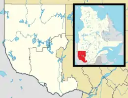 Papineauville Location in western Quebec | |
| Coordinates: 45°37′N 75°01′W[1] | |
| Country | Canada |
| Province | Quebec |
| Region | Outaouais |
| RCM | Papineau |
| Settled | c. 1850 |
| Constituted | November 29, 2000 |
| Government | |
| • Mayor | Christian Beauchamp |
| • Federal riding | Argenteuil—Papineau—Mirabel |
| • Prov. riding | Papineau |
| Area | |
| • Total | 64.90 km2 (25.06 sq mi) |
| • Land | 61.33 km2 (23.68 sq mi) |
| Population (2016)[3] | |
| • Total | 2,101 |
| • Density | 34.3/km2 (89/sq mi) |
| • Pop 2011-2016 | |
| • Dwellings | 1,086 |
| Time zone | UTC−5 (EST) |
| • Summer (DST) | UTC−4 (EDT) |
| Postal code(s) | J0V 1R0 |
| Area code(s) | 819 |
| Highways | |
| Website | www |
The municipality is bordered on the north side by the Petite-Nation River and on the south side by Pentecost Bay of the Ottawa River.
History
The Parish of Sainte-Angélique was formed in 1851, and the parish municipality with the same name was created in 1855. It was named after Angélique-Louise Cornud, wife of Denis-Benjamin Papineau, who donated land for the construction of the church and the rectory.[4]
Also in 1855, a post office was established with the name Papineauville. This may be named in honour of one of two persons named Papineau: Joseph Papineau (1752–1841), father of Louis-Joseph Papineau, who in 1801 bought the lordship of the Petite-Nation where the town formed; or Denis-Benjamin Papineau (1789–1854), brother of Louis-Joseph and husband of Angélique-Louise, and considered the founder of this place.[5]
In 1896, the Village Municipality of Papineauville separated from Sainte-Angélique. Its first mayor was Henri Bourassa.[5]
On November 29, 2000, the Village Municipality of Papineauville and the Parish Municipality of Sainte-Angélique were reunited and merged into the new Municipality of Papineauville.[5] The name Sainte-Angélique now identifies the sector of Papineauville which corresponds to the territory of the former parish municipality.[4]
On January 1, 2002, about 13 square kilometres (5.0 sq mi) of the Presqu'île Peninsula in the Ottawa River was transferred to the municipality of Plaisance.
Demographics
| Canada census – Papineauville, Quebec community profile | |||
|---|---|---|---|
| 2016 | 2011 | ||
| Population: | 2,101 (-3.0% from 2011) | 2,165 (-0.1% from 2006) | |
| Land area: | 61.33 km2 (23.68 sq mi) | 61.22 km2 (23.64 sq mi) | |
| Population density: | 34.3/km2 (89/sq mi) | 35.4/km2 (92/sq mi) | |
| Median age: | 48.8 (M: 48.6, F: 49.0) | 47.8 (M: 46.3, F: 48.7) | |
| Total private dwellings: | 1,086 | 1,078 | |
| Median household income: | $52,843 | $48,038 | |
| References: 2016[6] 2011[7] earlier[8] | |||
| Year | Pop. | ±% |
|---|---|---|
| 1986 | 2,166 | — |
| 1991 | 2,229 | +2.9% |
| 1996 | 2,262 | +1.5% |
| 2001 | 2,150 | −5.0% |
| 2006 | 2,167 | +0.8% |
| 2011 | 2,165 | −0.1% |
| 2016 | 2,101 | −3.0% |
| Population amounts prior to 2000 are total of Papineauville VL and Sainte-Angélique P. Source: Statistics Canada | ||
Mother tongue:[3]
- English as first language: 2.1%
- French as first language: 95.2%
- English and French as first language: 1.4%
- Other as first language: 1.2%
Local government

List of former mayors:
- André Blais (2005–2009)
- Gilles Clément (2009-2013)
- Christian Beauchamp (2013–present)
Education
The community is served by the French school board Commission Scolaire au Coeur des Vallees including École secondaire Louis-Joseph Papineau.
References
- Reference number 364753 of the Commission de toponymie du Québec (in French)
- Geographic code 80037 in the official Répertoire des municipalités (in French)
- "(Code 2480037) Census Profile". 2016 census. Statistics Canada. 2017.
- "Sainte-Angélique (Municipalité de paroisse)" (in French). Commission de toponymie du Québec. Retrieved 2008-10-06.
- "Papineauville (Municipalité de village)" (in French). Commission de toponymie du Québec. Archived from the original on 2016-03-03. Retrieved 2008-10-06.
- "2016 Community Profiles". 2016 Canadian Census. Statistics Canada. February 21, 2017. Retrieved 2020-01-30.
- "2011 Community Profiles". 2011 Canadian Census. Statistics Canada. July 5, 2013. Retrieved 2020-01-30.
- "2001 Community Profiles". 2001 Canadian Census. Statistics Canada. February 17, 2012.
External links
| Wikimedia Commons has media related to Papineauville. |
- Web site (French language only)
Places adjacent to Papineauville, Quebec | |
|---|---|
| Cities | |
|---|---|
| Municipalities | |
| Townships | |
| |
| Authority control |
|
|---|