Paulo Lopes
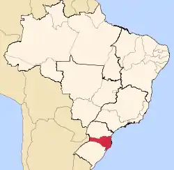
Paulo Lopes is a municipality in the state of Santa Catarina in the South region of Brazil.[3][4]
Paulo Lopes | |
|---|---|
Municipality | |
| The Municipality of Paulo Lopes | |
 Flag  Seal | |
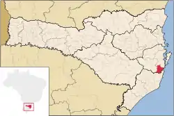 Location of Paulo Lopes in Santa Catarina state | |
| Coordinates: 27°57′43″S 48°41′02″W | |
| Country | |
| Region | South |
| State | Santa Catarina |
| Founded | December 21, 1961 |
| Government | |
| • Mayor | Evandro João dos Santos (PMDB) |
| Area | |
| • Total | 450.372 km2 (173.890 sq mi) |
| Elevation | 2 m (7 ft) |
| Population (2020 [1]) | |
| • Total | 7,569 |
| • Density | 17/km2 (44/sq mi) |
| Time zone | UTC-3 (UTC-3) |
| • Summer (DST) | UTC-2 (UTC-2) |
| HDI (2000) | 0.759 – medium[2] |
The municipality contains part of the 84,130 hectares (207,900 acres) Serra do Tabuleiro State Park, a protected area created in 1975. The lushly-forested park protects the sources of the Vargem do Braço, Cubatão and D'Una rivers, which supply most of the drinking water for greater Florianópolis and the south coast region.[5]
References
- IBGE 2020
- Archived 2009-10-03 at the Wayback Machine - UNDP
- "Divisão Territorial do Brasil" (in Portuguese). Divisão Territorial do Brasil e Limites Territoriais, Instituto Brasileiro de Geografia e Estatística (IBGE). July 1, 2008. Retrieved December 17, 2009.
- "Produto Interno Bruto dos Municípios 2002-2005" (PDF) (in Portuguese). Instituto Brasileiro de Geografia e Estatística (IBGE). December 19, 2007. Archived from the original (PDF) on October 2, 2008. Retrieved December 17, 2009.
- Parque Estadual da Serra do Tabuleiro (in Portuguese), FATMA: Fundação do meio Ambiente, retrieved 2016-06-11
Capital: Florianópolis | |||||||||
| Grande Florianópolis |
|  | |||||||
| Norte Catarinense |
| ||||||||
| Oeste Catarinense | |||||||||
| Serrana |
| ||||||||
| Sul Catarinense |
| ||||||||
| Vale do Itajai |
| ||||||||
This article is issued from Wikipedia. The text is licensed under Creative Commons - Attribution - Sharealike. Additional terms may apply for the media files.
