Urupema
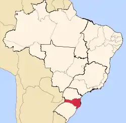
Urupema is a municipality in the state of Santa Catarina in the South region of Brazil.[2][3][4][5] It has an area of approximately 353 km² and a population of 2,459 inhabitants as of 2020. It is often cited as the coldest city in Brazil.
Urupema | |
|---|---|
Municipality | |
 Flag  Seal | |
 | |
| Country | |
| Region | South |
| State | Santa Catarina |
| Mesoregion | Serrana |
| Government | |
| • Mayor | Evandro Frigo Pereira (PP) |
| Area | |
| • Total | 353 km2 (136 sq mi) |
| Elevation | 1,335 m (4,380 ft) |
| Population (2020 [1]) | |
| • Total | 2,459 |
| • Density | 7.0/km2 (18/sq mi) |
| Time zone | UTC -3 |
Early history
The name Urupema (with variations including urupemba, arupemba, gurupema and jurupema) refers to a sieve made of vegetal fiber and used domestically to sieve cornmeal and cassava flour and in fishing.
The city's first inhabitants were attracted by the abundance of resources provided by the local Paraná pines, a coniferous tree which, at the time, was the main source of food for native populations during fall and winter. Unlike Amerindians in North America who used the fur of bisons and moose, the natives of Brazil did not had any similar large animals available.
Urupema became a municipality on 4 January 1988. Its patron saint is Saint Anne.
Climate
Urupema has a temperate oceanic climate (Köppen Cfb). Together with São Joaquim, Urubici, Bom Jardim da Serra and São José dos Ausentes, Urupema is considered the coldest city in Brazil if the maximum average temperature and the number of cold hours are considered. It is also the coldest in terms of absolute minimums together with Bom Jardim da Serra.[6][7] Snowfall occurs during the winter and less frequently in fall and spring.
| Climate data for Urupema (2010–2019) | |||||||||||||
|---|---|---|---|---|---|---|---|---|---|---|---|---|---|
| Month | Jan | Feb | Mar | Apr | May | Jun | Jul | Aug | Sep | Oct | Nov | Dec | Year |
| Record high °C (°F) | 31.1 (88.0) |
32.3 (90.1) |
28.5 (83.3) |
27.5 (81.5) |
25.2 (77.4) |
23.5 (74.3) |
25.7 (78.3) |
27.8 (82.0) |
28.8 (83.8) |
29.4 (84.9) |
28.5 (83.3) |
30.5 (86.9) |
32.3 (90.1) |
| Average high °C (°F) | 24.5 (76.1) |
24.5 (76.1) |
22.1 (71.8) |
20.0 (68.0) |
16.4 (61.5) |
15.2 (59.4) |
15.6 (60.1) |
17.4 (63.3) |
18.5 (65.3) |
19.6 (67.3) |
21.5 (70.7) |
23.5 (74.3) |
19.9 (67.8) |
| Daily mean °C (°F) | 18.1 (64.6) |
18.3 (64.9) |
15.8 (60.4) |
13.5 (56.3) |
10.4 (50.7) |
8.5 (47.3) |
8.9 (48.0) |
10.5 (50.9) |
12.0 (53.6) |
13.5 (56.3) |
15.0 (59.0) |
17.3 (63.1) |
13.5 (56.3) |
| Average low °C (°F) | 12.8 (55.0) |
13.5 (56.3) |
10.7 (51.3) |
7.9 (46.2) |
5.1 (41.2) |
2.7 (36.9) |
3.2 (37.8) |
4.4 (39.9) |
6.2 (43.2) |
8.0 (46.4) |
9.2 (48.6) |
12.0 (53.6) |
8.0 (46.4) |
| Record low °C (°F) | 1.4 (34.5) |
1.5 (34.7) |
−1.7 (28.9) |
−4.4 (24.1) |
−6.8 (19.8) |
−9.2 (15.4) |
−7.5 (18.5) |
−8.3 (17.1) |
−6.3 (20.7) |
−4.7 (23.5) |
−1.8 (28.8) |
0.1 (32.2) |
−9.2 (15.4) |
| Source: EPAGRI/CIRAM[8] | |||||||||||||
References
- IBGE 2020
- "Divisão Territorial do Brasil" (in Portuguese). Divisão Territorial do Brasil e Limites Territoriais, Instituto Brasileiro de Geografia e Estatística (IBGE). July 1, 2008. Retrieved December 17, 2009.
- "Estimativas da população para 1º de julho de 2009" (PDF) (in Portuguese). Estimativas de População, Instituto Brasileiro de Geografia e Estatística (IBGE). August 14, 2009. Retrieved December 17, 2009.
- "Ranking decrescente do IDH-M dos municípios do Brasil" (in Portuguese). Atlas do Desenvolvimento Humano, Programa das Nações Unidas para o Desenvolvimento (PNUD). 2000. Retrieved December 17, 2009.
- "Produto Interno Bruto dos Municípios 2002-2005" (PDF) (in Portuguese). Instituto Brasileiro de Geografia e Estatística (IBGE). December 19, 2007. Retrieved December 17, 2009.
- "Cidades de Santa Catarina travam guerra por título de mais fria do país". Folha de S.Paulo (in Portuguese). 2018-06-21. Retrieved 2018-11-18.
- "Cidades de SC têm temperaturas abaixo de -6ºC - Brasil - Estadão". Estadão (in Portuguese). Retrieved 2018-11-18.
- "EPAGRI/CIRAM". "Urupema (Epagri/Ciram)".
Capital: Florianópolis | |||||||||
| Grande Florianópolis |
|  | |||||||
| Norte Catarinense |
| ||||||||
| Oeste Catarinense | |||||||||
| Serrana |
| ||||||||
| Sul Catarinense |
| ||||||||
| Vale do Itajai |
| ||||||||