Pesawaran Regency
Pesawaran Regency is a regency (kabupaten) of Lampung Province, Sumatra, Indonesia. It covers an area of 1,173.77 km2, and had a population of 398,848 at the 2010 Census;[2] the latest official estimate (as at mid 2019) was 444,380.[3] The regency seat is the town of Gedong Tataan. This regency was formerly part of South Lampung Regency from which it was separated in 2007.
Pesawaran Regency
(Kabupaten Pesawaran) | |
|---|---|
 Coat of arms | |
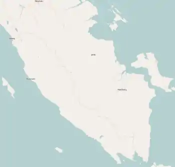
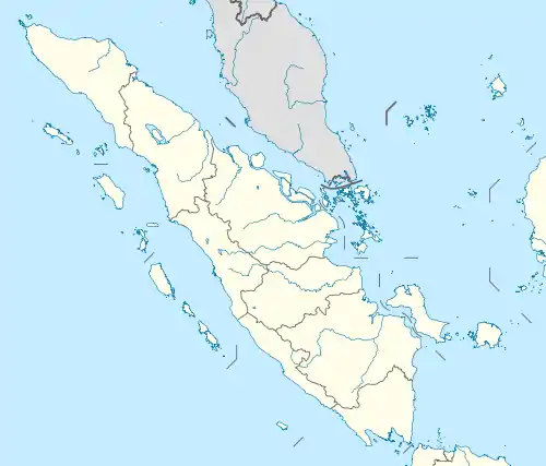
 Location within Lampung | |
| Coordinates: 5.4298°S 105.1790°E | |
| Country | Indonesia |
| Province | Lampung |
| Regency seat | Gedong Tataan |
| Government | |
| • Regent | Dendi Ramadhona |
| • Vice Regent | Eriawan |
| Area | |
| • Total | 1,173.77 km2 (453.20 sq mi) |
| Population (2019)[1] | |
| • Total | 444,380 |
| • Density | 380/km2 (980/sq mi) |
| Time zone | UTC+7 (IWST) |
| Area code | (+62) 721 |
| Website | pesawarankab |

Administrative divisions
Administratively at 2010 the regency was divided into seven districts (kecamatan). However, since 2010 four new districts have been created from parts of existing districts, bringing the total to eleven districts. The four new districts were Marga Punduh, Teluk Pandan, Way Khilau and Way Ratai. The eleven districts are tabulated below with their areas and their populations at the 2010 Census,[4] together with the latest official estimates (for mid 2019).[5] The table also includes the number of administrative villages (rural desa and urban kelurahan) in each district and its post code.
| Name | Area in km2 | Pop'n Census 2010 | Pop'n Estimate mid 2019 | No. of vill. | Post code |
|---|---|---|---|---|---|
| Punduh Pidada (a) | 115.79 | 25,943 | 13,619 | 11 | 35454 |
| Marga Punduh | 111.00 | (b) | 13,744 | 10 | 35453 |
| Padang Cermin (c) | 317.63 | 88,795 | 29,181 | 16 | 35351 |
| Teluk Pandan | (d) | (b) | 38,007 | 10 | 35350 |
| Wai Ratai | (d) | (b) | 36,740 | 10 | 35455 |
| Kedondong | 67.00 | 57,698 | 34,573 | 13 | 35368 |
| Wai Khilau | 64.11 | (b) | 27,448 | 9 | 35369 |
| Wai Lima | 99.83 | 29,442 | 31,148 | 16 | 35367 |
| Gedong Tataan | 97.06 | 86,059 | 99,982 | 19 | 35366 |
| Negeri Katon | 152.69 | 61,158 | 66,860 | 19 | 35353 |
| Tegineneng | 151.26 | 49,753 | 53,078 | 16 | 35363 |
| Totals | 1,173.77 | 398,848 | 444,380 | 144 |
Notes: (a) the district includes 30 islands off the south coast of Sumatra, the largest being Pulau Legundi and Pulau Siancal. (b) the population at 2010 census of these four new districts is included in the figure for the district from which they were separated. (c) the district includes 7 islands off the south coast of Sumatra. (d) the areas of Teluk Pandan District and Wai Ratai District are included in the figure quoted for Padang Cermin District, from which they were separated on 18 November 2014.
History
In September 2010, a number of people in Umbul Baru were rushed to a community health center after consuming water poisoned by industrial waste which was allegedly dumped in the Cikantor River by the gold mining company PT Napal Umbar Picung (NUP).[6]
References
- Badan Pusat Statistik, Jakarta, 2020.
- Biro Pusat Statistik, Jakarta, 2011.
- Badan Pusat Statistik, Jakarta, 2020.
- Biro Pusat Statistik, Jakarta, 2011.
- Badan Pusat Statistik, Jakarta, 2020.
- "Environment Watch: Lampung gold mines 'polluting' waters". Jakarta Post. 3 September 2010. Retrieved 22 February 2011.
Regencies and cities of Lampung | ||
|---|---|---|
Capital: Bandar Lampung | ||
| Regencies | ||
| Cities | ||