Port-Saint-Père
Port-Saint-Père is a commune in the Loire-Atlantique department in western France.
Port-Saint-Père | |
|---|---|
Commune | |
.jpg.webp) | |
 Coat of arms | |
Location of Port-Saint-Père 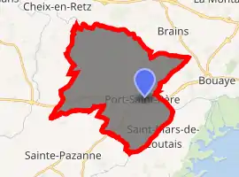
| |
 Port-Saint-Père  Port-Saint-Père | |
| Coordinates: 47°08′00″N 1°45′00″W | |
| Country | France |
| Region | Pays de la Loire |
| Department | Loire-Atlantique |
| Arrondissement | Nantes |
| Canton | Machecoul |
| Intercommunality | Cœur Pays de Retz |
| Government | |
| • Mayor (2020–2026) | Gaëtan Léauté |
| Area 1 | 32.57 km2 (12.58 sq mi) |
| Population (2017-01-01)[1] | 2,913 |
| • Density | 89/km2 (230/sq mi) |
| Time zone | UTC+01:00 (CET) |
| • Summer (DST) | UTC+02:00 (CEST) |
| INSEE/Postal code | 44133 /44710 |
| Elevation | 0–52 m (0–171 ft) |
| 1 French Land Register data, which excludes lakes, ponds, glaciers > 1 km2 (0.386 sq mi or 247 acres) and river estuaries. | |
Population
| Year | Pop. | ±% |
|---|---|---|
| 1800 | 1,232 | — |
| 1806 | 1,212 | −1.6% |
| 1821 | 1,563 | +29.0% |
| 1831 | 1,730 | +10.7% |
| 1841 | 1,826 | +5.5% |
| 1851 | 1,828 | +0.1% |
| 1861 | 1,897 | +3.8% |
| 1872 | 1,946 | +2.6% |
| 1881 | 1,902 | −2.3% |
| 1891 | 1,812 | −4.7% |
| 1901 | 1,782 | −1.7% |
| 1911 | 1,682 | −5.6% |
| 1921 | 1,511 | −10.2% |
| 1931 | 1,363 | −9.8% |
| 1946 | 1,311 | −3.8% |
| 1954 | 1,311 | +0.0% |
| 1962 | 1,349 | +2.9% |
| 1968 | 1,361 | +0.9% |
| 1975 | 1,370 | +0.7% |
| 1982 | 1,716 | +25.3% |
| 1990 | 1,695 | −1.2% |
| 1999 | 2,141 | +26.3% |
| 2006 | 2,533 | +18.3% |
| 2017 | 2,913 | +15.0% |
Sights
- Planète Sauvage, safari park
Transport
Gare de Port-Saint-Père-Saint-Mars is served by train services between Pornic, Saint-Gilles-Croix-de-Vie and Nantes.
References
- "Populations légales 2017". INSEE. Retrieved 6 January 2020.
| Wikimedia Commons has media related to Port-Saint-Père. |
| Authority control |
|
|---|
This article is issued from Wikipedia. The text is licensed under Creative Commons - Attribution - Sharealike. Additional terms may apply for the media files.