Potlatch (software)
Potlatch is a free software editing tool for OpenStreetMap geodata using Adobe AIR. For many years embedded directly within the OpenStreetMap website using Adobe Flash, it was rebuilt as a desktop application following the end-of-lifing of Flash. It continues to be actively maintained.
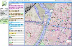 Potlatch 2 with OpenStreetMap data | |
| Developer(s) | Richard Fairhurst |
|---|---|
| Stable release | 3.0
/ December 30, 2020 |
| Repository | |
| Written in | ActionScript |
| Platform | Adobe AIR |
| Available in | 94 languages |
| Type | GIS software |
| License | WTFPL |
| Website | www |
History
Potlatch 1 was released mid 2006 and was the default editor on the main OpenStreetMap site until it was replaced by Potlatch 2 in April 2011. The name Potlatch came from the name of newsletter of the Lettrist International art collective.[1]
An alpha version of Potlatch 2, a complete reimplementation of the software, was published in summer 2010. In December 2010, Potlatch 2 was released for general use. After Microsoft had granted OpenStreetMap permission to use aerial imagery from their Bing Maps service for tracing, Potlatch 2 was extended to display these images in the background.
In 2020, the OpenStreetMap Foundation provided €2,500 funding for Potlatch to be ported to Adobe AIR, so that it could continue to run as a desktop application for Microsoft Windows and Apple Macintosh after Flash was disabled in web browsers. The desktop version was subsequently released as Potlatch 3.
iD began as a reimplementation of Potlatch 2 architecture in JavaScript.[1][2]
References
- Fairhurst, Richard. "It all starts with an editor". Archived from the original on 2012-10-23. Retrieved 2012-11-02.
- MacWright, Tom. "iD Updates". MapBox. Archived from the original on 12 December 2013. Retrieved 20 November 2012.
Further reading
- Ramm, Frederik; Topf, Jochen; Chilton, Steve (2010). OpenStreetMap: Using and Enhancing the Free Map of the World. UIT Cambridge. p. 386. ISBN 978-1-906860-11-0.
OpenStreetMap (OSM) | ||
|---|---|---|
| Related persons, organizations and events | ||
| OSM-based movements | ||
| Service providers (commercial) | ||
| OSM editors | ||
| OSM map renders | ||
| Software using OSM database |
| |
| Similar free projects | ||
| Proprietary equivalents | ||