Rattlesnake Hills
The Rattlesnake Hills, also known as Rattlesnake Ridge,[1] is a 16-mile (26 km) long anticline mountain ridge in Yakima County and Benton County in the U.S. state of Washington. It should not be confused with the much smaller Rattlesnake Ridge located near the west end of Ahtanum Ridge.[2] The highest point in the hills (as well as Benton County) is the 3,629 feet (1,106 m) Lookout Summit, which surpasses the more well-known Rattlesnake Mountain by approximately 100 ft (30 m).[3] The Rattlesnake Hills are part of the Yakima Fold Belt of east-tending long ridges formed by the folding of Miocene Columbia River basalt flows.[4]
| Rattlesnake Hills | |
|---|---|
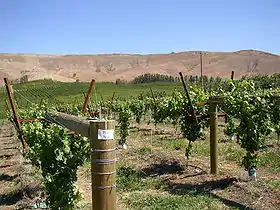 Rattlesnake Hills behind a vineyard. | |
| Highest point | |
| Peak | Lookout Summit |
| Elevation | 3,629 ft (1,106 m) |
| Geography | |
| Country | United States |
| State | Washington |
| County | Yakima and Benton |
| Range coordinates | 46°27′N 119°50′W |
The Rattlesnake Hills form the northern edge of the Yakima Valley, running from the vicinity of Benton City to just south of the city of Yakima, where the Yakima River cuts through the mountain ridge via Union Gap. To the west of the Yakima River the mountain ridge is known as Ahtanum Ridge.
North of the Rattlesnake Hills is Moxee Valley and the Black Rock Valley. The hills extend into the Hanford Site. A spur on the north side of the ridge nearly connects with the west end of Yakima Ridge.
Roza Canal, used for agricultural irrigation, passes under the Rattlesnake Hills through a tunnel.
Named high points of the Rattlesnake Hills, according to the USGS, include Elephant Mountain, Zillah Peak, Eagle Peak, High Top, Lookout, and Rattlesnake Mountain.
2018 Rattlesnake Ridge landslide
As of January 21, 2018, a large but slow landslide is occurring in the Rattlesnake Hills, about 3 miles south of Yakima in Washington, USA. The event first drew news coverage in late 2017, after a long fissure was discovered high on Rattlesnake Ridge: this fissure was reported to be 250 feet deep in one place.[5] The first road closure for public safety was reported on December 17, 2017. The Washington State Department of Natural Resources has a web-page providing information on the event, which reports that the moving mass of basalt is about 4 million tons, covering about 20 acres, and it is slipping roughly south at a rate of about 1.5 feet per week.[6]
On the weekend of January 20–21, 2018 there was flurry of new reporting, which highlighted a developing consensus that the landslide will at some time collapse suddenly, and that is likely to occur within months if not weeks.[7][8][9][10][11]
See also
References
- U.S. Geological Survey Geographic Names Information System: Rattlesnake Hills
- U.S. Geological Survey Geographic Names Information System: Rattlesnake Ridge
- Rattlesnake Hills Lookout, Washington, Peakbagger.com
- Complete Report for Saddle Mountains structures Archived 2011-07-21 at the Wayback Machine, USGS Earthquake Hazards Program
- "250-foot-deep crack in earth prompts landslide warnings at Rattlesnake Ridge near Union Gap". December 22, 2017.
- "Rattlesnake Hills Landslide - WA - DNR". www.dnr.wa.gov.
- "Landslide watch: Can experts predict collapse at Washington's Rattlesnake Ridge?". January 21, 2018.
- Bressan, David. "The Rattlesnake Ridge - A Landslide In The Making".
- EndPlay (January 20, 2018). "New images show intimidating landslide moving down Rattlesnake Ridge".
- "Giant crack on Washington's Rattlesnake Ridge prompts evacuations". ABC News. January 5, 2018.
- moliver@yakimaherald.com, By Miles Jay Oliver. "Rep. Newhouse receives briefing on Rattlesnake Ridge".