Ray, Indiana and Michigan
Ray is an unincorporated community in both Steuben County, Indiana and Branch County, Michigan in the United States. Located along the local "State Line Road," the small community straddles the border between the two states. The Indiana Northeastern Railroad travels southwest-northeast through Ray.[1] Its elevation is 1,079 feet (329 m), making it the highest populated place in northern Indiana.[2]
Ray, Indiana and Michigan | |
|---|---|
 Ray Community Church, on the Indiana side | |
 Location within the state of Michigan with Indiana to the southwest | |
| Coordinates: 41°45′35″N 84°52′19″W | |
| Country | United States |
| States | Michigan and Indiana |
| Counties | Branch and Steuben |
| Elevation | 1,079 ft (329 m) |
| Time zone | UTC-5 (Eastern (EST)) |
| • Summer (DST) | UTC-4 (EDT) |
| ZIP codes | 49255 (Montgomery, MI), 46737 (Fremont, IN) |
| GNIS feature ID | 635676 |
Indiana
The Indiana half of Ray lies in northeastern Fremont Township in the northeastern part of Steuben County. Surrounding towns include Clear Lake to the southeast and Fremont to the southwest.[3] The former Cedar Lake, now a marshy area, lies southwest of Ray and east of Fremont.[1] Ray once ran a post office from 1872 to 1960.[4] The residents are now served by the Fremont, IN 46737 post office in Indiana and the Montgomery, MI 49255 post office in Michigan.[5]
Michigan
The Michigan half of Ray lies at the intersection of Delmar Road with State Line Road in the far southeastern corner of Branch County, on the southern edge of California Township. Nearby surrounding communities include California directly to the north; Quincy almost directly to the north; Montgomery to the east-northeast; and Coldwater (the county seat)[6] to the northwest.[1]
References
- DeLorme. Michigan Atlas & Gazetteer. 11th ed. Yarmouth: DeLorme, 2003, p. 22. ISBN 0-89933-335-4.
- "Ray, Indiana and Michigan". Geographic Names Information System. United States Geological Survey. Retrieved September 29, 2016.
- DeLorme. Indiana Atlas & Gazetteer. 3rd ed. Yarmouth: DeLorme, 2004, p. 23. ISBN 0-89933-319-2.
- "Steuben County". Jim Forte Postal History. Retrieved September 29, 2016.
- USPS ZIP Code Lookup, United States Postal Service Accessed 2012-03-04.
- "Find a County". National Association of Counties. Retrieved 2011-06-07.
Municipalities and communities of Steuben County, Indiana, United States | ||
|---|---|---|
| City | Map of Indiana highlighting Steuben County | |
| Towns | ||
| Townships | ||
| Unincorporated communities |
| |
| Footnotes | ‡This populated place also has portions in an adjacent county or counties | |
| ||
Municipalities and communities of Branch County, Michigan, United States | ||
|---|---|---|
| Cities | 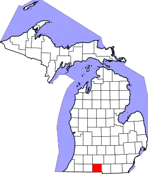 Map of Michigan highlighting Branch County.svg | |
| Villages | ||
| Townships | ||
| Unincorporated communities | ||
| Footnotes | ‡This populated place also has portions in an adjacent county or counties | |
| ||