Steuben County, Indiana
Steuben County is a county in the northeast corner of the U.S. state of Indiana. As of the 2010 United States Census the county population was 34,185.[1] The county seat (and only incorporated city) is Angola.[2]
Steuben County | |
|---|---|
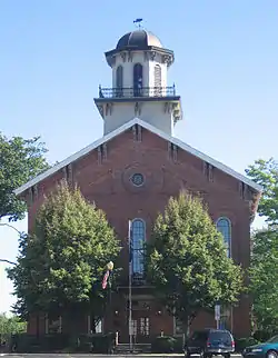 Steuben County Courthouse in Angola (on the National Register of Historic Places). | |
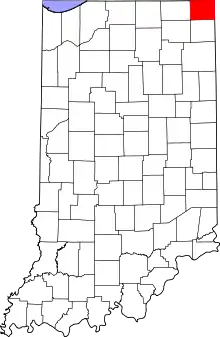 Location within the U.S. state of Indiana | |
 Indiana's location within the U.S. | |
| Coordinates: 41°38′N 85°00′W | |
| Country | |
| State | |
| Founded | 5 February 1836 (authorized) 1837 (organized) |
| Named for | Baron Frederick von Steuben |
| Seat | Angola |
| Largest city | Angola |
| Area | |
| • Total | 322.47 sq mi (835.2 km2) |
| • Land | 308.94 sq mi (800.2 km2) |
| • Water | 13.53 sq mi (35.0 km2) 4.20%% |
| Population | |
| • Estimate (2018) | 34,586 |
| • Density | 112/sq mi (43/km2) |
| Time zone | UTC−5 (Eastern) |
| • Summer (DST) | UTC−4 (EDT) |
| Congressional district | 3rd |
| Website | Official County Website |
| Indiana county number 76 | |
Steuben County comprises the Angola, IN Micropolitan Statistical Area.
History
After the American Revolutionary War established US sovereignty over the territory of the upper midwest, the new federal government defined the Northwest Territory in 1787 which included the area of present-day Indiana. In 1800, Congress separated Ohio from the Northwest Territory, designating the rest of the land as the Indiana Territory. President Thomas Jefferson chose William Henry Harrison as the governor of the territory, and Vincennes was established as the capital. After the Michigan Territory was separated and the Illinois Territory was formed, Indiana was reduced to its current size and geography. By December 1816 the Indiana Territory was admitted to the Union as a state.
This area was historically occupied by the Potawatomi people, one of the tribes in the Council of Three Fires. Typically they lived in highly decentralized bands. Treaties signed by some leaders with United States representatives ceded large areas of their territory to the US. Starting in 1794, Native American titles to Indiana lands were extinguished by usurpation, purchase, or war and treaty. The United States acquired land from the Native Americans in the 1809 treaty of Fort Wayne, by the treaty of St. Mary's in 1818, and in 1826 by the Treaty of Mississinewas, which included the future Steuben County.
The Indiana State Legislature passed an omnibus county bill[3] on 7 February 1835 that authorized the creation of thirteen counties in northeast Indiana, including Steuben.[4] In 1837 the county was organized. It was named for Baron Frederick von Steuben, an officer of the American Revolutionary War.[5] In 1840 the Potawatomi were forcibly removed from this area and neighboring territory in Michigan and Ohio to Indian Territory in Kansas.
A Potawatomi chief, Baw Beese, led a band that was based at what later became known as Baw Beese Lake nearby in Michigan. His daughter Winona married Negnaska and lived in what is now Indiana. She was executed in the 1830s by her husband's people after she killed Negnaska for selling her pony.[6] Winona's husband had pledged his rifle to Aaron B. Goodwin of Fremont for the use of a 5-gallon keg. The Indians had the keg filled with whiskey at Nichols' store in Jamestown, and he took all the money they had. Negnaska sold his wife Winona's pony in order to pawn his rifle. Winona owned the pony outright, either as a gift from her father or having bought it with her own money. She killed Negnaska in anger for selling what was hers. Winona was held by the tribe for a few hours, until her husband's nearest relative arrived to execute her. As was their custom, he stabbed her to the heart as she had her husband.[7]
John D. Barnard and Sheldon Havens encountered the Potawatomi group after the execution; they helped them move the bodies to a nearby grave that had been dug. The Indians did not bury the bodies until after the white men were out of sight. But Dr. B.F. Sheldon found out about it and exhumed the bodies for dissection a few days later, outraging the mourning Potawatomi. About two weeks later some Potawatomi returned the keg to Goodwin and tried to retrieve Negnaska's rifle, but Goodwin pretended not to know the man had been killed and refused to release the rifle to his friends.[7]
Geography
The county's low rolling hills have been largely cleared and leveled for agricultural use, although the drainage areas are still wooded.[8] The highest point (1,200 feet/366 meters ASL) is a hillock one mile (1.6 km) east of Glen Eden.[9]
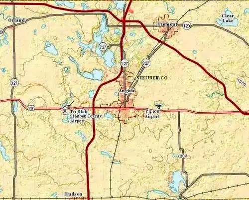
The county contains a state park and 105 lakes of various sizes. Some of the larger lakes are Lake James, Lake George, Clear Lake, Jimmerson Lake, Lake Gage, and Crooked Lake.
According to the 2010 census, the county has a total area of 322.47 square miles (835.2 km2), of which 308.94 square miles (800.2 km2) (or 95.80%) is land and 13.53 square miles (35.0 km2) (or 4.20%) is water.[10]
Adjacent counties
- Branch County, Michigan - north
- Hillsdale County, Michigan - northeast
- Williams County, Ohio - east
- DeKalb County - south
- Noble County - southwest
- LaGrange County - west
Major highways
Unincorporated communities
- Alvarado
- Berlien
- Circle Park
- Clarks Landing
- Cold Springs
- Courtney Corner
- Crooked Lake
- Ellis
- Flint
- Forest Park
- Fountain Park
- Glen Eden
- Helmer
- Indian Hills
- Inverness
- Island Park
- Jamestown
- Lake James
- Lakeside Park
- Meadow Shores Park
- Metz
- Moonlight
- Nevada Mills
- Oakwood
- Otsego Center
- Page
- Panama
- Penn Park
- Pleasant Lake
- Ravinia Oaks
- Ray
- Russels Point
- Salem Center
- Steubenville
- Turkey Creek
- Westview
- Wildwood
- York
Townships
Protected areas
- Cedar Lake Wetlands Conservation Area
- Marsh Lake Wetlands State Fish and Wildlife Area[8]
- Pokagon State Park
Climate and weather
| Angola, Indiana | ||||||||||||||||||||||||||||||||||||||||||||||||||||||||||||
|---|---|---|---|---|---|---|---|---|---|---|---|---|---|---|---|---|---|---|---|---|---|---|---|---|---|---|---|---|---|---|---|---|---|---|---|---|---|---|---|---|---|---|---|---|---|---|---|---|---|---|---|---|---|---|---|---|---|---|---|---|
| Climate chart (explanation) | ||||||||||||||||||||||||||||||||||||||||||||||||||||||||||||
| ||||||||||||||||||||||||||||||||||||||||||||||||||||||||||||
| ||||||||||||||||||||||||||||||||||||||||||||||||||||||||||||
In recent years, average temperatures in Angola have ranged from a low of 14 °F (−10 °C) in January to a high of 82 °F (28 °C) in July, although a record low of −27 °F (−33 °C) was recorded in January 1981 and a record high of 106 °F (41 °C) was recorded in July 1936. Average monthly precipitation ranged from 1.83 inches (46 mm) in February to 4.08 inches (104 mm) in August.[11]
Government
The county government is a constitutional body, and is granted specific powers by the Constitution of Indiana, and by the Indiana Code.
County Council: The legislative branch of the county government; controls spending and revenue collection in the county. Representatives are elected to four-year terms from county districts. They set salaries, the annual budget, and special spending. The council has limited authority to impose local taxes, in the form of an income and property tax that is subject to state level approval, excise taxes, and service taxes.[12][13]
Board of Commissioners: The executive body of the county; commissioners are elected county-wide to staggered four-year terms. One commissioner serves as president. The commissioners execute acts legislated by the council, collect revenue, and manage the county government.[12][13]
Court: The county maintains a small claims court that handles civil cases. The judge on the court is elected to a term of four years and must be a member of the Indiana Bar Association. The judge is assisted by a constable who is also elected to a four-year term. In some cases, court decisions can be appealed to the state level circuit court.[13]
County Officials: The county has other elected offices, including sheriff, coroner, auditor, treasurer, recorder, surveyor, and circuit court clerk. These officers are elected to four-year terms. Members elected to county government positions are required to declare party affiliations and to be residents of the county.[13]
Steuben County is part of Indiana's 3rd congressional district.
| Year | Republican | Democratic | Third parties |
|---|---|---|---|
| 2016 | 69.6% 10,133 | 25.7% 3,744 | 4.7% 689 |
| 2012 | 62.4% 8,547 | 35.4% 4,853 | 2.2% 295 |
| 2008 | 54.1% 7,674 | 44.3% 6,284 | 1.6% 230 |
| 2004 | 65.4% 8,433 | 33.7% 4,345 | 1.0% 127 |
| 2000 | 61.7% 6,953 | 36.4% 4,103 | 2.0% 221 |
| 1996 | 49.5% 5,513 | 37.1% 4,124 | 13.4% 1,493 |
| 1992 | 42.4% 4,868 | 31.7% 3,630 | 25.9% 2,971 |
| 1988 | 68.6% 6,855 | 31.1% 3,114 | 0.3% 31 |
| 1984 | 72.0% 6,424 | 27.4% 2,441 | 0.6% 56 |
| 1980 | 62.9% 5,670 | 28.9% 2,606 | 8.1% 732 |
| 1976 | 59.2% 5,079 | 38.8% 3,323 | 2.0% 173 |
| 1972 | 69.8% 5,636 | 29.7% 2,401 | 0.5% 38 |
| 1968 | 62.5% 4,762 | 29.8% 2,268 | 7.7% 588 |
| 1964 | 50.3% 4,075 | 49.3% 3,999 | 0.4% 31 |
| 1960 | 67.6% 5,464 | 32.0% 2,588 | 0.3% 27 |
| 1956 | 71.6% 5,538 | 28.1% 2,171 | 0.4% 30 |
| 1952 | 73.0% 5,322 | 25.9% 1,886 | 1.1% 80 |
| 1948 | 67.3% 4,341 | 30.9% 1,996 | 1.8% 115 |
| 1944 | 71.6% 4,739 | 27.8% 1,837 | 0.6% 42 |
| 1940 | 66.4% 5,056 | 33.1% 2,524 | 0.5% 40 |
| 1936 | 53.0% 3,998 | 45.1% 3,402 | 1.9% 145 |
| 1932 | 48.4% 3,594 | 50.0% 3,717 | 1.6% 117 |
| 1928 | 71.4% 4,435 | 27.8% 1,730 | 0.8% 51 |
| 1924 | 68.5% 4,046 | 27.3% 1,610 | 4.2% 249 |
| 1920 | 72.5% 4,963 | 24.5% 1,676 | 3.1% 209 |
| 1916 | 50.7% 2,418 | 29.9% 1,427 | 19.3% 922 |
| 1912 | 32.3% 1,290 | 31.7% 1,266 | 35.9% 1,433[15] |
| 1908 | 62.0% 2,704 | 33.3% 1,453 | 4.7% 204 |
| 1904 | 66.6% 2,864 | 29.3% 1,260 | 4.1% 177 |
| 1900 | 61.9% 2,715 | 34.7% 1,522 | 3.3% 146 |
| 1896 | 60.2% 2,655 | 37.9% 1,674 | 1.9% 84 |
| 1892 | 55.7% 2,100 | 33.6% 1,264 | 10.7% 404 |
| 1888 | 61.1% 2,352 | 35.0% 1,348 | 3.9% 148 |
Demographics
| Historical population | |||
|---|---|---|---|
| Census | Pop. | %± | |
| 1840 | 2,578 | — | |
| 1850 | 6,104 | 136.8% | |
| 1860 | 10,374 | 70.0% | |
| 1870 | 12,854 | 23.9% | |
| 1880 | 14,645 | 13.9% | |
| 1890 | 14,478 | −1.1% | |
| 1900 | 15,219 | 5.1% | |
| 1910 | 14,274 | −6.2% | |
| 1920 | 13,360 | −6.4% | |
| 1930 | 13,386 | 0.2% | |
| 1940 | 13,740 | 2.6% | |
| 1950 | 17,087 | 24.4% | |
| 1960 | 17,184 | 0.6% | |
| 1970 | 20,159 | 17.3% | |
| 1980 | 24,694 | 22.5% | |
| 1990 | 27,446 | 11.1% | |
| 2000 | 33,214 | 21.0% | |
| 2010 | 34,185 | 2.9% | |
| 2019 (est.) | 34,594 | [16] | 1.2% |
| US Decennial Census[17] 1790-1960[18] 1900-1990[19] 1990-2000[20] 2010-2013[1] | |||
2010 Census
As of the 2010 United States Census, there were 34,185 people, 13,310 households, and 9,153 families in the county.[21] The population density was 110.7 inhabitants per square mile (42.7/km2). There were 19,377 housing units at an average density of 62.7 per square mile (24.2/km2).[10] The racial makeup of the county was 96.8% white, 0.5% black or African American, 0.5% Asian, 0.3% American Indian, 0.9% from other races, and 0.9% from two or more races. Those of Hispanic or Latino origin made up 2.9% of the population.[21] In terms of ancestry, 37.8% were German, 12.6% were English, 10.5% were Irish, and 8.2% were American.[22]
Of the 13,310 households, 30.4% had children under the age of 18 living with them, 54.3% were married couples living together, 9.3% had a female householder with no husband present, 31.2% were non-families, and 25.3% of all households were made up of individuals. The average household size was 2.47 and the average family size was 2.94. The median age was 40.2 years.[21]
The median income for a household in the county was $47,697 and the median income for a family was $57,154. Males had a median income of $40,833 versus $29,614 for females. The per capita income for the county was $22,950. About 7.7% of families and 10.9% of the population were below the poverty line, including 16.4% of those under age 18 and 6.3% of those age 65 or over.[23]
Education
School districts
- Fremont Community Schools
- Hamilton Community Schools
- M S D of Steuben County
- Prairie Heights Community School Corporation
Notable people
- Edgar "Pop" Buell (1913–1980), humanitarian aid worker in Laos in the 1960s and 1970s, was born in Richland Township and farmed there until he joined International Voluntary Services in 1960.[24]
- Sile Doty (1800-1876), infamous robber, burglar, horse thief, highwayman, counterfeiter, and criminal gang leader.
See also
- The Herald Republican, daily newspaper covering Steuben County
- National Register of Historic Places listings in Steuben County, Indiana
References
- "Steuben County QuickFacts". US Census Bureau. Retrieved 25 September 2011.
- "Find a County". National Association of Counties. Retrieved 7 June 2011.
- John W Tyndall & OE Lesh, Standard history of Adams and Wells Counties, Indiana. pp. 284-6 (accessed 9 August 2020)
- The counties are Dekalb, Fulton, Jasper, Jay, Kosciusko, Marshall, Newton, Porter, Pulaski, Stark, Steuben, Wells, and Whitley. Newton County was merged with Jasper County in 1839, and was re-authorized as a separate county in 1859.
- De Witt Clinton Goodrich & Charles Richard Tuttle (1875). An Illustrated History of the State of Indiana. Indiana: R. S. Peale & co. pp. 573.
- Fuller, George Newman and Beeson, LewisMichigan History Vol. 6 Lansing: Michigan State Historical Society, 1922. p. 582
- History of Steuben County, Indiana, Chicago: Inter-state Publishing Company, 1885. pp. 550-551.
- Steuben County IN (Google Maps, accessed 13 August 2020)
- Tamarack Mountain/Steuben County, Indiana (PeakBagger.com, accessed 13 August 2020)
- "Population, Housing Units, Area, and Density: 2010 - County". US Census Bureau. Archived from the original on 12 February 2020. Retrieved 10 July 2015.
- "Monthly Averages for Angola IN". The Weather Channel. Retrieved 27 January 2011.
- Indiana Code. "Title 36, Article 2, Section 3". IN.gov. Retrieved 16 September 2008.
- Indiana Code. "Title 2, Article 10, Section 2" (PDF). IN.gov. Retrieved 16 September 2008.
- Leip, David. "Atlas of US Presidential Elections". uselectionatlas.org. Retrieved 20 May 2018.
- The leading "other" candidate, Progressive Theodore Roosevelt, received 1,210 votes, while Socialist candidate Eugene Debs received 177 votes, Prohibition candidate Eugene Chafin received 41 votes, and Socialist Labor candidate Arthur Reimer received 5 votes.
- "Population and Housing Unit Estimates". Retrieved July 26, 2019.
- "US Decennial Census". US Census Bureau. Retrieved July 10, 2014.
- "Historical Census Browser". University of Virginia Library. Retrieved July 10, 2014.
- "Population of Counties by Decennial Census: 1900 to 1990". US Census Bureau. Retrieved July 10, 2014.
- "Census 2000 PHC-T-4. Ranking Tables for Counties: 1990 and 2000" (PDF). United States Census Bureau. Retrieved July 10, 2014.
- "Profile of General Population and Housing Characteristics: 2010 Demographic Profile Data". US Census Bureau. Archived from the original on 13 February 2020. Retrieved 10 July 2015.
- "Selected Social Characteristics in the US – 2006-2010 American Community Survey 5-Year Estimates". US Census Bureau. Archived from the original on 14 February 2020. Retrieved 10 July 2015.
- "Selected Economic Characteristics – 2006-2010 American Community Survey 5-Year Estimates". US Census Bureau. Archived from the original on 14 February 2020. Retrieved 10 July 2015.
- See 1920 Federal Census, Richland Township, Steuben County, Indiana, page 5B, Enumeration District 161; and; Theory and Practice of Communism in 1972 (Southeast Asia), Part I. Hearings of the House Committee on Internal Security, May 25, 1972, on northeastern Laos. pp. 1-4, 7761-7817. Testimony of Edgar M. Buell.
External links
- National Register of Historic Places listings in Steuben County, Indiana
- Official Site of Steuben County, Indiana
- Steuben County Tourism Bureau
- Steuben County Community Foundation
- Carnegie Public Library of Steuben County
- Steuben County Genealogical Society
Places adjacent to Steuben County, Indiana | ||||||||||
|---|---|---|---|---|---|---|---|---|---|---|
| ||||||||||
Municipalities and communities of Steuben County, Indiana, United States | ||
|---|---|---|
| City | Map of Indiana highlighting Steuben County | |
| Towns | ||
| Townships | ||
| Unincorporated communities |
| |
| Footnotes | ‡This populated place also has portions in an adjacent county or counties | |
| ||

| Authority control |
|---|