Reichenau Island
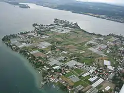
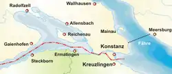
Reichenau Island[lower-alpha 1] (German: [ˈʁaɪçənaʊ]) is an island in Lake Constance in Southern Germany. It lies almost due west of the city of Konstanz, between the Gnadensee and the Untersee, two parts of Lake Constance. With a total land surface of 4.3 km2 (1.7 sq mi) and a circumference of 11 km (6.8 mi), the island is 4.5 km (2.8 mi) long and 1.5 km (0.93 mi) wide at its greatest extent. The highest point, the Hochwart, stands some 43 m (141 ft) above the lake surface and 438.7 m (1,439 ft) above mean sea level.
 Aerial view of Reichenau Island | |
 | |
| Geography | |
|---|---|
| Location | Lake Constance |
| Coordinates | 47°41′40″N 9°3′45″E |
| Area | 4.3 km2 (1.7 sq mi) |
| Administration | |
Germany | |
| State | Baden-Württemberg |
| District | Freiburg |
| Additional information | |
| Official website | www.reichenau.de |
| Official name | Monastic Island of Reichenau |
| Type | Cultural |
| Criteria | iii, iv, vi |
| Designated | 2000 (24th session) |
| Reference no. | 974 |
| Region | Europe and North America |
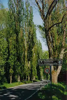
Reichenau is connected to the mainland by a causeway, completed in 1838, which is intersected between the ruins of Schopflen Castle and the eastern end of Reichenau Island by a 10 m (33 ft)-wide and 95 m (312 ft) long waterway, the Bruckgraben. A low road bridge allows the passage of ordinary boats but not of sailing-boats.
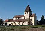
The island was declared a World Heritage Site in 2000 because of the Abbey of Reichenau. The abbey's Münster (minster church) is dedicated to the Virgin and Saint Mark. Two further churches were built on the island consecrated to Saint George and to Saints Peter and Paul. The famous artworks of Reichenau include (in the church of St George) the Ottonian murals of miracles of Christ, unique survivals from the 10th century. The abbey's bailiff was housed in a two-storey stone building to which two more storeys of timber framing were added in the 14th century, one of the oldest timber-frame buildings in south Germany.
Among the Abbey's far-flung landholdings was Reichenau, a village on the upper Rhine in the municipality of Tamins in the canton of Graubünden, Switzerland, named for the Abbey.
Today the island is also famous for its vegetable farms. The Wollmatinger Ried next to the island is a large nature reserve, a wetland area of reeds which is used by many birds as a stopover during their annual migration.
Gallery
_auf_der_Insel_Reichenau_im_Bodensee.jpg.webp) 15th-century towers on the Romanesque church of Sts Peter and Paul in Reichenau-Niederzell
15th-century towers on the Romanesque church of Sts Peter and Paul in Reichenau-Niederzell South West Reichenau Island
 South East Reichenau Island
 St. Georg, Reichenau-Oberzell
 One of the island's many vegetable fields with Sankt Georg Kirche in the background
Notes
- The Alemannic name of the island was Sindleozesauua, but it was also known as simply Ow, Auua (island) – Latinized as Augia, later also Augia felix or Augia dives (rich, or fertile, island), hence Richenow, Reichenau.
External links
| Wikivoyage has a travel guide for Reichenau. |
| Wikimedia Commons has media related to Reichenau Island. |
Monastic Island of Reichenau UNESCO Official Website
- Reichenau: monastic island
- (in German) History and images
- Reichenau Abbey Church
 Herbermann, Charles, ed. (1913). "Reichenau". Catholic Encyclopedia. New York: Robert Appleton Company.
- 3 spherical panoramas of St. Georg Church
- Saint George in Overzell in Circulo Romanico page
- Abacial de Santa Maria y San Marcos in Circulo Romanico page
- Iglesia de San Pedro y san Pablo in Circulo Romanico