Saint-Alyre-d'Arlanc
Saint-Alyre-d'Arlanc is a commune in the Puy-de-Dôme department in Auvergne in central France.
Saint-Alyre-d'Arlanc | |
|---|---|
Location of Saint-Alyre-d'Arlanc 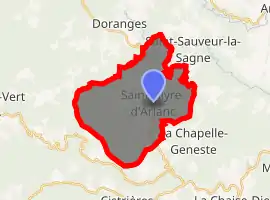
| |
 Saint-Alyre-d'Arlanc  Saint-Alyre-d'Arlanc | |
| Coordinates: 45°22′09″N 3°38′21″E | |
| Country | France |
| Region | Auvergne-Rhône-Alpes |
| Department | Puy-de-Dôme |
| Arrondissement | Ambert |
| Canton | Ambert |
| Intercommunality | Ambert Livradois Forez |
| Government | |
| • Mayor (2020–2026) | Olivier Bourron[1] |
| Area 1 | 24.19 km2 (9.34 sq mi) |
| Population (2017-01-01)[2] | 170 |
| • Density | 7.0/km2 (18/sq mi) |
| Time zone | UTC+01:00 (CET) |
| • Summer (DST) | UTC+02:00 (CEST) |
| INSEE/Postal code | 63312 /63220 |
| Elevation | 820–1,053 m (2,690–3,455 ft) (avg. 845 m or 2,772 ft) |
| 1 French Land Register data, which excludes lakes, ponds, glaciers > 1 km2 (0.386 sq mi or 247 acres) and river estuaries. | |
Geography
It is situated on the D999 road and almost midway between the cities of Clermont-Ferrand and Saint-Étienne at the heart of the Parc naturel régional Livradois-Forez.
The village is surrounded by pine forest with wild mushrooms to be found in the woods during autumn, rolling countryside and it is on the pilgrim trail. 9 km to the south is the mediaeval abbey town of La Chaise-Dieu.
Population
The village has a population of 50 permanent year round residents, which swells to 3-400 during the summer months.
The mayor, elected in 2020, is Olivier Bourron.[1] The annual Fete Patronale is held over the weekend of the third Sunday in July.
References
- "Répertoire national des élus: les maires". data.gouv.fr, Plateforme ouverte des données publiques françaises (in French). 2 December 2020. Retrieved 7 December 2020.
- "Populations légales 2017". INSEE. Retrieved 6 January 2020.
| Wikimedia Commons has media related to Saint-Alyre-d'Arlanc. |
| Authority control |
|---|
This article is issued from Wikipedia. The text is licensed under Creative Commons - Attribution - Sharealike. Additional terms may apply for the media files.
