Blanzat
Blanzat is a commune in the Puy-de-Dôme department in Auvergne-Rhône-Alpes in central France.
Blanzat | |
|---|---|
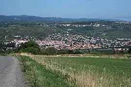 Blanzat from col de Bancillon | |
.svg.png.webp) Coat of arms | |
Location of Blanzat 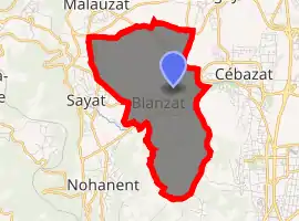
| |
 Blanzat  Blanzat | |
| Coordinates: 45°49′44″N 3°04′34″E | |
| Country | France |
| Region | Auvergne-Rhône-Alpes |
| Department | Puy-de-Dôme |
| Arrondissement | Clermont-Ferrand |
| Canton | Cébazat[1] |
| Intercommunality | Clermont Auvergne Métropole |
| Government | |
| • Mayor (2014–2020) | Michel Beyssi[2] |
| Area 1 | 6.96 km2 (2.69 sq mi) |
| Population (2017-01-01)[3] | 3,749 |
| • Density | 540/km2 (1,400/sq mi) |
| Time zone | UTC+01:00 (CET) |
| • Summer (DST) | UTC+02:00 (CEST) |
| INSEE/Postal code | 63042 /63112 |
| Elevation | 360–611 m (1,181–2,005 ft) |
| 1 French Land Register data, which excludes lakes, ponds, glaciers > 1 km2 (0.386 sq mi or 247 acres) and river estuaries. | |
Geography

Town hall of Blanzat.
It is located about 8 kilometres (5.0 mi) north of Clermont-Ferrand, within both the former French province of Auvergne and the former modern region of Auvergne-Rhône-Alpes.
Population
|
| ||||||||||||||||||||||||||||||||||||||||||
| Source: EHESS[4] and INSEE[5] | |||||||||||||||||||||||||||||||||||||||||||
References
- "Décret 2014-210 du 21 février 2014 portant délimitation des cantons dans le département du Puy-de-Dôme" [2014-210 decree delimiting cantons of Puy-de-Dôme department]. Légifrance (in French). 21 February 2014. Retrieved 29 July 2016.
- "List of Mayors of Puy-de-Dôme" (PDF). Prefecture of Puy-de-Dôme. 9 April 2014. Archived from the original (PDF) on 6 October 2014. Retrieved 29 July 2016.
- "Populations légales 2017". INSEE. Retrieved 6 January 2020.
- Données Cassini, EHESS
- Population en historique depuis 1968, INSEE
External links
| Wikimedia Commons has media related to Blanzat. |
- Official website (in French)
| Authority control |
|---|
This article is issued from Wikipedia. The text is licensed under Creative Commons - Attribution - Sharealike. Additional terms may apply for the media files.