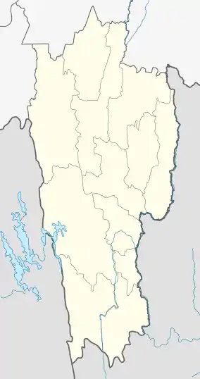
Sairang
Sairang is a census town in Aizawl district in the Indian state of Mizoram.
Sairang | |
|---|---|
city | |
 Sairang  Sairang | |
| Coordinates: 23.8°N 92.67°E | |
| Country | India |
| State | Mizoram |
| District | Aizawl |
| Elevation | 210 m (690 ft) |
| Population (2001) | |
| • Total | 5,036 |
| Languages | |
| • Official | Mizo |
| Time zone | UTC+5:30 (IST) |
| Vehicle registration | MZ |
| Climate | Aw |
| Website | mizoram |
History
After the British invasion of 1871-1872, Bengali traders set up the first market place in Mizoram in Changsil[1] on the tlawng river, when the British established control in the 1890s, the market moved up to Sairang. According to Administration report of 1922, there were 13 shops in Sairang. Up to the 1940s the road from Aizawl to Sairang was only a cart road. Improvement of the road started only in 1896.
Sairang is the nearest town with river from Aizawl which is about 14 kilometers. The journey of about 140 Kilometers from Sairang to Silchar via Tlawng river used to take about 15–30 days during the 1890s depending upon the season and water level on a flat water boat.[2]
Geography
Sairang is located at 23.8°N 92.67°E.[3] It has an average elevation of 210 metres (688 feet).
Connectivity
Sairang lies on the route of Kaladan Multi-Modal Transit Transport Project. It is connected with roads from major towns in Assam, through NH 54. The nearest railway station is at Bairabi, which is connected to the railway network with a broad gauge track. A new broad gauge line from Bairabi to Sairang is under construction and is expected to be commissioned by 2019.[4]
Survey for the Rail line from Sairang to Hmawngbuchhuah on border near Zorinpui was completed in August 2017 and it will be constructed in future phase.[5]
100 kilometres (62 mi) route from Indo-Myanmar border at Zorinpui to Aizawl is upgraded to two-lane in both directions (total 4 lanes). From Aizal it connect to Aizawal-Saiha National Highway at Lawngtlai in Mizoram in India by road on National Highway 54 (India) (NH-54), which then continues further to Dabaka in Assam via 850 km long NH-54 which in turn is part of the larger East-West Corridor connecting North East India with the rest of India.[6] Almost complete (June 2017).[7] Tender has been awarded, upgrade to this national highway is under-construction and to be Completed by 2019.[8]
Demographics
As of 2001 India census,[9] Sairang had a population of 5036. Males constitute 56% of the population and females 44%. Sairang has an average literacy rate of 82%, higher than the national average of 59.5%: male literacy is 85%, and female literacy is 77%. In Sairang, 15% of the population is under 6 years of age.
References
- Chaterjee, Suhas. Mizo Chiefs and the Chiefdom. p. 12.
- Pachuau, Joy (13 April 2015). The Camera as a Witness. Cambridge. pp. 149–150, 161, 169. ISBN 9781107073395.
- Falling Rain Genomics, Inc - Sairang
- Sanctioned in 2000, broad-gauge train reaches Mizoram after 16 years Indian Express, Retrieved 21 March 2016.
- India's north east opened up, PowerUpConstruction.Com
- Multi-modal route map
- India awards road contract to complete Kaladan project in Myanmar, Business Line, 9 June 2017.
- Still under construction, The Statesman, 13 May 2018.
- "Census of India 2001: Data from the 2001 Census, including cities, villages and towns (Provisional)". Census Commission of India. Archived from the original on 16 June 2004. Retrieved 1 November 2008.