Sibualong
Sibualong is a village in Balaesang district, Donggala Regency in North Sulawesi province, Indonesia. Its population is 2437.[1]:1756 Located about 1520 metres from the equator, it is the closest village in Sulawesi to the equator.
Sibualong | |
|---|---|
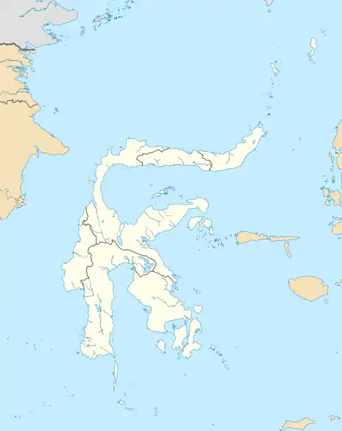 Sibualong Location in Central Sulawesi and Indonesia  Sibualong Sibualong (Indonesia) | |
| Coordinates: 0°0′49.374″S 119°55′57.1836″E | |
| Country | |
| Province | Central Sulawesi |
| Regency | Donggala Regency |
| District | Balaesang District |
| Elevation | 846 ft (258 m) |
| Population (2010) | |
| • Total | 2,437[1] |
| Time zone | UTC+8 (Indonesia Central Standard Time) |
Climate
Sibualong has a tropical rainforest climate (Af) with moderate to heavy rainfall year-round. With only 1410 mm of annual rainfall, it is one of the driest places with this climate type.
| Climate data for Sibualong | |||||||||||||
|---|---|---|---|---|---|---|---|---|---|---|---|---|---|
| Month | Jan | Feb | Mar | Apr | May | Jun | Jul | Aug | Sep | Oct | Nov | Dec | Year |
| Average high °C (°F) | 29.2 (84.6) |
29.3 (84.7) |
29.6 (85.3) |
29.6 (85.3) |
29.8 (85.6) |
29.0 (84.2) |
28.2 (82.8) |
29.4 (84.9) |
29.7 (85.5) |
30.7 (87.3) |
30.1 (86.2) |
29.7 (85.5) |
29.5 (85.2) |
| Daily mean °C (°F) | 25.3 (77.5) |
25.4 (77.7) |
25.7 (78.3) |
25.6 (78.1) |
26.1 (79.0) |
25.4 (77.7) |
24.5 (76.1) |
25.5 (77.9) |
25.5 (77.9) |
26.2 (79.2) |
25.9 (78.6) |
25.8 (78.4) |
25.6 (78.0) |
| Average low °C (°F) | 21.5 (70.7) |
21.6 (70.9) |
21.8 (71.2) |
21.7 (71.1) |
22.4 (72.3) |
21.8 (71.2) |
20.9 (69.6) |
21.6 (70.9) |
21.3 (70.3) |
21.8 (71.2) |
21.7 (71.1) |
21.9 (71.4) |
21.7 (71.0) |
| Average precipitation mm (inches) | 180 (7.1) |
145 (5.7) |
129 (5.1) |
123 (4.8) |
118 (4.6) |
116 (4.6) |
91 (3.6) |
74 (2.9) |
64 (2.5) |
75 (3.0) |
112 (4.4) |
183 (7.2) |
1,410 (55.5) |
| Source: Climate-Data.org[2] | |||||||||||||
References
- "Archived copy" (PDF). Archived from the original (PDF) on 2020-07-20. Retrieved 2020-07-20.CS1 maint: archived copy as title (link)
- "Climate: Sibualong". Climate-Data.org. Retrieved July 20, 2020.
Regencies and cities of Central Sulawesi | ||
|---|---|---|
Capital: Palu | ||
| Regencies | ||
| Cities | ||
| Other populated places | ||
This article is issued from Wikipedia. The text is licensed under Creative Commons - Attribution - Sharealike. Additional terms may apply for the media files.
