Sigi Regency
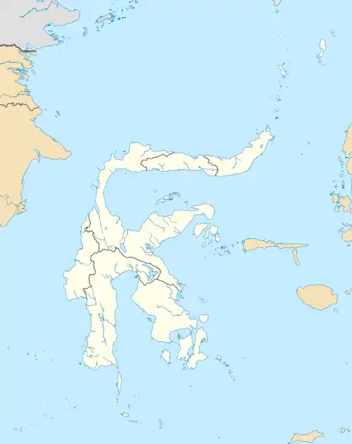
Sigi Regency is a regency of Central Sulawesi, Indonesia. It lies upstream on the Palu River, and immediately south of Palu city, the provincial capital. The principal town lies at Sigi Biromaru.
Sigi Regency
Kabupaten Sigi | |
|---|---|
 Coat of arms | |
| Motto(s): Mareso Masagena (Kaili) (Difficult and Happy to be Together) | |
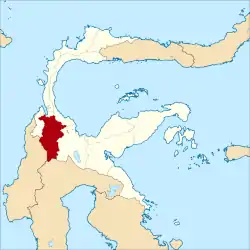 Location within Central Sulawesi | |
| Coordinates: 1°23′06″S 119°58′01″E | |
| Country | Indonesia |
| Province | Central Sulawesi |
| Capital | Sigi Biromaru |
| Government | |
| • Regent | Muhammad Irwan Lapata |
| • Vice Regent | Paulina |
| Area | |
| • Total | 5,196.02 km2 (2,006.19 sq mi) |
| Population (2010) | |
| • Total | 215,030 |
| • Density | 41/km2 (110/sq mi) |
| Time zone | UTC+8 (ICST) |
| Area code | (+62) 451 |
| Website | sigikab.go.id |

Sigi Regency was one of the areas in northwest Sulawesi most affected by the 2018 earthquake and tsunami in Sulawesi. Dozens of people were reported to have been killed by the earthquake and there were reports of "massive liquification" which caused homes to be swept away.
Conflicts
Following religious conflicts in the neighbouring Poso Regency, the Indonesia government mounted Operation Tinombala in early 2016 to combat local terrorist activities carried out by the East Indonesia Mujahiddin (Mujahiddin Indonesian Timur, or MIT) in the province.[1] In late November 2020, there were indications that the conflict had spread into Sigi Regency when four residents of remote Lembantongoa village were killed in an apparent terrorist attack attributed to MIT.[2] Indonesia's senior Coordinating Political, Legal and Security Minister Mahfud MD issued a statement saying that the government was committed to tracking down those responsible for the murders and the accompanying destruction.
Administration
The Sigi Regency was divided at 2010 into fifteen districts (kecamatan), tabulated below with their areas and their 2010 Census populations.[3]
| Name | Area in km2 | Population Census 2010 |
|---|---|---|
| Pipikoro | 977.74 | 7,817 |
| Kulawi Selatan (South Kulawi) | 431.86 | 8,473 |
| Kulawi | 1,077.72 | 14,172 |
| Lindu | 577.87 | 4,690 |
| Nokilalaki | 75.33 | 5,626 |
| Palolo | 645.72 | 27,385 |
| Gumbasa | 201.27 | 11,682 |
| Tanambulava | 58.44 | 7,866 |
| Dolo Selatan (South Dolo) | 583.52 | 14,448 |
| Dolo Barat (West Dolo) | 91.06 | 12,576 |
| Dolo | 56.11 | 20,591 |
| Sigi Biromaru | 304.17 | 42,857 |
| Marawola | 38.66 | 20,991 |
| Kinovaro | 60.34 | 9,474 |
| Marawola Barat (West Marawola) | 166.46 | 6,382 |
References
- Marchio Irfan Gorbiano, 'Reevaluate Operation Tinambala after Sigi attack: Analysts', The Jakarta Post, 9 December 2020.
- Any Rufaedah and Idhamsyah Eka Putra, 'IS replication in Indonesia and counterterrism after the Sigi attack', East Asia Forum, Australian National University, 9 January 2012. See also Rizki Rachriansyah, 'Four killed in alleged MIT attack in Sigi, reigniting concerns over sectarian conflict', The Jakarta Post, 29 November 2020.
- Biro Pusat Statistik, Jakarta, 2011 & 2016.
Regencies and cities of Central Sulawesi | ||
|---|---|---|
Capital: Palu | ||
| Regencies | ||
| Cities | ||
| Other populated places | ||
