Sihora
Sihora is a town and a municipality in Jabalpur district in the Indian state of Madhya Pradesh.Previously Sihora was biggest sub-district(Tehsil) of MP But, after the formation of District of Katni half of land of Sihora was given to Katni. Still people of Sihora argue to make Sihora a District
Sihora | |
|---|---|
town | |
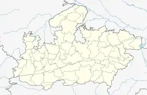
 Sihora Location in Madhya Pradesh, India  Sihora Sihora (India) | |
| Coordinates: 23.00°N 80.12°E | |
| Country | |
| State | Madhya Pradesh |
| District | Jabalpur |
| Founded by | Unknown |
| Named for | farming of Water chestnut |
| Government | |
| • Type | Unicameral |
| • Body | nagar palika |
| Elevation | 386 m (1,266 ft) |
| Population (2011) | |
| • Total | 44,048 |
| Languages Hindi,English,etc. | |
| • Official | Hindi |
| Time zone | UTC+5:30 (IST) |
| ISO 3166 code | IN-MP |
| Vehicle registration | MP20 |
It has many interesting facts 1) It has the Asia's 1st water regulatory dam called"By Nala".
2) India's 1st private bank was established here "State Bank Of India (SBI)".
3) Invention of regulators in gas(Commonly used in kitchens) done here.
4)Few well known personalities are Arunabh Ghosh, Rajbhan Shukla, Prabhat Pandey, Manju Rai, Sid Goyal
Geography
Sihora is located at 23.48°N 80.12°E.[1] Tropic of cancer passes through city.It has an average elevation of 386 metres (1266 feet)It was the biggest tehsil of the state. The people of Sihora are demanding district status from their state government..Also "Roopnath" which is famous for Ashoka's minor rock edict is situated very near to sihora.
Sihora municipal corporation is one of the oldest corporations of Madhya Pradesh. It was established in 1867.
Sihora region is also very rich minerals area, many types of minerals can easily found in this region like bauxite, iron ore, limestone, and marble. Mainly black soil is found here which helps in good production of crops. Sihora also has one of the largest water chestnut market of ASIA from where it is exported to other states of country as well as to foreign countries also.
River Hiran is lifeline of sihora region whose origin place is kundam and mouth is river Narmada. It has a good irrigation system, canal is made which is connected through bargi dam situated at jabalpur.
People of sihora are mainly dependent on agriculture but now few industrial development can be seen. Majority of population is dependent on farming followed by business. Service sector is developing very fast along with primary and tertiary sector.
Demographics
According to the 2011 India census,[2] Sihora had a population of 44048; Males constitute 52% of the population and females 48%. Sihora has an average literacy rate of 68%, higher than the national average of 59.5%: male literacy is 75%, and female literacy is 59%. In Sihora, 15% of the population is under 6 years of age. The total population is dominated by Hindu religion, followed by Muslim, Jain and Christians. This city is infamous for Liquor Brahmins.
The potential of location was ignored after freedom from British rule. Over a period of time, the unemployment ruined the hope of talented youth and forced them to join local politics. Other Christian missionary activities are getting spread among the poor.
The location of the city can be utilised as HUB as good connectivity with 102 villages. The city is situated at main railroute and can be utilised as a parcel and packaging center with well connectivity with Katni Jn, Damoh and Jabalpur Jn.
It is said that Asia's first water canal regulator was first built at Sihora.
References
- Falling Rain Genomics, Inc – Sihora. Fallingrain.com. Retrieved on 2012-07-26.
- "Census of India 2001: Data from the 2011 Census, including cities, villages and towns (Provisional)". Census Commission of India. Archived from the original on 16 June 2004. Retrieved 1 November 2008.