Vijayraghavgarh
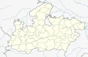
Vijayraghavgarh is a big town, tehsil headquarters, and a nagar panchayat in Katni district in the Indian state of Madhya Pradesh. It belongs to Jabalpur division and is 34 km east of district headquarters Katni. Vijayraghavgarh is surrounded by Badwara tehsil in the south, Shahnagar tehsil in the west and Maihar tehsil north.
Vijayraghavgarh | |
|---|---|
city | |
 Vijayraghav Fort | |
 Vijayraghavgarh Location in Madhya Pradesh, India  Vijayraghavgarh Vijayraghavgarh (India) | |
| Coordinates: 23°59′45″N 80°36′18″E | |
| Country | India |
| State | Madhya Pradesh |
| District | Katni |
| Population (2011) | |
| • Total | 8,371 |
| Languages | |
| • Official | Hindi |
| Time zone | UTC+5:30 (IST) |
| Telephone code | 07626 |
| Vehicle registration | MP-21 |
| Website | www |
Katni, Jabalpur, Rewa, Satna, Umariya, and Shahdol are nearby cities.
History
Vijayraghavgarh has a historic fort built in 1826. One can visit the fort while traveling from Bandhavgarh (92 km) to Khajuraho via Satna. Vijayraghavgarh fort was constructed by the son of Maihar king Bisan Singh: Thakur Prayag Das.
The fort is made up to sandstone and is surrounded by a deep trench like the Red Fort of Delhi. It was dedicated to Lord Vijayraghav.
The fort has many places of interest; some of them are Rang mahal, Bramha chabutra, Sita temple, Samadhi sthal, Gupt dwar Rani ki Rasoi, Antah puram etc. The fort was the victim of the famous revolt of 1857 when it was attacked by the British. In the attack some parts of this royal asset were damaged.
Temples
Many temples are here but the famous temple Vijayraghavgarh Sharda Devi Temple is on Govt. ITI College Road (Karitalai Road) Vijayraghavgarh.
Maihar Sharda Devi temple vision of recognition after Maihar philosophy.
Other temples
- Pachmatha Dham Ganesha Temple
- Sankat Mochan Ashram and Hanuman Temple (in the middle of the city on the bank of the Jhapawan River)
- Jhiriya ghat
- Radha krishna Temple
- Ram Harshan Temple
- Bihari ju Temple
- Ram Janki Temple
- Ramghat Hanuman Temple
- Banjari Mai Temple
- Shri Hari Vishnu Temple (Madfa)
Festival
Dussehra and Navratri are popular festivals here. Dussehra is the biggest annual event. The effigy of Ravana ranges in height from 60 to 75 feet.
Education
Vijayraghavgarh has more than 20 schools in Hindi, English, Urdu and Sanskrit.
Colleges
- Govt. Degree College Vijayraghavgarh
- Govt. I.T.I. College Vijayraghavgarh
- Shri Dwarka Prasad I.T.I. & Computer College Vijayraghavgarh
- Shri Chitransh I.T.I. College Vijayraghavgarh
- Shri Chitransh Computer & IT Institute Vijayraghavgarh
Schools
- Govt. Boys Hr. Sec. School Vijayraghavgarh
- Govt. Excellence Hr. Sec. School Vijayraghavgarh
- Govt. Girls Hr. Sec. School Vijayraghavgarh
- Govt. Model Hr. Sec. School Vijayraghavgarh
- Govt. Boys Middle School Vijayraghavgarh
- Govt. Primary School Pachmatha Vijayraghavgarh
- Govt. Primary School Nadipaar Vijayraghavgarh
- Govt. Primary School Banjari Vijayraghavgarh
- Govt. Primary School Ambedkar Nagar Vijayraghavgarh
- Govt. Primary School Majhgawan Vijayraghavgarh
Transport
Vijayraghavgarh is 32 km from Katni. Daily bus services are available every 10 minutes from Katni to Vijayraghavgarh. The railway station is around 35 km away. Airport Jabalpur is 135 km away.
Demographics
As of 2001 India census,[1] Vijayraghavgarh had a population of 7,157. Males constitute 53% of the population and females 47%. Vijayraghavgarh has an average literacy rate of 67%, higher than the national average of 59.5%: male literacy is 76%, and female literacy is 56%. In the town, 16% of the population is under 6 years of age.
Geography
The STD code is 07626 and Pin code 483775 Postal headquarter. The nearest RTO is Katni. The town in accessible by road. It is situated almost 32 kilometers from Katni and 90 kilometers from Satna.
The Bandhavgarh National Park is just 92 km from the town.
Public representatives (MLA)
| Period | MLA |
|---|---|
| 2008-Till Date | Sanjay Pathak |
| 2004-2008 | Dhruv Pratap Singh |
| 1993-2004 | Sateyendra Pathak |
References
- "Census of India 2001: Data from the 2001 Census, including cities, villages and towns (Provisional)". Census Commission of India. Archived from the original on 16 June 2004. Retrieved 1 November 2008.