Sinai, South Dakota
Sinai (/ˈsaɪniaɪ/ SY-nee-eye)[7] is a town in Brookings County, South Dakota, United States. The population was 120 at the 2010 census.
Sinai, South Dakota | |
|---|---|
 Location in Brookings County and the state of South Dakota | |
| Coordinates: 44°14′42″N 97°2′36″W | |
| Country | United States |
| State | South Dakota |
| County | Brookings |
| Incorporated | 1908[1] |
| Area | |
| • Total | 0.37 sq mi (0.95 km2) |
| • Land | 0.37 sq mi (0.95 km2) |
| • Water | 0.00 sq mi (0.00 km2) |
| Elevation | 1,781 ft (543 m) |
| Population | |
| • Total | 120 |
| • Estimate (2019)[4] | 124 |
| • Density | 336.96/sq mi (130.20/km2) |
| Time zone | UTC-6 (Central (CST)) |
| • Summer (DST) | UTC-5 (CDT) |
| ZIP code | 57061 |
| Area code(s) | 605 |
| FIPS code | 46-58900[5] |
| GNIS feature ID | 1258080[6] |
Geography
Sinai is located at 44°14′42″N 97°2′36″W (44.245039, -97.043380).[8]
According to the United States Census Bureau, the town has a total area of 0.37 square miles (0.96 km2), all land.[9]
Sinai has been assigned the ZIP code 57061 and the FIPS place code 58900.
Demographics
| Historical population | |||
|---|---|---|---|
| Census | Pop. | %± | |
| 1920 | 216 | — | |
| 1930 | 217 | 0.5% | |
| 1940 | 182 | −16.1% | |
| 1950 | 181 | −0.5% | |
| 1960 | 166 | −8.3% | |
| 1970 | 147 | −11.4% | |
| 1980 | 129 | −12.2% | |
| 1990 | 120 | −7.0% | |
| 2000 | 133 | 10.8% | |
| 2010 | 120 | −9.8% | |
| 2019 (est.) | 124 | [4] | 3.3% |
| U.S. Decennial Census[10] | |||
2010 census
As of the census[3] of 2010, there were 120 people, 52 households, and 32 families residing in the town. The population density was 324.3 inhabitants per square mile (125.2/km2). There were 61 housing units at an average density of 164.9 per square mile (63.7/km2). The racial makeup of the town was 96.7% White, 0.8% Asian, and 2.5% from two or more races. Hispanic or Latino of any race were 1.7% of the population.
There were 52 households, of which 36.5% had children under the age of 18 living with them, 50.0% were married couples living together, 3.8% had a female householder with no husband present, 7.7% had a male householder with no wife present, and 38.5% were non-families. 38.5% of all households were made up of individuals, and 9.6% had someone living alone who was 65 years of age or older. The average household size was 2.31 and the average family size was 3.00.
The median age in the town was 37 years. 28.3% of residents were under the age of 18; 5.1% were between the ages of 18 and 24; 26.6% were from 25 to 44; 27.5% were from 45 to 64; and 12.5% were 65 years of age or older. The gender makeup of the town was 55.0% male and 45.0% female.
2000 census
As of the census[5] of 2000, there were 133 people, 54 households, and 42 families residing in the town. The population density was 364.0 people per square mile (138.8/km2). There were 62 housing units at an average density of 169.7 per square mile (64.7/km2). The racial makeup of the town was 100.00% White.
There were 54 households, out of which 31.5% had children under the age of 18 living with them, 75.9% were married couples living together, and 22.2% were non-families. 18.5% of all households were made up of individuals, and 13.0% had someone living alone who was 65 years of age or older. The average household size was 2.46 and the average family size was 2.83.
In the town, the population was spread out, with 24.8% under the age of 18, 9.0% from 18 to 24, 24.8% from 25 to 44, 24.8% from 45 to 64, and 16.5% who were 65 years of age or older. The median age was 36 years. For every 100 females, there were 121.7 males. For every 100 females age 18 and over, there were 108.3 males.
The median income for a household in the town was $38,000, and the median income for a family was $39,750. Males had a median income of $31,875 versus $23,750 for females. The per capita income for the town was $17,451. There were 4.3% of families and 5.7% of the population living below the poverty line, including 5.7% of under eighteens and none of those over 64.
History
Sinai was laid out in 1907, and named after the Biblical Mount Sinai.[11]
References
- "SD Towns" (PDF). South Dakota State Historical Society. Retrieved 2010-02-15.
- "2019 U.S. Gazetteer Files". United States Census Bureau. Retrieved July 30, 2020.
- "U.S. Census website". United States Census Bureau. Retrieved 2012-06-21.
- "Population and Housing Unit Estimates". United States Census Bureau. May 24, 2020. Retrieved May 27, 2020.
- "U.S. Census website". United States Census Bureau. Retrieved 2008-01-31.
- "US Board on Geographic Names". United States Geological Survey. 2007-10-25. Retrieved 2008-01-31.
- "Broadcast Pronunciation Guide and South Dakota Pronunciations". Associated Press. Archived from the original on 2011-06-14. Retrieved 2009-11-10.
- "US Gazetteer files: 2010, 2000, and 1990". United States Census Bureau. 2011-02-12. Retrieved 2011-04-23.
- "US Gazetteer files 2010". United States Census Bureau. Archived from the original on 2012-01-25. Retrieved 2012-06-21.
- "Census of Population and Housing". Census.gov. Retrieved June 4, 2015.
- Federal Writers' Project (1940). South Dakota place-names, v.1-3. University of South Dakota. p. 61.
Municipalities and communities of Brookings County, South Dakota, United States | ||
|---|---|---|
| Cities | 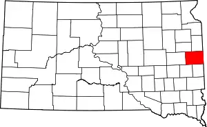 | |
| Towns | ||
| CDP | ||
| Other unincorporated communities | ||
| Townships |
| |
| Footnotes | ‡This populated place also has portions in an adjacent county or counties | |
| ||