Brookings, South Dakota
Brookings is a city in Brookings County, South Dakota, United States. Brookings is the fourth largest city in South Dakota, with a population of 22,056 at the 2010 census. It is the county seat of Brookings County,[6] and home to South Dakota State University, the largest institution of higher education in the state.[7] Also found in Brookings are the South Dakota Art Museum, the Children's Museum of South Dakota, the annual Brookings Summer Arts Festival, and the headquarters of a number of manufacturing companies and agricultural operations.[8]
Brookings, South Dakota | |
|---|---|
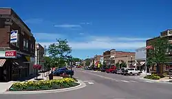 Main Avenue in downtown Brookings | |
| Nickname(s): Scoreboard Town | |
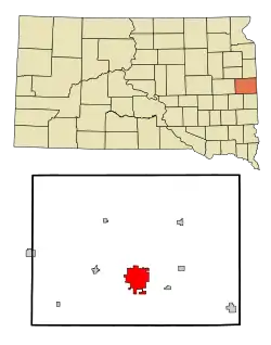 Location in Brookings County and the state of South Dakota | |
 Brookings, South Dakota Location in the United States | |
| Coordinates: 44°18′23″N 96°47′17″W | |
| Country | United States |
| State | South Dakota |
| County | Brookings |
| Incorporated | 1883[1] |
| Government | |
| • Mayor | Keith Corbett |
| • City Manager | Paul Briseno |
| Area | |
| • Total | 13.54 sq mi (35.07 km2) |
| • Land | 13.46 sq mi (34.86 km2) |
| • Water | 0.08 sq mi (0.20 km2) |
| Elevation | 1,621 ft (494 m) |
| Population | |
| • Total | 22,056 |
| • Estimate (2019)[4] | 24,415 |
| • Density | 1,813.76/sq mi (700.29/km2) |
| Time zone | UTC−6 (Central (CST)) |
| • Summer (DST) | UTC−5 (CDT) |
| ZIP codes | 57006-57007 |
| Area code(s) | 605 Exchanges: 688,692,697 |
| FIPS code | 46-07580 |
| GNIS feature ID | 1254074[5] |
| Website | www.cityofbrookings.org |
History
Pioneer
The county and city were both named after one of South Dakota's pioneer promoters, Wilmot Brookings (1830 - 1905).[9] Brookings set out for the Dakota Territory in June 1857. He arrived at Sioux Falls on August 27, 1857, and became one of the first settlers there. He and his group represented the Western Town Company. After a time in Sioux Falls, Brookings and a companion set out for the Yankton area to locate a town in an area that was soon to be ceded by the Native Americans. This trip was begun in January 1858, and the two soon encountered a blizzard that froze Brookings' feet which both had to be amputated.
He rose to a high position in the Territory, once being a member of the Squatter Territorial Legislature and later being elected Squatter Governor. Brookings then became appointed superintendent of a road that was to be built from the Minnesota state line west to the Missouri River about 30 miles north of Ft. Pierre. It was during the construction of this road that Brookings came into contact with land that was part of this county at the time. Because of his drive to settle the Dakota Territory, Brookings County and city were named for a spirited pioneer promoter. Wilmot W. Brookings made settlement of this area a real possibility for many people.
Medary
The first real town that was organized in Brookings County was Medary in 1857. Up to this point, the area had been traveled and utilized by only Native Americans, with a few indistinct traces left showing the penetration of the area by explorers, missionaries, trappers, and traders. Along with Sioux Falls and Flandreau, Medary was one of the first three European settlements to be established in South Dakota.
The first actual site of Medary was located by the Dakota Land Company out of Minnesota which was led by Alpheus G. Fuller and Major Franklin J. DeWitt and accompanied by engineer Samuel A. Medary, Jr. In 1857, the men put up quarters in preparation to live out the winter in Medary. Many other settlers moved into the area in 1858. But in the spring of that year, a large group of Yankton and Yanktonnia Indians drove the settlers from the area, and Medary remained nearly abandoned for the next 11 years.
In 1869, a group of 10 Norwegian pioneers moved west into the Dakota Territory and resettled the area of Medary, which was located about four and one half miles south of present-day Brookings. The county of Brookings was formally organized in Medary in the cabin of Martin Trygstad on July 3, 1871.[10] The original boundaries of the county extended to two miles south of Flandreau, until the territorial legislature relocated the boundaries of the county to the current location on January 8, 1873. Two other small settlements, Oakwood and Fountain, appeared in the Brookings County area around this time. All three settlements hoped that they would be the lucky town by which the railroad would decide to lay tracks through as it moved westward but it didn't go through Medary so it became a ghost town.
Railroad
As it turned out, none of the three towns were chosen to be passed through by the railroad. When the businessmen of Medary and Fountain found out that the railroad had no plans of laying tracks through the two towns, they began a push to find a central location. In a sense, their attitude was 'if you can't beat 'em, join 'em!' Many private meetings and much effort on the part of the men of Medary and Fountain led to the railroad deciding to lay its tracks through what would become the city of Brookings.
In a letter sent to Chicago on September 30, 1879, Land Commissioner Charles E. Simmons communicated the layout of the series of towns in Brookings County to be passed through by the railroad. These towns were to be Aurora, Brookings, and Volga. Many merchants of Medary and Fountain packed up their businesses and belongings and moved to Brookings, which was surveyed and platted on October 3 and 4, 1879. Fountain ceased to exist after this turn of events, while Medary and Oakwood continued to exist for a while but eventually faded away. A monument still stands at the site of the old Medary as a reminder of the people who once lived there.
The railroad crossed the Minnesota state line and into Brookings County on October 2, 1879. With tracks being built at about one mile per day, the track and first train reached Brookings' Main Street on October 18, 1879. The railroad station was opened a month later.
Brookings was laid out in 1880.[11]
Employment
According to the City's 2016 Comprehensive Annual Financial Report,[12] the largest employers in the city are:
| # | Employer | # of Employees |
|---|---|---|
| 1 | South Dakota State University | 4,463 |
| 2 | Daktronics | 1,600 |
| 3 | 3M | 1,008 |
| 4 | Hy-Vee Food Store | 690 |
| 5 | Larson Manufacturing | 516 |
| 6 | Brookings Health System | 502 |
| 7 | Walmart | 425 |
| 8 | Aramark | 405 |
| 9 | Brookings School District | 400 |
| 10 | Twin City Fan | 299 |
The unemployment rate in Brookings is 2.7 percent, well below the national average of 4.7 percent.
Bel Brands USA, Inc., a subsidiary of Paris-based multinational Fromageries BEL or Bel Group, began commercial construction of a 170,000-square-foot Babybel cheese production plant in July 2014 in the city's Foster Addition north of the Swiftel Center. The project added 250 new jobs in Brookings by the end of 2014.[13]
Geography
Brookings is located at 44°18′23″N 96°47′17″W (44.306253, −96.788105).[14]
According to the United States Census Bureau, the city has a total area of 13.04 square miles (33.77 km2), of which 12.94 square miles (33.51 km2) is land and 0.10 square miles (0.26 km2) is water.[15]
Brookings has been assigned ZIP codes 57006 and 57007 as well as the FIPS place code 07580.
Climate
Brookings experiences a humid continental climate (Köppen Dfb), which is characterized by warm, relatively humid summers and cold, dry winters, and is located in USDA Hardiness Zones 4.[16] The monthly daily average temperature ranges from 12.9 °F (−10.6 °C) in January to 70.3 °F (21.3 °C) in July, while there are nine days of 90 °F (32 °C)+ highs and 36 days with sub-0 °F (−18 °C) lows annually. Snowfall occurs mostly in light to moderate amounts during the winter, totaling 36 inches (91 cm). Precipitation, at 24.3 inches (617 mm) annually, is concentrated in the warmer months. Extremes range from −41 °F (−41 °C) as recently as January 12, 1912 to 109 °F (43 °C) on July 24, 1940.
| Climate data for Brookings, South Dakota (1981−2010 normals) | |||||||||||||
|---|---|---|---|---|---|---|---|---|---|---|---|---|---|
| Month | Jan | Feb | Mar | Apr | May | Jun | Jul | Aug | Sep | Oct | Nov | Dec | Year |
| Record high °F (°C) | 65 (18) |
69 (21) |
85 (29) |
93 (34) |
106 (41) |
105 (41) |
109 (43) |
106 (41) |
102 (39) |
93 (34) |
77 (25) |
68 (20) |
109 (43) |
| Average high °F (°C) | 22.9 (−5.1) |
27.8 (−2.3) |
39.4 (4.1) |
55.4 (13.0) |
67.5 (19.7) |
76.6 (24.8) |
81.6 (27.6) |
79.7 (26.5) |
71.1 (21.7) |
57.7 (14.3) |
40.2 (4.6) |
26.0 (−3.3) |
53.8 (12.1) |
| Average low °F (°C) | 2.9 (−16.2) |
8.1 (−13.3) |
20.6 (−6.3) |
32.7 (0.4) |
44.6 (7.0) |
54.8 (12.7) |
59.1 (15.1) |
56.8 (13.8) |
47.0 (8.3) |
33.8 (1.0) |
21.1 (−6.1) |
7.4 (−13.7) |
32.4 (0.2) |
| Record low °F (°C) | −41 (−41) |
−41 (−41) |
−23 (−31) |
−2 (−19) |
7 (−14) |
28 (−2) |
37 (3) |
28 (−2) |
12 (−11) |
−9 (−23) |
−22 (−30) |
−36 (−38) |
−41 (−41) |
| Average precipitation inches (mm) | 0.35 (8.9) |
0.40 (10) |
1.23 (31) |
2.18 (55) |
2.97 (75) |
4.30 (109) |
3.24 (82) |
3.06 (78) |
3.19 (81) |
2.05 (52) |
0.91 (23) |
0.41 (10) |
24.29 (614.9) |
| Average snowfall inches (cm) | 5.8 (15) |
6.1 (15) |
7.6 (19) |
3.3 (8.4) |
0 (0) |
0 (0) |
0 (0) |
0 (0) |
0 (0) |
0.7 (1.8) |
5.4 (14) |
7.0 (18) |
36.0 (91) |
| Average precipitation days (≥ 0.01 in) | 4.8 | 4.6 | 6.5 | 9.0 | 10.6 | 11.7 | 9.9 | 8.7 | 8.8 | 7.0 | 4.9 | 4.9 | 91.3 |
| Average snowy days (≥ 0.1 in) | 5.3 | 4.3 | 4.0 | 1.5 | 0 | 0 | 0 | 0 | 0.1 | 0.5 | 2.8 | 4.9 | 23.4 |
| Source: NOAA (extremes 1893−present)[17][18] | |||||||||||||
Demographics
| Historical population | |||
|---|---|---|---|
| Census | Pop. | %± | |
| 1890 | 1,518 | — | |
| 1900 | 2,846 | 87.5% | |
| 1910 | 2,971 | 4.4% | |
| 1920 | 3,921 | 32.0% | |
| 1930 | 4,376 | 11.6% | |
| 1940 | 5,346 | 22.2% | |
| 1950 | 7,764 | 45.2% | |
| 1960 | 10,558 | 36.0% | |
| 1970 | 13,717 | 29.9% | |
| 1980 | 14,951 | 9.0% | |
| 1990 | 16,270 | 8.8% | |
| 2000 | 18,504 | 13.7% | |
| 2010 | 22,056 | 19.2% | |
| 2019 (est.) | 24,415 | [4] | 10.7% |
| U.S. Decennial Census[19] | |||
2010 census
As of the census[3] of 2010, there were 22,056 people, 8,159 households, and 3,836 families living in the city. The population density was 1,704.5 inhabitants per square mile (658.1/km2). There were 8,715 housing units at an average density of 673.5 per square mile (260.0/km2). The racial makeup of the city was 92.1% White, 1.1% African American, 1.0% Native American, 3.7% Asian, 0.5% from other races, and 1.6% from two or more races. Hispanic or Latino of any race were 1.5% of the population.
There were 8,159 households, of which 23.2% had children under the age of 18 living with them, 37.5% were married couples living together, 6.5% had a female householder with no husband present, 3.0% had a male householder with no wife present, and 53.0% were non-families. 32.6% of all households were made up of individuals, and 7.8% had someone living alone who was 65 years of age or older. The average household size was 2.29 and the average family size was 2.93.
The median age in the city was 23.5 years. 16.1% of residents were under the age of 18; 38% were between the ages of 18 and 24; 22.3% were from 25 to 44; 15.2% were from 45 to 64; and 8.4% were 65 years of age or older. The gender makeup of the city was 51.1% male and 48.9% female.
2000 census
As of the census of 2000, there were 18,504 people, 6,971 households, and 3,422 families living in the city. The population density was 1,549.7 people per square mile (598.4/km2). There were 7,359 housing units at an average density of 616.3 per square mile (238.0/km2). The racial makeup of the city was 95.49% White, 0.44% African American, 0.99% Native American, 1.88% Asian, 0.05% Pacific Islander, 0.26% from other races, and 0.88% from two or more races. Hispanic or Latino of any race were 0.75% of the population.
There were 6,971 households, out of which 24.9% had children under the age of 18 living with them, 39.5% were married couples living together, 7.3% had a female householder with no husband present, and 50.9% were non-families. 34.4% of all households were made up of individuals, and 9.0% had someone living alone who was 65 years of age or older. The average household size was 2.26 and the average family size was 2.93.
In the city, the population was spread out, with 17.4% under the age of 18, 36.6% from 18 to 24, 22.0% from 25 to 44, 14.0% from 45 to 64, and 9.9% who were 65 years of age or older. The median age was 24 years. For every 100 females, there were 99.7 males. For every 100 females age 18 and over, there were 98.6 males.
As of 2000 the median income for a household in the city was $31,266, and the median income for a family was $49,246. Males had a median income of $31,276 versus $22,763 for females. The per capita income for the city was $17,028. About 7.3% of families and 18.5% of the population were below the poverty line, including 12.7% of those under age 18 and 6.6% of those age 65 or over.
Religion
As of 2010, 60.7% of the Brookings population claim an affiliation with a religious congregation. The largest such groups were:[21]
- Lutheran – 29%
- Roman Catholic – 22%
- Methodist – 10%
- Wesleyan - 10%
- All other religious congregations - 30%
Brookings is also home to the Institute of Lutheran Theology, a pan-denominational Lutheran seminary. Students come from across the Lutheran spectrum, although the majority are affiliated with one of three denominations; the North American Lutheran Church, Lutheran Congregations in Mission for Christ and the Canadian Association of Lutheran Congregations.
Education
The Brookings School District[22] serves students in pre-kindergarten through twelfth grade. South Dakota State University,[23] the largest college in South Dakota,[24] is located in Brookings.
Media
Newspaper
The Brookings Register publishes daily Monday through Saturday morning with a focus on local news and sports. The paper serves all of Brookings County as well as portions of Hamlin, Deuel, Kingsbury, Lake and Moody counties in South Dakota and Lincoln County, Minnesota.
AM Radio
| AM radio stations | |||||
|---|---|---|---|---|---|
| Frequency | Call sign | Name | Format | Owner | City |
| 910 AM | KJJQ | The Ranch AM 910 | Classic Country | Alpha Media | Volga/Brookings |
| 1430 AM | KBRK | KBRK 1430 AM | Adult standards | Alpha Media | Brookings |
FM Radio
| FM radio stations | ||||||
|---|---|---|---|---|---|---|
| Frequency | Call sign | Name | Format | Owner | Target city/market | City of license |
| 88.3 FM | KESD | South Dakota Public Broadcasting | NPR | SD Board of Directors for Educational Telecommunications | Brookings | Brookings |
| 88.7 FM | K204FH | WLOG | Christian Contemporary WLOG-FM translator | Edgewater Broadcasting, Inc | Brookings | Brookings |
| 89.7 FM | K209DX | Sonlife Radio | Christian WJFM-FM translator | Jimmy Swaggart Ministries | Brookings | Brookings |
| 90.7 FM | KSDJ | New Rock 90.7 | Alternative/College | South Dakota State University | Brookings | Brookings |
| 93.7 FM | KBRK-FM | B93.7 | Hot Adult Contemporary | Alpha Media | Brookings | Brookings |
| 95.5 FM | K238AX | Minnesota Public Radio | NPR | Minnesota Public Radio | Brookings | Brookings |
| 99.7 FM | KKCK | 99.7 KKCK | Top 40 (CHR) | Linder Radio Group | Marshall/Brookings | Marshall, MN |
| 105.5 FM | K288EV | The Refuge | Contemporary Christian WJRF-FM translator | Refuge Media Group | Brookings | Brookings |
| 102.3 FM | KKQQ | K-Country 102.3 | Country | Alpha Media | Brookings | Volga |
| 107.1 FM | KDBX | 107.1 The Hawk | Classic Rock | Alpha Media | Brookings | Clear Lake |
Transportation
Roads
 Interstate 29-while Exits 132 and 133 both are located within the city limits, Exit 132 is the only one signed for Brookings
 U.S. Highway 14
Airport
Brookings Regional Airport serves the City of Brookings. A major reconstruction project of the airport took place in the summer of 2012.
Points of interest
Popular culture
- Brookings is the hometown of the main character in Netflix's series Love, Gus Cruikshank.
- Brookings is the hometown of Charles Percy in the ABC medical drama, Grey's Anatomy.
- Brookings (although misspelled as Brookins) is mentioned several times in By the Shores of Silver Lake novel by Laura Ingalls Wilder as a nearby town, where Charles Ingalls went to register the lot.
- On October 7, 2005, Brookings was featured on the reality-TV show Three Wishes.
Notable people
- Jacob M. Appel, wrote portions of Coulrophobia & Fata Morgana in Brookings Public Library[25]
- Robert H. Burris, biochemist, educated in Brookings
- Ray Ellefson, professional basketball player, born in Brookings
- Geraldine Fenn, children's activist, born in Brookings
- Cheris Kramarae, co-author of A Feminist Dictionary, born in Brookings
- Gene Okerlund, Professional wrestling announcer, born in Brookings
References
- "SD Towns" (PDF). South Dakota State Historical Society. Archived from the original (PDF) on 2010-02-10. Retrieved 2010-02-11.
- "2019 U.S. Gazetteer Files". United States Census Bureau. Retrieved July 30, 2020.
- "U.S. Census website". United States Census Bureau. Retrieved 2012-06-21.
- "Population and Housing Unit Estimates". United States Census Bureau. May 24, 2020. Retrieved May 27, 2020.
- "US Board on Geographic Names". United States Geological Survey. 2007-10-25. Retrieved 2008-01-31.
- "Find a County". National Association of Counties. Archived from the original on 2011-05-31. Retrieved 2011-06-07.
- "Doing Business in South Dakota (Public Universities)". Governor's Office of Economic Development. Archived from the original on 2008-09-08. Retrieved 2007-11-26.
- "Manufacturers - Brookings Area Chamber of Commerce, SD". www.brookingschamber.org. Retrieved 2017-02-16.
- "Profile for Brookings, South Dakota". ePodunk. Retrieved 4 June 2014.
- "History of Brookings County - Brookings County, SD - Official Website". www.brookingscountysd.gov. Retrieved 5 July 2017.
- Chicago and North Western Railway Company (1908). A History of the Origin of the Place Names Connected with the Chicago & North Western and Chicago, St. Paul, Minneapolis & Omaha Railways. p. 47.
- "City of Brookings 2016 Comprehensive Annual Financial Report" (PDF). March 7, 2018. p. 152. Archived from the original (PDF) on June 29, 2017. Retrieved March 7, 2018.
- "Our Locations". Bel Brands USA. Retrieved July 17, 2016.
- "US Gazetteer files: 2010, 2000, and 1990". United States Census Bureau. 2011-02-12. Retrieved 2011-04-23.
- "US Gazetteer files 2010". United States Census Bureau. Archived from the original on 2012-07-02. Retrieved 2012-06-21.
- "Station Name: SD BROOKINGS 2 NE". National Oceanic and Atmospheric Administration. Retrieved 2013-03-10.
- "NOWData - NOAA Online Weather Data". National Oceanic and Atmospheric Administration. Retrieved 2013-02-18.
- United States Census Bureau. "Census of Population and Housing". Retrieved September 23, 2013.
- "Races in Brookings, South Dakota (SD): White, Black, Hispanic, Asian. Ancestries, Foreign born residents, place of birth - Detailed Stats". www.city-data.com. Retrieved 5 July 2017.
- "Brookings, South Dakota (SD 57006) profile: population, maps, real estate, averages, homes, statistics, relocation, travel, jobs, hospitals, schools, crime, moving, houses, news, sex offenders". www.city-data.com. Retrieved 5 July 2017.
- "Brookings School District 05-1 / Homepage". http. Retrieved 2020-08-04.
- "South Dakota State University Homepage". South Dakota State University. Retrieved 2020-08-04.
- "Biggest Colleges in South Dakota". College Stats .org.
- American Writer, June 2017, P 22
External links
| Wikimedia Commons has media related to Brookings, South Dakota. |
- City of Brookings
- BrookingsSD.com community portal
- Brookings Register - local newspaper
- Brookings Radio - local broadcast media
- South Dakota State University website
- South Dakota Art Museum website
Municipalities and communities of Brookings County, South Dakota, United States | ||
|---|---|---|
| Cities | 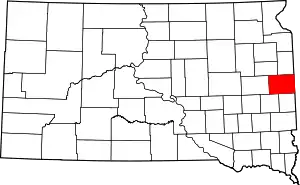 | |
| Towns | ||
| CDP | ||
| Other unincorporated communities | ||
| Townships |
| |
| Footnotes | ‡This populated place also has portions in an adjacent county or counties | |
| ||

| Authority control |
|---|