Site No. RH00-062
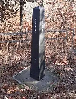
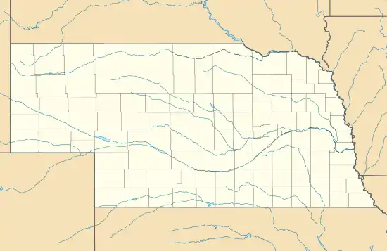
Site No. RH00-062 is a survey monument located at the tripoint of Richardson County, Nebraska, and Brown and Doniphan counties in Kansas. The cast iron monument is 6 feet (1.8 m) tall and 16 inches (410 mm) square at its base. The monument marks the starting point of the land survey of the Kansas-Nebraska border along the 40th parallel north, which intersects the top of the Missouri River's western bluff at this spot. U.S. Deputy Surveyor Charles A. Manners erected the monument in 1855 at the beginning of the survey. In 1924, the monument was displaced and reset at the wrong location before Leo M. Petersen reset it in a sturdier base.[2]
Site No. RH00-062 | |
 | |
  | |
| Nearest city | Rulo, Nebraska |
|---|---|
| Coordinates | 40°0′0″N 95°19′55″W |
| Area | less than one acre |
| Built | 1855 |
| MPS | Nebraska--Kansas Public Land Survey TR |
| NRHP reference No. | 87001001[1] |
| Added to NRHP | June 19, 1987 |
The monument was added to the National Register of Historic Places on June 19, 1987.[1]
See also
- Site No. JF00-072, the intersection of the 40th parallel north and the sixth principal meridian
References
External links
![]() Media related to Survey monument RH00-062 (Kansas-Nebraska) at Wikimedia Commons
Media related to Survey monument RH00-062 (Kansas-Nebraska) at Wikimedia Commons
| Topics | |
|---|---|
| Lists by state |
|
| Lists by insular areas | |
| Lists by associated state | |
| Other areas | |
| Related | |
| |