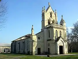
Sore, Landes
Sore is a commune in the Landes department in Nouvelle-Aquitaine in southwestern France. It is in the middle of the Landes de Gascogne Regional Natural Park.
Sore | |
|---|---|
 | |
Location of Sore 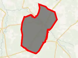
| |
 Sore  Sore | |
| Coordinates: 44°19′28″N 0°34′48″W | |
| Country | France |
| Region | Nouvelle-Aquitaine |
| Department | Landes |
| Arrondissement | Mont-de-Marsan |
| Canton | Haute Lande Armagnac |
| Intercommunality | Pays d'Albret |
| Government | |
| • Mayor (2014–2020) | Vincent Gelley |
| Area 1 | 147.72 km2 (57.04 sq mi) |
| Population (2017-01-01)[1] | 1,122 |
| • Density | 7.6/km2 (20/sq mi) |
| Time zone | UTC+01:00 (CET) |
| • Summer (DST) | UTC+02:00 (CEST) |
| INSEE/Postal code | 40307 /40430 |
| Elevation | 45–99 m (148–325 ft) (avg. 73 m or 240 ft) |
| 1 French Land Register data, which excludes lakes, ponds, glaciers > 1 km2 (0.386 sq mi or 247 acres) and river estuaries. | |
Population
| Year | Pop. | ±% |
|---|---|---|
| 1793 | 1,529 | — |
| 1806 | 1,145 | −25.1% |
| 1821 | 1,353 | +18.2% |
| 1831 | 1,733 | +28.1% |
| 1841 | 1,740 | +0.4% |
| 1851 | 1,900 | +9.2% |
| 1861 | 2,006 | +5.6% |
| 1872 | 1,907 | −4.9% |
| 1881 | 1,981 | +3.9% |
| 1891 | 1,911 | −3.5% |
| 1901 | 1,927 | +0.8% |
| 1911 | 1,840 | −4.5% |
| 1921 | 1,658 | −9.9% |
| 1931 | 1,588 | −4.2% |
| 1946 | 1,427 | −10.1% |
| 1954 | 1,143 | −19.9% |
| 1962 | 1,059 | −7.3% |
| 1968 | 933 | −11.9% |
| 1975 | 918 | −1.6% |
| 1982 | 843 | −8.2% |
| 1990 | 883 | +4.7% |
| 1999 | 898 | +1.7% |
| 2008 | 1,005 | +11.9% |
| 2013 | 1,071 | +6.6% |
Sore is about 65 km south of Bordeaux and about 50 km inland east of the Atlantic coast.
References
- "Populations légales 2017". INSEE. Retrieved 6 January 2020.
| Wikimedia Commons has media related to Sore (Landes). |
| Authority control |
|---|
This article is issued from Wikipedia. The text is licensed under Creative Commons - Attribution - Sharealike. Additional terms may apply for the media files.
