Southern Ute, Colorado
Southern Ute is an unincorporated community and a census-designated place (CDP) located on the Southern Ute Indian Reservation in southern La Plata County, Colorado, United States. The population of the Southern Ute CDP was 177 at the United States Census 2010.[4] The Ignacio post office (Zip Code 81137) serves the area.[3]
Southern Ute, Colorado | |
|---|---|
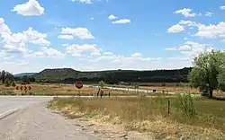 Southern Ute south of State Highway 151. | |
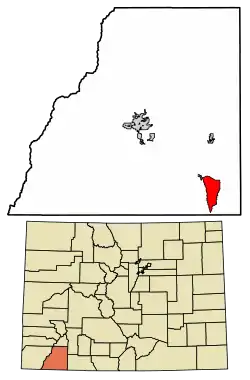 Location of the Southern Ute CDP in La Plata County, Colorado. | |
 Southern Ute Location of the Southern Ute CDP in the United States. | |
| Coordinates: 37°04′30″N 107°35′36″W[1] | |
| Country | |
| State | |
| County | La Plata County |
| Government | |
| • Type | unincorporated community |
| Area | |
| • Total | 15.960 sq mi (41.335 km2) |
| • Land | 15.960 sq mi (41.335 km2) |
| • Water | 0.000 sq mi (0.000 km2) |
| Elevation | 6,562 ft (2,000 m) |
| Population (2010) | |
| • Total | 177 |
| • Density | 11/sq mi (4/km2) |
| Time zone | UTC-7 (MST) |
| • Summer (DST) | UTC-6 (MDT) |
| ZIP Code[3] | Ignacio 81137 |
| Area code(s) | 970 |
| GNIS feature[2] | Southern Ute CDP |
Etymology
Southern Ute is named for the Southern Ute people and the Southern Ute Indian Reservation.
Geography
The Southern Ute CDP has an area of 10,214 acres (41.335 km2), all land.[1]
Demographics
The United States Census Bureau initially defined the Southern Ute CDP for the United States Census 2010.
| Year | Pop. | ±% |
|---|---|---|
| 2010 | 177 | — |
| 2020 | — | |
| Source: United States Census Bureau | ||
See also
References
- "State of Colorado Census Designated Places - BAS20 - Data as of January 1, 2020". United States Census Bureau. Retrieved December 22, 2020.
- "U.S. Board on Geographic Names: Domestic Names". United States Geological Survey. Retrieved December 22, 2020.
- "Zip Code 81137 Map and Profile". zipdatamaps.com. 2020. Retrieved December 22, 2020.
- "2010: DEC Summary File 1". United States Census Bureau. Retrieved December 22, 2020.
External links
Municipalities and communities of La Plata County, Colorado, United States | ||
|---|---|---|
| City | 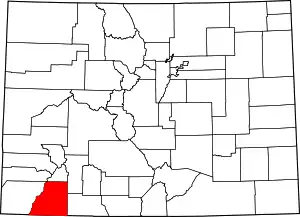 Map of Colorado highlighting La Plata County | |
| Towns | ||
| CDPs | ||
| Unincorporated communities | ||
| Indian reservations | ||
| Footnotes | ‡This populated place also has portions in an adjacent county or counties | |
| ||
| Authority control |
|---|
This article is issued from Wikipedia. The text is licensed under Creative Commons - Attribution - Sharealike. Additional terms may apply for the media files.