Ignacio, Colorado
The Town of Ignacio is a Statutory Town in La Plata County, Colorado, United States. The population was 697 at the 2010 United States Census. It is the headquarters of the Southern Ute Indian Reservation.
Town of Ignacio, Colorado | |
|---|---|
Statutory Town | |
 Looking north along Goddard Avenue in Ignacio | |
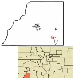 Location of Ignacio in La Plata County, Colorado. | |
| Coordinates: 37°7′0″N 107°38′6″W | |
| Country | |
| State | |
| County[1] | La Plata |
| Incorporated (town) | July 7, 1913[2] |
| Government | |
| • Type | Statutory Town[1] |
| Area | |
| • Total | 0.43 sq mi (1.12 km2) |
| • Land | 0.43 sq mi (1.12 km2) |
| • Water | 0.00 sq mi (0.00 km2) |
| Elevation | 6,453 ft (1,967 m) |
| Population (2010) | |
| • Total | 697 |
| • Estimate (2019)[5] | 908 |
| • Density | 2,101.85/sq mi (812.23/km2) |
| Time zone | UTC-7 (Mountain (MST)) |
| • Summer (DST) | UTC-6 (MDT) |
| ZIP code[6] | 81137 |
| Area code(s) | 970 |
| FIPS code | 08-38535 |
| GNIS feature ID | 184487 |
| Website | Town of Ignacio |
Geography
Ignacio is located at 37°7′0″N 107°38′6″W (37.116773, -107.634864).[7]
According to the United States Census Bureau, the town has a total area of 0.273 square miles (0.71 km2), all of it land.
Demographics
| Historical population | |||
|---|---|---|---|
| Census | Pop. | %± | |
| 1920 | 290 | — | |
| 1930 | 464 | 60.0% | |
| 1940 | 555 | 19.6% | |
| 1950 | 526 | −5.2% | |
| 1960 | 609 | 15.8% | |
| 1970 | 613 | 0.7% | |
| 1980 | 667 | 8.8% | |
| 1990 | 720 | 7.9% | |
| 2000 | 669 | −7.1% | |
| 2010 | 697 | 4.2% | |
| 2019 (est.) | 908 | [5] | 30.3% |
| U.S. Decennial Census[8] | |||
At the 2000 census there were 669 people, 262 households, and 175 families in the town. The population density was 2,449.7 people per square mile (956.7/km2). There were 303 housing units at an average density of 1,109.5 per square mile (433.3/km2). The racial makeup of the town was 51.27% White, 0.75% African American, 21.97% Native American, 0.30% Asian, 18.39% from other races, and 7.32% from two or more races. Hispanic or Latino of any race were 48.58%.[9]
Of the 262 households 33.6% had children under the age of 18 living with them, 45.4% were married couples living together, 14.1% had a female householder with no husband present, and 33.2% were non-families. 27.9% of households were one person and 11.1% were one person aged 65 or older. The average household size was 2.55 and the average family size was 3.12.
The age distribution was 30.5% under the age of 18, 7.5% from 18 to 24, 29.9% from 25 to 44, 20.5% from 45 to 64, and 11.7% 65 or older. The median age was 36 years. For every 100 females, there were 91.7 males. For every 100 females age 18 and over, there were 87.5 males.
The median household income was $27,917 and the median family income was $39,583. Males had a median income of $27,333 versus $20,125 for females. The per capita income for the town was $14,803. About 16.8% of families and 19.0% of the population were below the poverty line, including 28.1% of those under age 18 and 7.4% of those age 65 or over.
References
- "Active Colorado Municipalities". State of Colorado, Department of Local Affairs. Archived from the original on 2009-12-12. Retrieved 2007-09-01.
- "Colorado Municipal Incorporations". State of Colorado, Department of Personnel & Administration, Colorado State Archives. 2004-12-01. Retrieved 2007-09-02.
- "2019 U.S. Gazetteer Files". United States Census Bureau. Retrieved July 1, 2020.
- "US Board on Geographic Names". United States Geological Survey. 2007-10-25. Retrieved 2008-01-31.
- "Population and Housing Unit Estimates". United States Census Bureau. May 24, 2020. Retrieved May 27, 2020.
- "ZIP Code Lookup". United States Postal Service. Archived from the original (JavaScript/HTML) on November 4, 2010. Retrieved October 13, 2007.
- "US Gazetteer files: 2010, 2000, and 1990". United States Census Bureau. 2011-02-12. Retrieved 2011-04-23.
- "Census of Population and Housing". Census.gov. Retrieved June 4, 2015.
- "U.S. Census website". United States Census Bureau. Retrieved 2008-01-31.
External links
- Town of Ignacio Website
- CDOT map of the Town of Ignacio
- Community Portal
- Ignacio Community Library Website
Municipalities and communities of La Plata County, Colorado, United States | ||
|---|---|---|
| City | 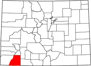 Map of Colorado highlighting La Plata County | |
| Towns | ||
| CDPs | ||
| Unincorporated communities | ||
| Indian reservations | ||
| Footnotes | ‡This populated place also has portions in an adjacent county or counties | |
| ||

| Authority control |
|
|---|