Split Rock Township, Carlton County, Minnesota
Split Rock Township is a township in Carlton County, Minnesota, United States. The population was 124 at the 2000 census.[3] Split Rock Township took its name from the Split Rock River.[4]
Split Rock Township, Minnesota | |
|---|---|
 Split Rock Township, Minnesota Location within the state of Minnesota  Split Rock Township, Minnesota Split Rock Township, Minnesota (the United States) | |
| Coordinates: 46°27′4″N 92°58′31″W | |
| Country | United States |
| State | Minnesota |
| County | Carlton |
| Area | |
| • Total | 36.6 sq mi (94.8 km2) |
| • Land | 36.6 sq mi (94.8 km2) |
| • Water | 0.0 sq mi (0.0 km2) |
| Elevation | 1,204 ft (367 m) |
| Population (2000) | |
| • Total | 124 |
| • Density | 3.4/sq mi (1.3/km2) |
| Time zone | UTC-6 (Central (CST)) |
| • Summer (DST) | UTC-5 (CDT) |
| FIPS code | 27-61708[1] |
| GNIS feature ID | 0665665[2] |
Geography
According to the United States Census Bureau, the township has a total area of 36.6 square miles (94.8 km2), all land.
Split Rock Township is the farthest southwest organized township in Carlton County.
Adjacent townships
- Automba Township (north)
- Kalevala Township (northeast)
- Silver Township (east)
- Sturgeon Lake Township, Pine County (southeast)
- Birch Creek Township, Pine County (south)
- Millward Township, Aitkin County (southwest)
- Beaver Township, Aitkin County (west)
- Salo Township, Aitkin County (northwest)
Cemeteries
The township contains Saint Joseph's Cemetery.
Demographics
At the 2000 census,[1] there were 124 people, 55 households and 31 families residing in the township. The population density was 3.4 per square mile (1.3/km2). There were 100 housing units at an average density of 2.7/sq mi (1.1/km2). The racial makeup of the township was 99.19% White, and 0.81% from two or more races. Hispanic or Latino of any race were 0.81% of the population. 31.9% were of Polish, 20.4% Finnish, 15.0% German and 11.5% American ancestry according to Census 2000
There were 55 households, of which 30.9% had children under the age of 18 living with them, 43.6% were married couples living together, 9.1% had a female householder with no husband present, and 43.6% were non-families. 41.8% of all households were made up of individuals, and 25.5% had someone living alone who was 65 years of age or older. The average household size was 2.25 and the average family size was 3.13.
29.8% of the population were under the age of 18, 4.0% from 18 to 24, 25.8% from 25 to 44, 21.8% from 45 to 64, and 18.5% who were 65 years of age or older. The median age was 41 years. For every 100 females, there were 90.8 males. For every 100 females age 18 and over, there were 97.7 males.
The median household income was $26,250 and the median family income was $43,750. Males had a median income of $37,500 and females $16,875. The per capita income was $17,677. There were 16.7% of families and 17.3% of the population living below the poverty line, including 25.0% of under eighteens and 30.8% of those over 64.
References
- United States National Atlas
- United States Census Bureau 2007 TIGER/Line Shapefiles
- United States Board on Geographic Names (GNIS)
- "U.S. Census website". United States Census Bureau. Retrieved 2008-01-31.
- "US Board on Geographic Names". United States Geological Survey. 2007-10-25. Retrieved 2008-01-31.
- "U.S. Census website". Retrieved 2009-01-02.
- Upham, Warren (1920). Minnesota Geographic Names: Their Origin and Historic Significance. Minnesota Historical Society. p. 76.
Municipalities and communities of Carlton County, Minnesota, United States | ||
|---|---|---|
| Cities | 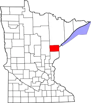 Map of Minnesota highlighting Carlton County | |
| Townships | ||
| CDPs | ||
| Unorganized territories | ||
| Unincorporated communities | ||
| Indian reservations | ||
| Footnotes | ‡This populated place also has portions in an adjacent county or counties | |
| ||
