St. Ann Highlands, Colorado
St. Ann Highlands is an unincorporated community and a census-designated place (CDP) located in and governed by Boulder County, Colorado, United States. The CDP is a part of the Boulder, CO Metropolitan Statistical Area. The population of the St. Ann Highlands CDP was 288 at the United States Census 2010.[4] The Nederland post office (Zip Code 80466) serves the area.[3]
St. Ann Highlands, Colorado | |
|---|---|
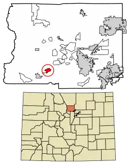 Location of the St. Ann Highlands CDP in Boulder County, Colorado. | |
 St. Ann Highlands Location of the St. Ann Highlands CDP in the United States. | |
| Coordinates: 39°59′14″N 105°27′21″W[1] | |
| Country | |
| State | |
| County | Boulder County |
| Government | |
| • Type | unincorporated community |
| Area | |
| • Total | 1.391 sq mi (3.602 km2) |
| • Land | 1.391 sq mi (3.602 km2) |
| • Water | 0.000 sq mi (0.000 km2) |
| Elevation | 8,284 ft (2,525 m) |
| Population (2010) | |
| • Total | 288 |
| • Density | 207/sq mi (80/km2) |
| Time zone | UTC-7 (MST) |
| • Summer (DST) | UTC-6 (MDT) |
| ZIP Code[3] | Nederland 80466 |
| Area codes | 303 & 720 |
| GNIS feature[2] | St. Ann Highlands CDP |
Geography
St. Ann Highlands is located in southern Boulder County, 4 miles (6 km) northeast of the town of Nederland. It occupies a ridge between the valleys of North Boulder Creek and Middle Boulder Creek. State Highway 119 forms the southern edge of the CDP, connecting Nederland to the west with Boulder 12 miles (19 km) to the east.
Geography
The St. Ann Highlands CDP has an area of 890 acres (3.602 km2), all land.[1]
Demographics
The United States Census Bureau initially defined the St. Ann Highlands CDP for the United States Census 2010.
| Year | Pop. | ±% |
|---|---|---|
| 2010 | 288 | — |
| 2020 | — | |
| Source: United States Census Bureau | ||
See also
References
- "State of Colorado Census Designated Places - BAS20 - Data as of January 1, 2020". United States Census Bureau. Retrieved December 12, 2020.
- "U.S. Board on Geographic Names: Domestic Names". United States Geological Survey. Retrieved December 12, 2020.
- "Zip Code 80466 Map and Profile". zipdatamaps.com. 2020. Retrieved December 20, 2020.
- "2010: DEC Summary File 1". United States Census Bureau. Retrieved December 20, 2020.
External links
Municipalities and communities of Boulder County, Colorado, United States | ||
|---|---|---|
| Cities | 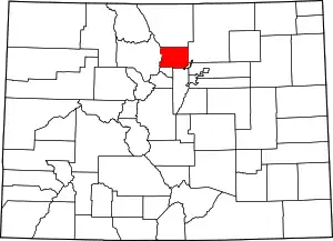 Map of Colorado highlighting Boulder County | |
| Towns | ||
| CDPs | ||
| Unincorporated communities | ||
| Ghost towns |
| |
| Footnotes | ‡This populated place also has portions in an adjacent county or counties | |
| ||