Glendale, Boulder County, Colorado
Glendale is an unincorporated community and a census-designated place (CDP) located in and governed by Boulder County, Colorado, United States. The CDP is a part of the Boulder, CO Metropolitan Statistical Area. The population of the Glendale CDP was 69 at the United States Census 2010.[4] The Jamestown post office (Zip Code 80455) serves the area.[3]
Glendale CDP, Colorado | |
|---|---|
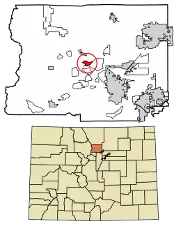 Location of the Glendale CDP in Boulder County, Colorado. | |
 Glendale CDP Location of the Glendale CDP in the United States. | |
| Coordinates: 40°05′13″N 105°22′18″W[1] | |
| Country | |
| State | |
| County | Boulder County |
| Government | |
| • Type | unincorporated community |
| Area | |
| • Total | 1.255 sq mi (3.251 km2) |
| • Land | 1.255 sq mi (3.251 km2) |
| • Water | 0.000 sq mi (0.000 km2) |
| Elevation | 7,362 ft (2,244 m) |
| Population (2010) | |
| • Total | 69 |
| • Density | 55/sq mi (21/km2) |
| Time zone | UTC-7 (MST) |
| • Summer (DST) | UTC-6 (MDT) |
| ZIP Code[3] | Jamestown 80455 |
| Area codes | 303 & 720 |
| GNIS feature[2] | Glendale CDP |
Geography
Glendale is located in central Boulder County in the Front Range of the Colorado Rocky Mountains, in the valley of Left Hand Creek. Lefthand Canyon Drive leads east 7 miles (11 km) to Altona and U.S. Highway 36, and west 9 miles (14 km) to Ward and State Highway 72.
The Glendale CDP has an area of 803 acres (3.251 km2), all land.[1]
Demographics
The United States Census Bureau initially defined the Glendale CDP for the United States Census 2010.
| Year | Pop. | ±% |
|---|---|---|
| 2010 | 69 | — |
| 2020 | — | |
| Source: United States Census Bureau | ||
See also
References
- "State of Colorado Census Designated Places - BAS20 - Data as of January 1, 2020". United States Census Bureau. Retrieved December 8, 2020.
- "U.S. Board on Geographic Names: Domestic Names". United States Geological Survey. Retrieved December 8, 2020.
- "Zip Code 80455 Map and Profile". zipdatamaps.com. 2020. Retrieved December 20, 2020.
- "2010: DEC Summary File 1". United States Census Bureau. Retrieved December 20, 2020.
External links
Municipalities and communities of Boulder County, Colorado, United States | ||
|---|---|---|
| Cities | 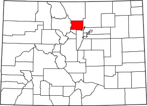 Map of Colorado highlighting Boulder County | |
| Towns | ||
| CDPs | ||
| Unincorporated communities | ||
| Ghost towns |
| |
| Footnotes | ‡This populated place also has portions in an adjacent county or counties | |
| ||